Manassas, Virginia — The American South (Mid-Atlantic)
Burning of Manassas
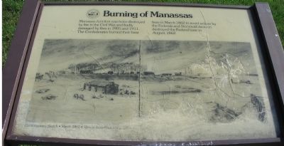
Manassas Junction was twice destroyed by fire in the Civil War and badly damaged by fires in 1905 and 1911. The Confederates burned their base here in March 1862 to avoid seizure by the Federals and Stonewall Jackson destroyed the Federal base in August, 1862.
Topics. This historical marker is listed in this topic list: War, US Civil. A significant historical month for this entry is March 1862.
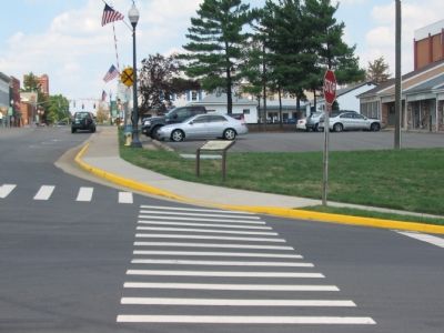
Location. This marker has been replaced by another marker nearby. 38° 44.988′ N, 77° 28.271′ W. Marker is in Manassas, Virginia. Marker is at the intersection of Prince William Street and Main Street, on the right when traveling west on Prince William Street. Across the intersection from the Manassas Museum. Touch for map. Marker is in this post office area: Manassas VA 20110, United States of America. Touch for directions.
Other nearby markers. At least 8 other markers are within walking distance of this location. Manassas 1905 - The Great Fire (here, next to this marker); Wartime Manassas (within shouting distance of this marker); Our Story Continues (about 300 feet away, measured in a direct line); a different marker also named Wartime Manassas (about 300 feet away); Occupation or Liberation (about 300 feet away); War on the Landscape (about 400 feet away); Manassas (about 400 feet away); Manassas Veterans Memorial (about 400 feet away). Touch for a list and map of all markers in Manassas.
More about this marker. A drawing dominates the marker, with the caption, “Contemporary Sketch – March 1862 – View is from Present Playground to South.” (The playground mentioned is behind the Manassas Museum, but a trees obscure a similar view from that point today.)
This marker was replaced in 2009 by a new marker titled, Manassas 1905 - The Great Fire.
Also see . . . History of Manassas Volunteer Fire Company. Website entry (Submitted on September 11, 2007, by Craig Swain of Leesburg, Virginia.)
Credits. This page was last revised on July 3, 2023. It was originally submitted on September 11, 2007, by Craig Swain of Leesburg, Virginia. This page has been viewed 1,887 times since then and 37 times this year. Photos: 1, 2. submitted on September 11, 2007, by Craig Swain of Leesburg, Virginia. • J. J. Prats was the editor who published this page.

