Dunning in Chicago in Cook County, Illinois — The American Midwest (Great Lakes)
Read-Dunning Cemetery No. 3
Photographed by Sean Flynn, May 2, 2024
1. Read-Dunning Cemetery No. 3 Marker
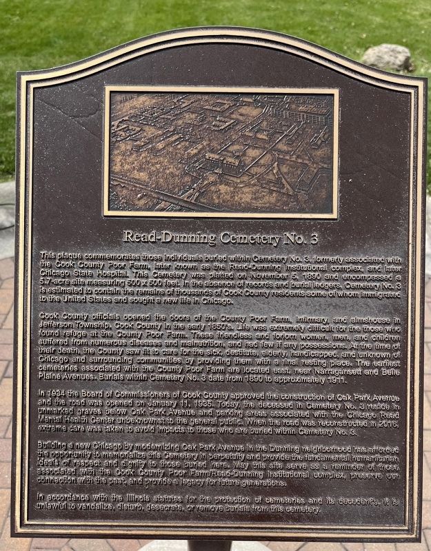
Cook County officials opened the doors of the County Poor Farm, infirmary, and almshouse in Jefferson Township, Cook County in the early 1850's. Life was extremely difficult for the those who found refuge at the County Poor Farm. These friendless and forlorn women, men, and children suffered from numerous diseases and malnutrition, and had few if any possessions. At the time of their death, the County saw fit to care for the sick, destitute, elderly, handicapped, and unknown of Chicago and surrounding communities by providing them with a final resting place. The earliest cemeteries associated with
this page online
In 1934 the Board of Commissioners of Cook County approved the construction of Oak Park Avenue and the road was opened on January 11, 1935. Today, the deceased in Cemetery No. 3 reside in unmarked graves below Oak Park Avenue and parking areas associated with the Chicago Read Mental Health Center unbeknownst to the general public. When the road was reconstructed in 2016, extreme care was taken to avoid impacts to those who are buried within Cemetery No. 3.
Building a new Chicago by modernizing Oak Park Avenue in the Dunning neighborhood has afforded the opportunity to memorialize this Cometery in perpetuity and provide the fundamental humanitarian ideals of respect and dignity to those buried here. May this site serve as a reminder of those associated with the Cook County Poor Farm/Read-Dunning institutional complex, preserve our connection with the past, and provide a legacy for future generations.
In accordance with the Illinois statutes for the protection of cemeteries and
Photographed by Sean Flynn, May 2, 2024
2. Read-Dunning Cemetery No. 3 Marker
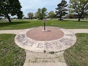
The marker stands in front of the grounds of Chicago-Read Mental Health Center, and atop a cemetery erected in 1890 as a potter's field near what was then the Cook County Poor Farm. This cemetery is one of several in the general vicinity that are believed to hold the remains of around 38,000 people.
Topics. This historical marker is listed in these topic lists: Cemeteries & Burial Sites • Immigration • Roads & Vehicles • Science & Medicine. A significant historical date for this entry is November 5, 1890.
Location. 41° 57.35′ N, 87° 47.839′ W. Marker is in Chicago, Illinois, in Cook County. It is in Dunning. It is on Oak Park Avenue 0.2 miles north of West Irving Park Road (Illinois Route 19), on the left when traveling north. The marker is in front of the entrance for Chicago-Read Mental Health Center. Touch for map. Marker is at or near this postal address: 4200 N Oak Park Avenue, Chicago IL 60634, United States of America. Touch for directions.

Regionally, this marker is on Chicago’s North Side. It is also in the American Midwest. Globally, it is in North America, on the Great Lakes, in the Western Hemisphere, in the Western World, and in the Anglosphere. Historically, it finds itself in what was once the Viceroyalty of New France, the territory of the Mississippian Culture, and the Northwest Territory.
Other nearby markers. At
Photographed by Sean Flynn, May 2, 2024
3. Read-Dunning Cemetery No. 3 Marker
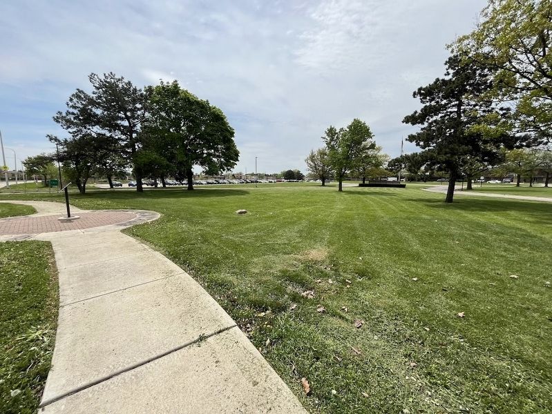
A side view of the marker with Oak Park Avenue on the far left.
Chicago Daily News Collection, Chicago History Museum, circa 1908
4. Farm workers at Chicago State Hospital
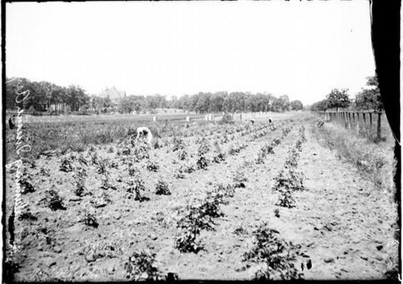
Caption from Chicago History Museum: "View of people working on the farm at the Chicago State Hospital, in the Dunning community area of Chicago, Illinois."
Regarding Read-Dunning Cemetery No. 3. The gravesites are believed to be roughly within the area bounded on the south by Irving Park Road, on the north and west by Harlem Avenue and Forest Preserve Drive, on the north by Montrose Avenue, and on the east by Narragansett Avenue. As referenced on the plaque, the cemetery reentered the public memory in 2016 when the city of Chicago modernized Oak Park Avenue north of Irving Park Road in the Dunning neighborhood and in the process uncovered human remains from what had been the Cook County Cemetery. Two years later, a similar story played out when a new school building for Taft High School was built, across Oak Park Avenue from this marker. However, the area's development has been going on for many years prior to that and includes a shopping strip at Narragansett and Irving Park, Wilbur Wright College at Narragansett and Montrose, and the Chicago-Read Mental Health Center, itself a remnant of the area's old site as an insane asylum.
In addition to this marker in
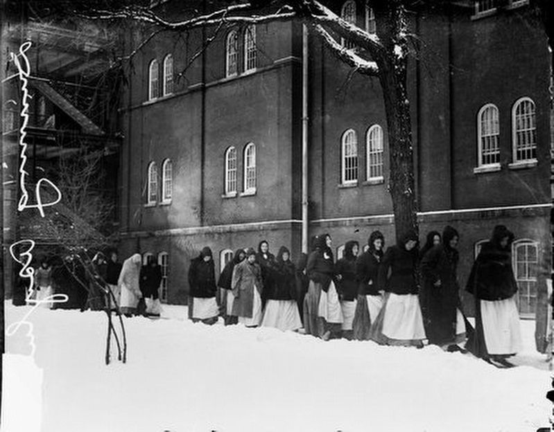
Chicago Daily News Collection, Chicago History Museum, December 10, 1910
5. Patients outdoors in the snow at Chicago State Hospital
Caption from Chicago History Museum: "Patients at the Chicago State Hospital walking outdoors on a snow-covered path, Chicago, Illinois, December 10, 1910. The Chicago State Hospital (also called the Dunning Mental Institute) was located at West Irving Park Road and North Narragansett Avenue in the Dunning neighborhood."
Also see . . .
1. Grave Mistake-the Story of Cook County Cemetery at Dunning. A reprint of a 1989 article in the Chicago Reader looking at the history of the Cook County Cemetery and how developers in the 1980s bumped into the nearly forgotten graves on Chicago's northwest side.
Excerpt: "Nowhere else in the country has a cemetery with hundreds or thousands of graves been so nearly forgotten that a developer had to rediscover it by accident. 'It is a very unusual situation,' says assistant city corporation counsel Nancy Marin, with characteristic understatement."(Submitted on May 2, 2024, by Sean P. Flynn of Oak Park, Illinois.)
2. The Story Of Dunning, A ‘Tomb For The Living’. From WBEZ Chicago's Curious City (free signup required), a history of the Dunning Asylum
Excerpt: Dunning Insane Asylum's history is "a long history with many dark chapters. Curious City can’t detail the entire history, so we focused on finding out who lived at Dunning — and who is still lying in Dunning’s unmarked graves. In both life and death, the people who ended up at Dunning were some of Chicago’s least fortunate residents."(Submitted on May 2, 2024, by Sean P. Flynn of Oak Park, Illinois.)
3. History of Dunning. From the Portage Park Chamber of Commerce, a history of the Dunning neighborhood, which got its start as the home to the Cook County Poor Farm.
Excerpt: “In 1851, this remote prairie location seemed ideal for Cook County’s plans to erect a poor farm and asylum for the insane. The county purchased 160 acres bordered by Irving Park Road and Narragansett, and Montrose and Oak Park Avenues. In 1863, the institution began admitting tuberculosis patients. The county built a separate building for the insane asylum in 1870. The construction of two more buildings in the 1880s added enough space to accommodate the more than 1,000 patients.(Submitted on March 12, 2025, by Sean P. Flynn of Oak Park, Illinois.)
“Following the Civil War, Andrew Dunning purchased 120 acres just south of the property to start a nursery and lay the groundwork for a village. He set aside 40 acres for the settlement, but proximity to the insane hospital kept settlers away. In 1882, the local train line was extended to the facilities, making transportation far less difficult. The Chicago/Milwaukee/St. Paul 'crazy train' brought patients, supplies, and medicines. The county built a station, naming it for Dunning.”
Credits. This page was last revised on September 4, 2026. It was originally submitted on May 2, 2024, by Sean P. Flynn of Oak Park, Illinois. This page has been viewed 1,951 times since then and 138 times this year. Photos: 1, 2, 3, 4, 5. submitted on May 2, 2024, by Sean P. Flynn of Oak Park, Illinois.
