
West Augustine in St. Augustine in St. Johns County, Florida — The American South (South Atlantic)
8 Dr. R.B. Hayling Place
ACCORD Freedom Trail
Photographed by Mrs. Shirley Williams-Galvin, May 5, 2008
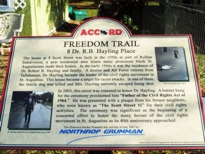
1. 8 Dr. R.B. Hayling Place Marker
The house at 8 Scott Street was built in the 1950s as part of Rollins Subdivision, a new residential area where many prominent black St. Augustinians made their homes. In the early 1960s it was the residence of Dr. Robert B. Hayling and family. A dentist and Air Force veteran from Tallahassee, Dr. Hayling became the leader of the civil rights movement in St. Augustine. This house became a target for racist attacks. In one of them, the family dog was killed and Mrs. Hayling narrowly escaped being shot.
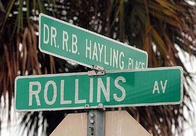
In 2003, this street was renamed to honor Dr. Hayling. A banner hung for the ceremony proclaimed him "Father of the Civil Rights Act of 1964." He was presented with a plaque from his former neighbors, who were known as "The Scott Street 11" for their civil rights activities. The ceremony was significant as the beginning of a concerted effort to honor the many heroes of the civil rights movement in St. Augustine as its 40th anniversary approached.
[Captions:]
Dr. Hayling walks the street renamed in his honor, 2003.
Bullet holes in the door, 1964.
Photos Courtesy of The St. Augustine RECORD and the St. Augustine Historical Society
This Historical Marker Presented this 2nd Day of July, 2007 by: Northrop Grumman
Erected 2007
this page online
Topics and series. This historical marker is listed in these topic lists: African Americans • Air & Space • Civil Rights • Science & Medicine. In addition, it is included in the Florida, St. Augustine Freedom Trail series list.
Location. 29° 53.312′ N, 81° 19.92′ W. Marker is in St. Augustine, Florida, in St. Johns County. It is in West Augustine. It is on Dr. R.B. Hayling Place east of South Whitney Street, on the right when traveling east. Touch for map. Marker is at or near this postal address: 8 Dr R.B Hayling Place, Saint Augustine FL 32084, United States of America. Touch for directions.

Regionally, this marker is in First Coast and in Greater Jacksonville. It is also in the American South and on the Eastern Seaboard. Globally, it is in the North Atlantic Region, North America, a Gulf of Mexico state, the Western Hemisphere, the Western World, and the Anglosphere. Historically, it finds itself in what was once New Spain, the territory of the Mississippian Culture,
Photographed by Mrs. Shirley Williams-Galvin, May 5, 2008
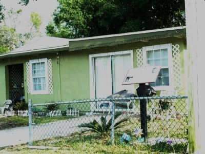
2. 8 Dr. R.B. Hayling Place and Marker
Other nearby markers. At least 8 other markers are within walking distance of this marker: Shiloh Missionary Baptist Church (about 600 feet away, measured in a direct line); 570 Christopher Street (about 700 feet away); S.D.W. Smith, Ancient City, Mt. Horeb #20 (about 800 feet away); 262 West King Street (about 800 feet away); 57 Chapin Street (approx. 0.3 miles away); Zion Baptist Church (approx. 0.4 miles away); 96 Evergreen Avenue (approx. 0.4 miles away); Randolph Caldecott (approx. 0.4 miles away). Touch for a list and map of all markers in St. Augustine.
More about this marker. Marker was removed by a previous developer of the home and replaced when authorities were notified by local residents.
Also see . . . ACCORD Freedom Trail website. (Submitted on May 16, 2008, by Christopher Busta-Peck of Shaker Heights, Ohio.)
Photographed by Gwendolyn Duncan, June 19, 2003
3. Street Named in Honor of Dr. Robert B. Hayling
Credits. This page was last revised on September 9, 2026. It was originally submitted on May 5, 2008, by Gwendolyn Duncan of St. Augustine, Florida. This page has been viewed 4,151 times since then and 79 times this year. Last updated on May 14, 2024, by Cheyenne Leahy of St. Augustine, Florida. Photos: 1, 2. submitted on May 16, 2008, by Gwendolyn Duncan of St. Augustine, Florida. 3. submitted on May 5, 2008, by Gwendolyn Duncan of St. Augustine, Florida. • Bernard Fisher was the editor who published this page.
