Salt Lick Township near Shawnee in Perry County, Ohio — The American Midwest (Great Lakes)
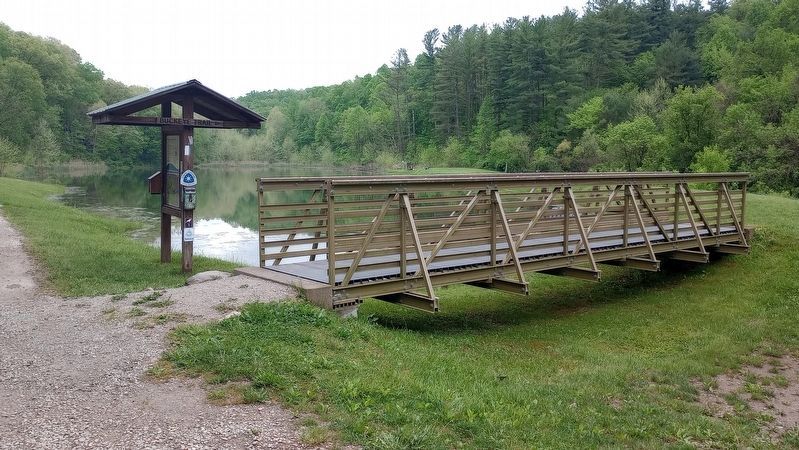
You're on the Buckeye Trail!

Photographed by Craig Doda, May 4, 2024
1. Buckeye Trail Marker
The Buckeye Trail
The Buckeye Trail is Ohio's State Scenic Trail. It's 1400+ miles, winding around Ohio, from a Lake Erie, beach, to a hilltop overlooking the Ohio River, to the rock formations of Hocking Hills and the expanse of forests in Eastern Ohio.
First envisioned in the late 1950's as a trail from the Ohio River to Lake Erie, the Buckeye Trail evolved into a large loop. Because it is a loop, it is also in essence, endless. You may start a hike at any point and hike as long as you want without ever reaching an end!
The Buckeye Trail Association
The Buckeye Trail is regularly maintained by passionate, hardworking volunteers of the Buckeye Trail Association. The Buckeye Trail Association strives to bring more people outside on the trails. Our chapters host group hikes, offer assistance to thru-hikers, events and more.
You, too, can join us to build trail and promote the trail, as well as make friends on the trail We are always looking for volunteers.
Topics. This historical marker is listed in these topic lists: Parks & Recreational Areas • Roads & Vehicles.
Location. 39° 36.028′ N, 82° 12.731′ W. Marker is near Shawnee, Ohio, in Perry County. It is in Salt Lick Township. It is on Ohio Route 93 south of Scotch Hill Road, on the right when traveling north. Touch for map. Marker is at or near this postal address: 8147 State Route 93, New Straitsville OH 43766, United States of America. Touch for directions.

Regionally, this marker is in the Hocking Hills. It is also in the American Midwest, in Appalachia, and specifically in Northern Appalachia. Globally, it is in North America, the Western Hemisphere, the Western World, and the Anglosphere. Historically, it finds itself in what was once the Haudenosaunee (Iroquois) Confederacy,
this page online
Other nearby markers. At least 8 other markers are within walking distance of this marker: Welcome to Tecumseh Lake and the Wayne National Forest! (here, next to this marker); Shawnee (about 500 feet away, measured in a direct line); Knights of Labor Opera House (approx. ¼ mile away); A Little City in the Forest (approx. ¼ mile away); a different marker also named Shawnee (approx. ¼ mile away); Saltlick Township Memorial Park (approx. ¼ mile away); Tecumseh Theater (approx. ¼ mile away); Black Diamonds and Bricks (approx. ¼ mile away). Touch for a list and map of all markers in Shawnee.
Photographed by Craig Doda, May 4, 2024
2. Buckeye Trail Marker
Credits. This page was last revised on May 22, 2024. It was originally submitted on May 21, 2024, by Craig Doda of Napoleon, Ohio. This page has been viewed 350 times since then and 39 times this year. Photos: 1, 2. submitted on May 21, 2024, by Craig Doda of Napoleon, Ohio. • Devry Becker Jones was the editor who published this page.
