Bear Creek Township in Petoskey in Emmet County, Michigan — The American Midwest (Great Lakes)
Round Lake
Head of the Inland Waterway
| — | The Hiawatha Pageant — The Loons of Round Lake | — |

Photographed by J. J. Prats, September 24, 2023
1. Round Lake Marker
Round Lake is not exactly round in shape, but is more triangular or even heart-shaped. The name comes from the Native American words for “round lake:” Lake Wa-Ga-Mug. About 50 other lakes throughout Michigan are also named Round Lake.
This Round Lake covers 337 acres, or about ½ square mile. The maximum depth is 14 feet and the average depth is 5.6 feet with a shoreline length of three miles. It contains about 100 million gallons of water. Round Lake’s watershed (the area of land draining into the lake) covers six square miles. The inlet stream is an unnamed stream flowing from Mud Lake (see map) and the outlet is known as Round Lake Creek.
Round Lake is monitored regularly by several organizations and agencies and has been found to have good water quality. Like many small, shallow lakes in northern Michigan, this lake is classified as eutrophic or highly Productive. This is evidenced by beds of submerged aquatic plants such as pondweed, water milfoil, and chara (branched algae) with occasional summer algae “blooms.”
The
this page online
Round Lake was formerly part of larger post glacial stages of what are now the Great Lakes. About 3,500 years ago, a sandbar formed the Head of what is now Little Traverse Bay. The water level dropped and sand dunes formed on top of the sandbar isolating what is now Round Lake from what is now Lake Michigan and Little Traverse Bay. The hills beyond the far western shore are those now forested dunes. Lake Michigan lies only about a quarter mile beyond the crest of the dunes.
Despite its proximity to Lake Michigan, Round Lake is part of the Cheboygan River Watershed, and its waters eventually flow to Lake Huron at Cheboygan.
Native Americans and early European explorers would portage their canoes from Lake Michigan over the dunes to Round Lake, down Round Lake Creek, and then through a series of interconnecting
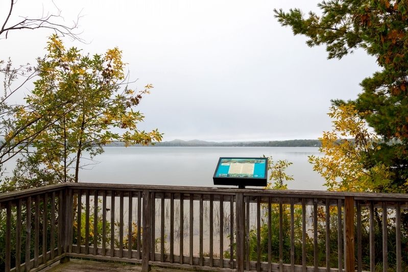
Photographed by J. J. Prats, September 24, 2023
2. Round Lake and this Marker
(Note to modem day adventurers Round Lake Creek w only marginally navigable even for a canoe, and can get very low or even dry up in summer.)
The Hiawatha Pageant. Look to the left of here about 700 feet to see the site of the historical Hiawatha Pageant on Barney’s Pond which ran at this location from 1905–1917. The Hiawatha pageant was a rare opportunity for indigenous communities to portray themselves in an entertainment venue. From Ontario to Michigan, the widely successful play was carried out by numerous tribal communities, mainly from the Ojibway and Odawa tribes.
The play is based on Henry Longfellow’s 1855 poem “Song of Hiawatha.” But the poem has its roots in the Great Lakes. An Ojibway from Garden River, Ontario, Buk-wuj-ji-nini, told the stories of Nanaboozhoo, a prominent figure in Odawa and Ojibway beliefs, to Longfellow. Nanaboozhoo,
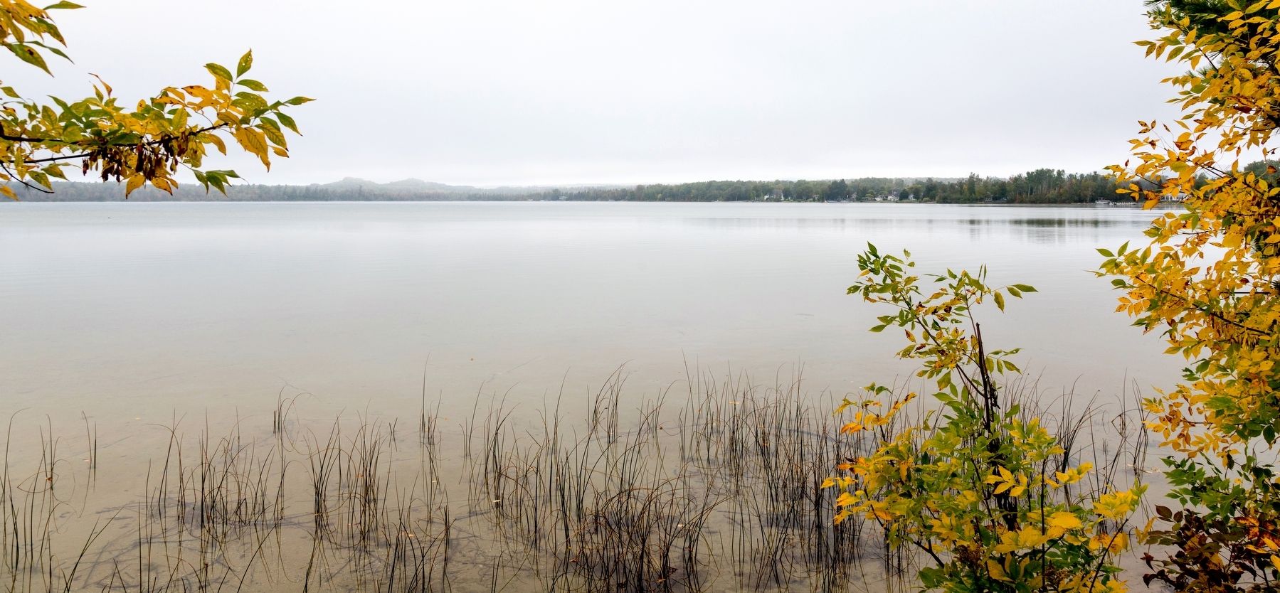
Photographed by J. J. Prats, September 24, 2023
3. Round Lake, Emmet County Michigan, on a Cloudy Autumn Day
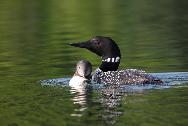
The Loons of Round Lake. For many decades, a marshy cove on the far side of the lake has been home to a pair of nesting Common looks (Gavia immer). The loon is an ancient species whose ancestral roots can be traced back more than 100 million years. Feeding primarily on fish, they are excellent swimmers and divers, able to dive to 200 feet for up to five minutes. Common loons are known for their spectacular mating dances and eerie wails that make them symbolic of our wild northern lakes and marshes. They winter on the Gulf of Mexico and Atlantic Coast.
Loons require undisturbed habitat and are very sensitive to human activity while nesting or rearing their young. Loon numbers today are very low compared to what historical populations are believed to have been. As such, the loon has been listed as a threatened species in Michigan since 1987.
The nesting pair on Round
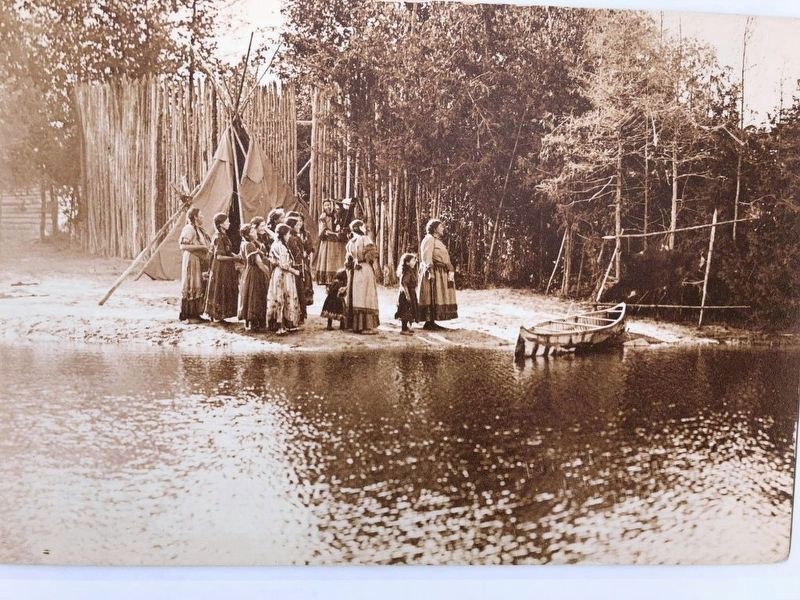
(Public Domain) from the collection of Eric Hemmenway via Top of Michigan Trails Website
4. Hiawatha Pageant Scene
Erected by Little Traverse Conservancy and the Petoskey-Harbor Springs Area Community foundation.
Topics. This historical marker is listed in these topic lists: Entertainment • Environment • Indigenous Peoples and Communities. A significant historical year for this entry is 1855.
Location. 45° 24.345′ N, 84° 52.84′ W. Marker is in Petoskey, Michigan, in Emmet County. It is in Bear Creek Township. It can be reached from Hiawatha Trail 0.2 miles north of Barney Road, on the left when traveling north. Touch for map. Marker is at or near this postal address: 4139 Hiawatha Trail, Petoskey MI 49770, United States of America. Touch for directions.

Regionally,
Other nearby markers. At least 8 other markers are within 3 miles of this marker, measured as the crow flies: Horace McKee Huffman, Jr. ~ 1914-1996 (here, next to this marker); Hiawatha Pageant (within shouting distance of this marker); Passenger Pigeons (approx. 2.1 miles away); State Board of Fish Commissioners / State Game and Fish Warden (approx. 2.1 miles away); Fish and Rails (approx. 2.1 miles away); Luring Visitors (approx. 2.1 miles away); Welcome to Oden State Fish Hatchery (approx. 2.2 miles away); Stafford's Bay View Inn (approx. 2.7 miles away). Touch for a list and map of all markers in Petoskey.
More about this marker. This interpretive panel is illustrated with three photographs, two maps, and two logos. Clockwise from top left,
a photograph of a Pumpkinseed sunfish (Lepomis gibbosus),
a drone view from above where you are now standing, looking west northwest.
a photograph by Debbie Klein of Common loons (Gavia immer))
logos of the Little Traverse Conservancy and the Petoskey-Harbor Springs Area Community Foundation
a map showing round lake, Lake Michigan, Crooked Lake, and Pickerel Lake and captioned “Conservancy Nature preserves are shown in light green”
a photograph of “the Hiawatha Pageant on Lake Wa-Ga-Mug.” The photograph is captioned “The Natural Woodland Stage Setting and the Wonderful Reflections in the Pond of Stars.”
a historical map of this region showing Little Traverse bay and GR&I rail line from Petoskey to Harbor Springs and the branch from Ke-go-mic, past the southeastern shore of Round Lake and the northern shore of Crooked Lake to Oden.
Credits. This page was last revised on May 27, 2024. It was originally submitted on May 27, 2024, by J. J. Prats of Powell, Ohio. This page has been viewed 383 times since then and 81 times this year. Photos: 1, 2, 3, 4, 5. submitted on May 27, 2024, by J. J. Prats of Powell, Ohio.
