Near Tensaw in Baldwin County, Alabama — The American South (East South Central)
The South Wall
| — | Fort Mims Historical and Archaeological Site | — |
Photographed by Mark Hilton, May 28, 2024
1. The South Wall Marker
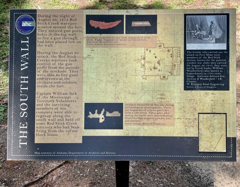
During the night of August 29, 1813 Red Stick Creek warriors scouted around the fort. They noticed gun ports, holes in the log wall to fire a gun through, had been placed low on the wall.
During the August 30 attack, the Red Stick Creeks warriors took control of the gun ports from the outside of the stockade. They were able to fire guns and arrows at the civilians and soldiers inside the fort.
Captain William Jack of the Mississippi Territory Volunteers and the surviving members of his company were able to regroup along the south wall and hold off some Red Stick Creek warriors who had been firing from the corner block house.
[Captions:]
Middle top: Artifacts excavated on site. Left: fragment of knife blade. Right: fragment of buckle for sword belt, American Revolution era.
Source: Alabama Historical Commission
Middle bottom: Artifacts recovered on this site during archaeological investigations. These are fragments of a brass patch box from a rifle stock. These guns used during the battle were muzzleloading flintlocks that required powder, ball, and patches.
Source: Alabama Historical Commission
Top right: The Creeks who carried out the attack on Fort Mims were members of the Red Stick faction, known for the painted, wooden war clubs they carried. On August 29, 1813, they were led by Creek leader William Weatherford (also known as Lamochatee) ca. 1781-1824. Image: Interview between Gen. Jackson & Weatherford / J.R. Chapin; W. Ridgway Steel Engraving.
Source: Library of Congress
Erected 2022
this page online
Topics. This historical marker is listed in these topic lists: Forts and Castles • Indigenous Peoples and Communities • Wars, US Indian. A significant historical date for this entry is August 29, 1813.
Location. 31° 10.798′ N, 87° 50.269′ W. Marker is near Tensaw, Alabama, in Baldwin County. It can be reached from Fort Mims Road 0.4 miles north of Boatyard Road (County Road 80), on the right when traveling west. Located within Fort Mims. Touch for map. Marker is at or near this postal address: 1813 Fort Mims Rd, Stockton AL 36579, United States of America. Touch for directions.

Regionally, this marker is on the Gulf Coast and in the Mobile Bay area. It is also in the American South, specifically in the Deep South, and on the Gulf Coast. Globally, it is in North America, a Gulf of Mexico state, the Western Hemisphere, the Western World, and the Anglosphere. Historically, it finds itself in what was once New Spain, the Viceroyalty of New France, the territory of the Mississippian Culture, one of the Confederate States of America, and the Antebellum South.
Other nearby markers. At least
Photographed by Mark Hilton, May 28, 2024
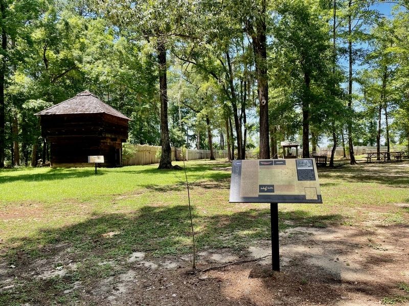
2. The South Wall Marker near blockhouse.
Also see . . . History of Fort Mims - Fort Mims Restoration Association. (Submitted on May 29, 2024, by Mark Hilton of Montgomery, Alabama.)

Photographed by Mark Hilton, July 25, 2015
3. Fort Mims Site
Credits. This page was last revised on July 3, 2024. It was originally submitted on May 29, 2024, by Mark Hilton of Montgomery, Alabama. This page has been viewed 450 times since then and 46 times this year. Photos: 1, 2, 3. submitted on May 29, 2024, by Mark Hilton of Montgomery, Alabama.
