Fridley in Anoka County, Minnesota — The American Midwest (Upper Plains)
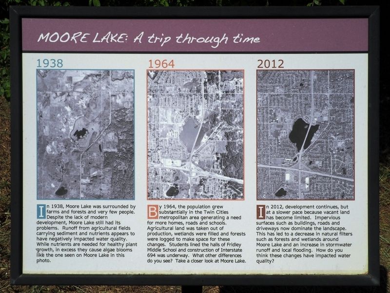
Moore Lake: A trip through time
Photographed by McGhiever, June 7, 2024
1. Moore Lake: A trip through time Marker
1938
In 1938, Moore Lake was surrounded by farms and forests and very few people. Despite the lack of modern development, Moore Lake still had its problems. Runoff from agricultural fields carrying sediment and nutrients appears to have negatively impacted water quality. While nutrients are needed for healthy plant growth, in excess they cause algae blooms like the one seen on Moore Lake in this photo.
1964
By 1964, the population grew substantially in the Twin Cities metropolitan area generating a need for more homes, roads and schools. Agricultural land was taken out of production, wetlands were filled and forests were logged to make space for these changes. Students lined the halls of Fridley Middle School and construction of Interstate 694 was underway. What other differences do you see? Take a closer look at Moore Lake.
2012
In 2012, development continues, but at a slower pace because vacant land has become limited. Impervious surfaces such as buildings, roads and driveways not dominate the landscape. This had led to a decrease in natural filters such as forests and wetlands around Moore Lake and an increase
this page online
Topics. This historical marker is listed in these topic lists: Environment • Waterways & Vessels. A significant historical year for this entry is 1938.
Location. 45° 4.753′ N, 93° 15.027′ W. Marker is in Fridley, Minnesota, in Anoka County. It is at the intersection of W. Moore Lake Drive and 61st Avenue NE, on the right when traveling south on W. Moore Lake Drive. Touch for map. Marker is at or near this postal address: 6100 W Moore Lake Drive, Minneapolis MN 55432, United States of America. Touch for directions.

Regionally, this marker is in the Twin Cities Metropolitan Area. It is also in the American Midwest, in the Corn Belt, and in the Great River Road Region. Globally, it is in North America, the Western Hemisphere, the Western World, and the Anglosphere. Historically, it finds itself in what was once Rupert’s Land and also the territory of the Mississippian Culture.
Other nearby markers. At least 8 other markers are within 4 miles of this marker, measured as the crow flies: Planting for Clean Water (a few steps

Photographed by McGhiever, June 7, 2024
2. Moore Lake marker (left) along W. Moore Lake Drive
Credits. This page was last revised on June 9, 2024. It was originally submitted on June 9, 2024, by McGhiever of Minneapolis, Minnesota. This page has been viewed 671 times since then and 97 times this year. Photos: 1, 2. submitted on June 9, 2024, by McGhiever of Minneapolis, Minnesota.
