
Near Miami in Roberts County, Texas — The American South (West South Central)
Miami-Mammoth Kill Site
Photographed by Allen Lowrey, June 9, 2024
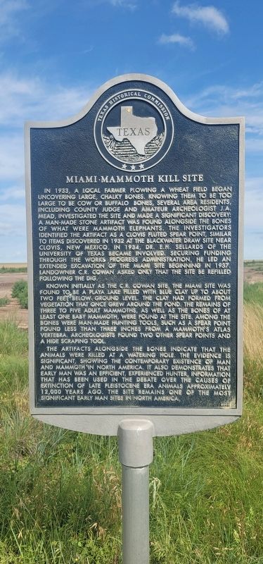
1. Miami-Mammoth kill site Marker
Known initially as the C.R. Cowan site, the Miami site was found to be a playa lake filled with blue clay up to about two feet below ground level. The clay had formed from vegetation that once the pond. The remains of three to five adult mammoths, as well as the bones of at least one baby mammoth, were found at this site. Among the bones were man-made hunting tools, such as a spear point found less three inches from a mammoth’s atlas vertebra. Archeologists found two other spear points and hide scraping tool.
The artifacts alongside the bones indicate that the animals were killed at a watering hole. The evidence is significant, showing the contemporary existence of man and mammoth in North America. It also demonstrates that early man was an efficient, experienced hunter, information that has been used in the debate over the causes of extinction of late Pleistocene era animals approximately 12,000 years ago. The site remains one of the most significant early
this page online
Erected 2003 by Texas Historical Commission. (Marker Number 14162.)
Topics. This historical marker is listed in these topic lists: Animals • Anthropology & Archaeology • Indigenous Peoples and Communities. A significant historical year for this entry is 1933.
Location. 35° 45.131′ N, 100° 43.462′ W. Marker is near Miami, Texas, in Roberts County. It is at the intersection of Ranch to Market Road 283 and Farm to Market Road 2699, on the left when traveling north on Road 283. Touch for map. Marker is at or near this postal address: 805 Ranch Rd 283, Miami TX 79059, United States of America. Touch for directions.

Regionally, this marker is on the Texas Panhandle. It is also on the American Great Plains and specifically on the Southern Plains. Globally, it is in North America, a Gulf of Mexico state, the Western Hemisphere, the Western World, and the Anglosphere. Historically, it finds itself in what was once New Spain, the Comanchería, the Dust Bowl, the Republic of Texas, and one of the Confederate States of America.
Other nearby markers. At least 8 other markers are within 10

Photographed by Allen Lowrey, June 9, 2024
2. Miami-Mammoth kill site Marker
Credits. This page was last revised on June 10, 2024. It was originally submitted on June 9, 2024, by Allen Lowrey of Amarillo, Texas. This page has been viewed 801 times since then and 118 times this year. Photos: 1, 2. submitted on June 9, 2024, by Allen Lowrey of Amarillo, Texas. • James Hulse was the editor who published this page.
