
Watson in Fraser in Stikine Region, British Columbia — Canada’s West Coast (North America)
Fraser
Welcome to Canada: Welcome to the Yukon
Photographed by Sandra Hughes Tidwell, June 5, 2024
1. Fraser Marker
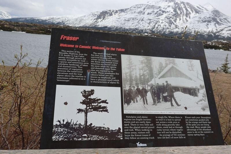
This section of the Klondike Highway from the U.S. border to Log Cabin passes through terrain not usually accessible by road- a sparse and sometimes eerie subalpine landscape of lakes and stunted trees. This transition of vegetation between the treed lower elevations and the true alpine above the treeline is sometimes referred to as a 'moonscape'.
The small twisted alpine firs that you see have survived decades of fierce winter storms. Every winter the dense and matted lower branches are buried under the snow while the sparse and distorted upper branches are exposed to icy winds. These misshapen firs (shown below) are also known as mopheads and have a pleasant smell which is characteristic of alpine fir.
Subalpine and alpine regions are fragile environments and are easily damaged. There is very little soil over the glacial carved gravel and rock When walking in these areas visitors will leave the fewest traces if they follow an existing track in single file. Where there is no trail it is best to spread out across a wide area or walk along gravelly lakeshore, creek bed, or through rocky terrain where vegetation will
this page online
[Caption:]
Log Cabin original site of Canadian customs, March 17, 1899. University of Washington Collection, Yukon Archives
Erected by Yukon Tourism.
Topics. This historical marker is listed in these topic lists: Environment • Roads & Vehicles. A significant historical date for this entry is March 17, 1899.
Location. 59° 42.944′ N, 135° 2.808′ W. Marker is in Fraser, British Columbia, in Stikine Region. It is in Watson. It is on Klondike Highway. Touch for map. Marker is in this post office area: Fraser BC V0W 1A0, Canada. Touch for directions.

Regionally, this marker is in Northern BC. Globally, it is in North America, on the Ring of Fire, in the Pacific Rim, in the Western Hemisphere, in the Western World, and in the Anglosphere. Historically, it finds itself in what was once a British colony.
Other nearby markers. At least 8
Photographed by Sandra Hughes Tidwell, June 5, 2024
2. Fraser Marker
Credits. This page was last revised on August 23, 2024. It was originally submitted on June 12, 2024, by Sandra Hughes Tidwell of Killen, Alabama, USA. This page has been viewed 142 times since then and 21 times this year. Photos: 1, 2. submitted on June 12, 2024, by Sandra Hughes Tidwell of Killen, Alabama, USA. • J. Makali Bruton was the editor who published this page.
