Guilford in South Central Region, Connecticut — The American Northeast (New England)
Four Centuries of Harvesting and Protecting the Salt Meadows
Photographed by Conrad Ward, March 29, 2024
1. Four Centuries of Harvesting and Protecting the Salt Meadows Marker
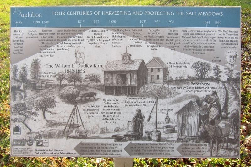
1640s The first settlers of Guilford harvest hay from salt meadows along the East River.
1699 Howlet's Bridge is constructed.
1708 Ebenezer Hubbard comes to live in the section known as "Howlet's", named from the lots where the wolves howled ie. Howl-lots.
1815 Amos Dudley buys part of the Hubbard Farm where the nature trail now runs. He erects tide gates to aid in salt haying and establishes a potashery (see below).
1842 William L. Dudley builds a Greek Revival house. By 1851 he has pieced together a 60 acre farm.
1880 The Dudley barn is struck by lightning and rebuilt by Samuel Cornell.
1933 Anne and Woolsey Conover purchase the Dudley/Cornell Farm.
1936 During the Depression, the Works Progress Administration digs mosquito ditches throughout the marsh.
1938 The 1938 Hurricane washes away the tide gates and brings salt haying to an end.
1964 Anne Conover rallies neighbors to donate their salt marsh parcels to National Audubon Society as part of a movement that results in the transfer of thousands of acres of tidal wetlands in Connecticut from private hands to conservation groups.
this page online
1969 The Tidal Wetlands Act in Connecticut brings to an end the filling and draining of Connecticut's coastal marshes.
Research by Joel Helander Text and Illustration by Edward Henrey
Erected by Audubon Connecticut.
Topics. This historical marker is listed in these topic lists: Agriculture • Disasters • Environment • Settlements & Settlers.
Location. 41° 17.953′ N, 72° 39.185′ W. Marker is in Guilford in South Central Region, Connecticut. It can be reached from Meadowlands east of Clapboard Hill Road, on the right when traveling east. Located on the Anne Conover Nature Education Trail in Guilford Salt Meadows Audubon Sanctuary. Touch for map. Marker is in this post office area: Guilford CT 06437, United States of America. Touch for directions.

Regionally, this marker is in the Connecticut River Valley, on the Connecticut Shoreline, and in Greater New Haven. It is also in the American Northeast, in New England, and on the Eastern Seaboard. Globally, it is in the North Atlantic Region, North America, the Western Hemisphere, the Western World, and the
Photographed by Conrad Ward, March 29, 2024
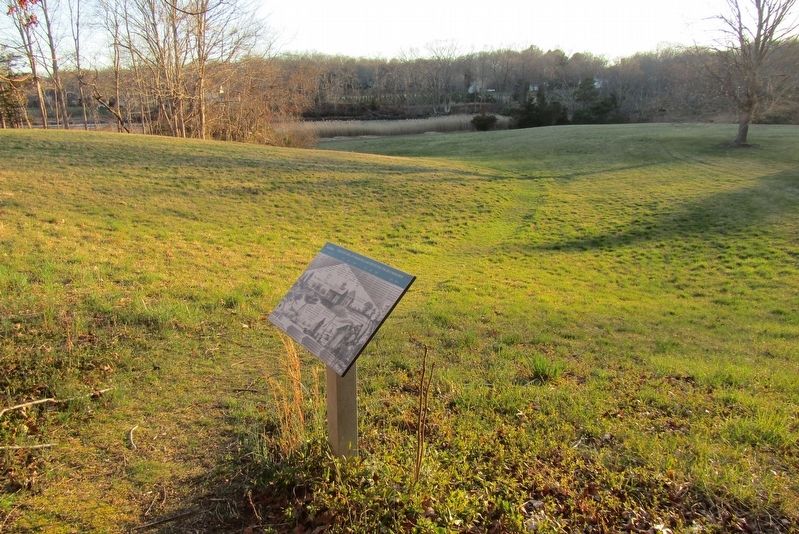
2. Marker on Nature Trail
Other nearby markers. At least 8 other markers are within 2 miles of this marker, measured as the crow flies: The Return of Bluebirds and Ospreys (about 500 feet away, measured in a direct line); The East River Watershed and Tidal Marsh (approx. 0.2 miles away); Anne Conover Nature Education Trail Dedication (approx. 0.2 miles away); Salt Haying (approx. 0.3 miles away); Guilford Gun (approx. 1.1 miles away); Pompey (approx. 1.2 miles away); Candace (approx. 1.7 miles away); Richard and Nancy Holmes House (approx. 1.8 miles away). Touch for a list and map of all markers in Guilford.
Credits. This page was last revised on May 19, 2026. It was originally submitted on June 16, 2024, by Conrad Ward of Guilford, Connecticut. This page has been viewed 143 times since then and 14 times this year. Photos: 1, 2. submitted on June 16, 2024, by Conrad Ward of Guilford, Connecticut. • Michael Herrick was the editor who published this page.
