Downtown West in Minneapolis in Hennepin County, Minnesota — The American Midwest (Upper Plains)
The Resurrection of Washington Avenue
| — | Washington Avenue | — |

Photographed by McGhiever, May 12, 2024
1. The Resurrection of Washington Avenue Marker
[Caption:] The Guthrie Theater, circa 2010
As industry and railroads left the Mississippi riverfront, private and public stakeholders gradually became aware that the area could be a destination for living, working and playing. The Minneapolis Park and Recreation Board acquired land along the central riverfront and developed it with trails and parkways which spurred private land development adjacent to the riverfront creating the new Mill District neighborhood which now comprises new condominium and townhouse projects as well as the Mill City Museum, Mill Ruins Park, the Guthrie Theater and MacPhail Center for Music. The Stone Arch Bridge was opened to pedestrian traffic in 1994, creating a link in the trail system and providing spectacular views of St. Anthony Falls.
This site sat vacant until 1983 when a 6-story, 1,397-space municipal parking ramp was erected and named the Gateway Parking Ramp due to its proximity to the Gateway District.
Washington Avenue has remained a major Minneapolis thoroughfare. In February 2008, Mayor R.T. Rybak and leaders of the Washington Boulevard Great City Design Team unveiled
this page online
Image Source: Photographer: Ryan F. Kronzer, 5/2010. Text Sources: Washington Ave: from the first street of Minneapolis to 21st century boulevard, page. http://en.wikipedia.org/wiki/History_of_Minneapolis,_Minnesota#Reshaping_downtown. http://www.downtownjournal.com/index.php?&story=6003&page=65category=54. http://edcmpls.org/EDC80228.html.
Topics. This historical marker is listed in these topic lists: Entertainment • Parks & Recreational Areas • Roads & Vehicles. A significant historical year for this entry is 1983.
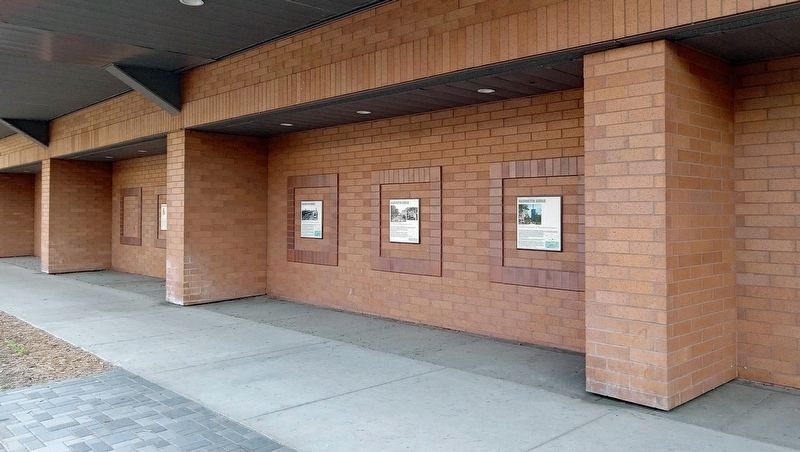
Location. 44° 58.743′ N, 93° 15.733′ W. Marker is in Minneapolis, Minnesota, in Hennepin County. It is in Downtown West. It is on Washington Avenue S. east of 4th Avenue S., on the right when traveling east. The marker is in an alcove on the north side of the Gateway Parking Ramp.
Photographed by McGhiever, May 20, 2024
2. The Resurrection of Washington Avenue Marker (right) on the north side of the Gateway Parking Ramp

Regionally, this marker is in the Twin Cities Metropolitan Area. It is also in the American Midwest, in the Corn Belt, and in the Great River Road Region. Globally, it is in North America, the Western Hemisphere, the Western World, and the Anglosphere. Historically, it finds itself in what was once Rupert’s Land, the territory of the Mississippian Culture, and the Louisiana Purchase.
Other nearby markers. At least 8 other markers are within walking distance of this marker: The Decline of Washington Avenue (here, next to this marker); Transportation on Washington Avenue (here, next to this marker); Industry's Impact on Washington Avenue (here, next to this marker); The Genesis of Washington Avenue (a few steps from this marker); Changing Times (about 500 feet away, measured in a direct line); Welcome to the Rail Maze (about 500 feet away); Trains Can't Swim (about 700 feet away); Barrels / Bags / Bust / and Beyond (about 700 feet away). Touch for a list and map of all markers in Minneapolis.
Credits. This page was last revised on June 16, 2024. It was originally submitted on June 16, 2024, by McGhiever of Minneapolis, Minnesota. This page has been viewed 180 times since then and 17 times this year. Photos: 1, 2. submitted on June 16, 2024, by McGhiever of Minneapolis, Minnesota.
