
North Olmsted in Cuyahoga County, Ohio — The American Midwest (Great Lakes)
Coe Ridge
Photographed by William Fischer, Jr., June 5, 2011
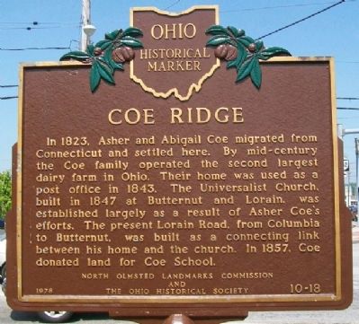
1. Coe Ridge Marker
In 1823, Asher and Abigail Coe migrated from Connecticut and settled here. By mid-century the Coe family operated the second largest dairy farm in Ohio. Their home was used as a post office in 1843. The Universalist Church, built in 1847 at Butternut and Lorain, was established largely as a result of Asher Coe's efforts. The present Lorain Road, from Columbia to Butternut, was built as a connecting link between his home and the church. In 1857, Coe donated land for Coe School.
Erected 1978 by North Olmsted Landmarks Commission and The Ohio Historical Society. (Marker Number 10-18.)
Topics and series. This historical marker is listed in these topic lists: Agriculture • Religion & Religious Structures • Roads & Vehicles • Settlements & Settlers. In addition, it is included in the Ohio Historical Society / The Ohio History Connection, and the Unitarian Universalism (UUism) series lists. A significant historical year for this entry is 1823.
Location. 41° 25.598′ N, 81° 53.708′ W. Marker is in North Olmsted, Ohio, in Cuyahoga County. It is at the intersection of Lorain Road (Ohio Route 10) and Walter Road,
this page online

Regionally, this marker is in Greater Cleveland, on the Lake Erie Shore, and in the Western Reserve. It is also in the American Midwest and on the Great Lakes. Globally, it is in North America, the Western Hemisphere, the Western World, and the Anglosphere. Historically, it finds itself in what was once the Haudenosaunee (Iroquois) Confederacy, the territory of the Mississippian Culture, and the Northwest Territory.
Other nearby markers. At least 8 other markers are within 2 miles of this marker, measured as the crow flies: Parker Ranch (approx. one mile away); Joseph Peake's Farm (approx. 1.1 miles away); John J. Donnelly (approx. 1.3 miles away); Frostville Post Office / Frostville Museum (approx. 1.4 miles away); Butternut Ridge Cemetery 1835 (approx. 1½ miles away); Ohio History (approx. 1½ miles away); American History (approx. 1½ miles away); North Olmsted History (approx. 1½ miles away). Touch for a list and map of
Photographed by William Fischer, Jr., June 5, 2011
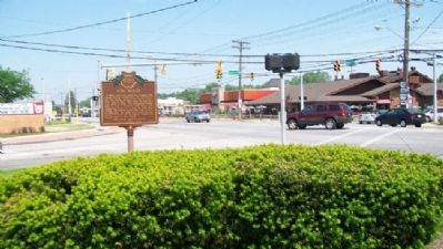
2. Coe Ridge Marker
Looking east along Lorain Road (Ohio Route 10).
Also see . . . About North Olmsted. City website entry (Submitted on June 12, 2011, by William Fischer, Jr. of Reynoldsburg, Ohio.)
Photographed by Grant & Mary Ann Fish, July 17, 2022
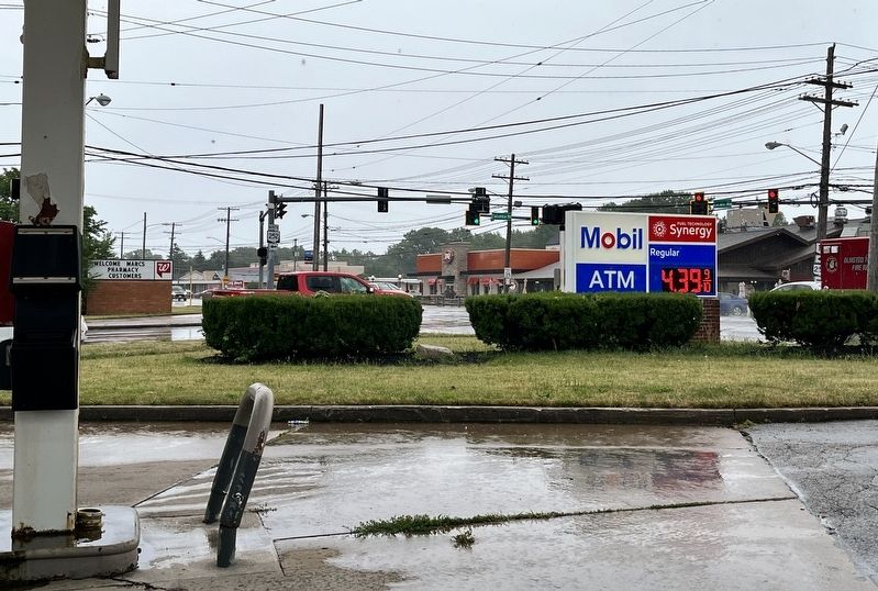
3. Coe Ridge Marker Site (now missing)
Credits. This page was last revised on June 25, 2024. It was originally submitted on June 12, 2011, by William Fischer, Jr. of Reynoldsburg, Ohio. This page has been viewed 1,692 times since then and 72 times this year. Last updated on June 20, 2024, by Nick Stevens of North Olmsted, Ohio. Photos: 1, 2. submitted on June 12, 2011, by William Fischer, Jr. of Reynoldsburg, Ohio. 3. submitted on July 19, 2022, by Grant & Mary Ann Fish of Galloway, Ohio. • Devry Becker Jones was the editor who published this page.
Editor’s want-list for this marker. Photo of the marker in its current context. • Can you help?
