Old City in Philadelphia in Philadelphia County, Pennsylvania — The American Northeast (Mid-Atlantic)
Old York Road
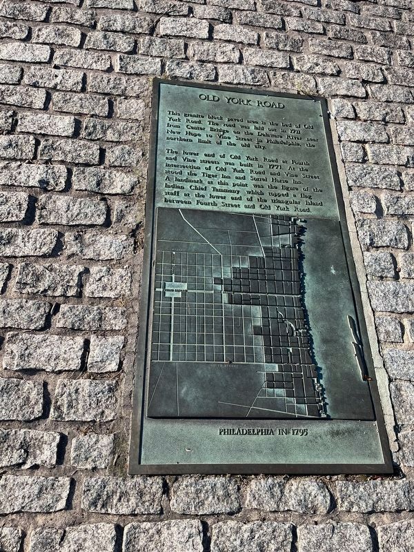
This granite block paved area is the bed of Old York Road. The road was laid out in 1711 from Center Bridge on the Delaware River near New Hope to Vine Street in Philadelphia, the northern limit of the old city.
The lower end of Old York Road at Fourth and Vine streets was built in 1771. At the intersection of Old York Road and Vine Street stood the Tiger Inn and Sorrel Horse Inn. A landmark at this point was the figure of the Indian Chief Tammany which topped a flag staff at the lower end of the triangular island between Fourth Street and Old York Road.
Topics. This historical marker is listed in these topic lists: Colonial Era • Industry & Commerce • Roads & Vehicles • Settlements & Settlers. A significant historical year for this entry is 1711.
Location. 39° 57.408′ N, 75° 8.764′ W. Marker is in Philadelphia, Pennsylvania, in Philadelphia County. It is in Old City. It is at the intersection of Wood Street and North 4th Street, on the right when traveling west on Wood Street. Touch for map. Marker is at or near this postal address: 340 York Ave, Philadelphia PA 19106, United States of America. Touch for directions.

Regionally,
this page online
Other nearby markers. At least 8 other markers are within walking distance of this marker: St. Augustine's (about 500 feet away, measured in a direct line); St. Augustine's Roman Catholic Church (about 500 feet away); Old St. George's United Methodist Church (about 500 feet away); Nicola Monachesi (about 500 feet away); St. Augustine's R.C. Church (about 500 feet away); Old St. George's (about 600 feet away); St. George's Church (about 600 feet away); The Methodist Book Concern (about 600 feet away). Touch for a list and map of all markers in Philadelphia.

Credits. This page was last revised on June 22, 2024. It was originally submitted on June 22, 2024, by Devry Becker Jones of Washington, District of Columbia. This page has been viewed 447 times since then and 74 times this year. Photos: 1, 2. submitted on June 22, 2024, by Devry Becker Jones of Washington, District of Columbia.
