
Lebanon in Warren County, Ohio — The American Midwest (Great Lakes)
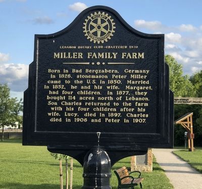
Miller Family Farm
⎯⎯⎯
Miller Park
Photographed by Duane and Tracy Marsteller, May 27, 2024
1. Miller Family Farm side of marker
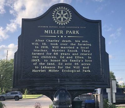
Miller Park – After Charles' death, his son, Will, 18, took over the farming. In 1916, Will married a local teacher, Harriet Snook. They farmed for 66 years and reared two children, Ed and Ellen. In 1993, to honor his family's love of the land, Ed sold 46 acres to Lebanon for the Will and Harriet Miller Ecological Park.
Erected by Lebanon Rotary Club.
Topics and series. This historical marker is listed in these topic lists: Agriculture • Parks & Recreational Areas. In addition, it is included in the Rotary International series list. A significant historical year for this entry is 1877.
Location. 39° 27.445′ N, 84° 13.106′ W. Marker is in Lebanon, Ohio, in Warren County. It can be reached from Miller Road (County Road 101) west of Katherine Avenue/Reveres
this page online

Regionally, this marker is in Greater Cincinnati and in the Miami Valley. It is also in the American Midwest and in the Corn Belt. Globally, it is in North America, the Western Hemisphere, the Western World, and the Anglosphere. Historically, it finds itself in what was once the Haudenosaunee (Iroquois) Confederacy, the territory of the Mississippian Culture, and the Northwest Territory.
Other nearby markers. At least 8 other markers are within 2 miles of this marker, measured as the crow flies: Ichabod Corwin (approx. 1.4 miles away); Lebanon Academy (approx. 1½ miles away); Eleanor Dell Clark Ullum (approx. 1.6 miles away); The Reeves House (approx. 1.6 miles away); Dilatush-Hedges Building (approx. 1.6 miles away); General O. M. Mitchel (approx. 1.7 miles away); Nixon-Brant House (approx. 1.7 miles away); Thomas Corwin (approx. 1.7 miles away). Touch for a list and map of all markers in Lebanon.
Photographed by Duane and Tracy Marsteller, May 27, 2024
2. Miller Park side of marker
Photographed by Duane and Tracy Marsteller, May 27, 2024
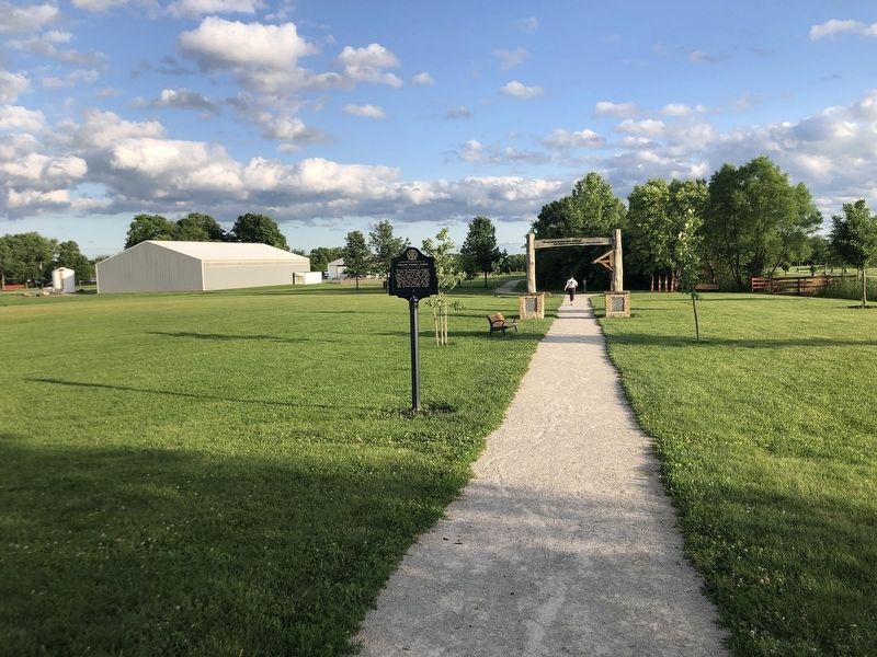
3. Miller Family Farm / Miller Park Marker
Credits. This page was last revised on June 22, 2024. It was originally submitted on June 22, 2024, by Duane and Tracy Marsteller of Murfreesboro, Tennessee. This page has been viewed 295 times since then and 68 times this year. Photos: 1, 2, 3. submitted on June 22, 2024, by Duane and Tracy Marsteller of Murfreesboro, Tennessee.
