Killingworth in Lower Connecticut River Valley Region, Connecticut — The American Northeast (New England)
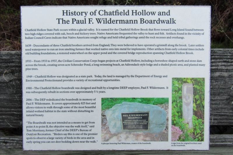
Chatfield Hollow and The Paul F. Wildermann Boardwalk
Photographed by Conrad Ward, April 20, 2024
1. Wildermann Boardwalk Marker
History of Chatfield Hollow and The Paul F. Wildermann Boardwalk
Chatfield Hollow State Park occurs within a glacial valley. It is named for the Chatfield Hollow Brook that flows toward Long Island Sound between two high ridges covered with oak, beech and hickory trees. Native Americans frequented the valley to hunt and fish. Artifacts found in the vicinity of Indian Council Caves indicate that Native Americans sought refuge and held tribal gatherings amid the rock recesses and overhangs.
1639 — Descendants of three Chatfield brothers arrived from England; They were believed to have operated a gristmill along the brook. Later settlers used waterpower to run an iron smelting furnace that worked native ores into metal for implements. Other artifacts from early colonial times include old building foundations, a restored waterwheel on the upper pond and the covered bridge reproduction spanning Chatfield Hollow Brook.
1933 — From 1933 to 1937, the Civilian Conservation Corps began projects at Chatfield Hollow, including a horseshoe-shaped earth and stone dam across the brook, creating seven acre Schreeder Pond, a long
this page online
1949 — Chatfield Hollow was designated as a state park. Today, the land is managed by the Department of Energy and Environmental Protection and provides a variety of recreational opportunities.
1988 — The Chatfield Hollow boardwalk was designed and built by a longtime DEEP employee, Paul F. Wildermann. It was subsequently rebuilt in sections over approximately 5 ½ years.
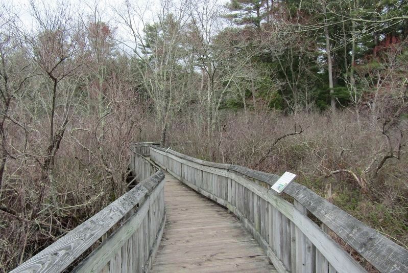
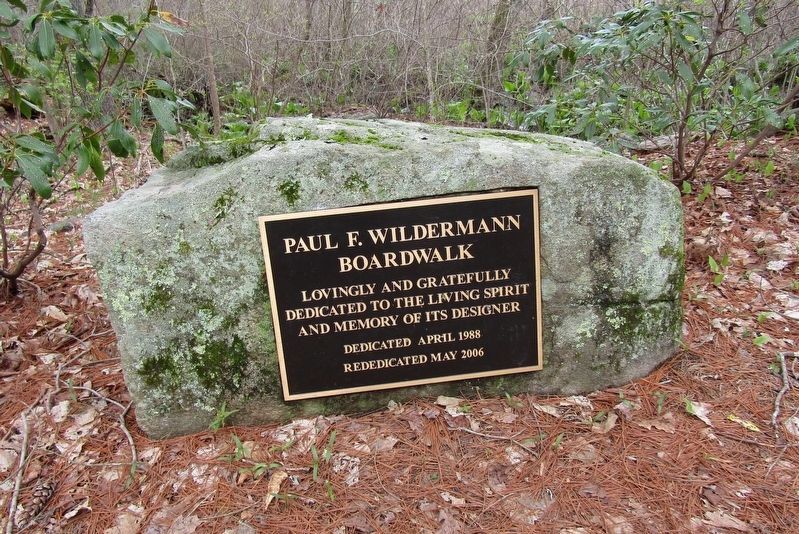
2006 — The DEP rededicated the boardwalk in memory of Paul F. Wildermann. It covers approximately 825 feet and allows visitors to walk through some of the most beautiful inland wetland habitat in the state without disturbing its natural beauty.
"The Boardwalk was not intended as a means to get from point A to point B, the objective was the walk itself," said Tom Morrissey, former Chief of the DEEP's Bureau of Outdoor Recreation. "Birders say this is one of the premier spots to observe a large variety of birds in the area and in early spring you can see deer bedding down near the walk."
Topics. This historical marker is listed in these topic lists: Environment •
Photographed by Conrad Ward, April 20, 2024
2. Wildermann Boardwalk Marker
Location. 41° 21.977′ N, 72° 35.257′ W. Marker is in Killingworth in Lower Connecticut River Valley Region, Connecticut. It can be reached from N Branford Road (Connecticut Route 80) half a mile north of Hemlock Drive, on the right when traveling north. Located in Chatfield Hollow State Park. Touch for map. Marker is in this post office area: Killingworth CT 06419, United States of America. Touch for directions.

Regionally, this marker is in the Connecticut River Valley and on the Connecticut Shoreline. It is also in the American Northeast, in New England, and on the Eastern Seaboard. Globally, it is in the North Atlantic Region, North America, the Western Hemisphere, the Western World, and the Anglosphere. Historically, it finds itself in what was once Middlesex County and also one of the original Thirteen Colonies.
Other nearby markers. At least 8 other markers are within 2 miles of this marker, measured as the crow flies: "CCC Worker" (approx. 0.2 miles away); Killingworth World War I Memorial (approx. 1.1
Photographed by Conrad Ward, April 20, 2024
3. Dedication Plaque
Also see . . . Chatfield Hollow State Park. (Submitted on July 5, 2024, by Michael Herrick of Southbury, Connecticut.)
Credits. This page was last revised on May 19, 2026. It was originally submitted on June 30, 2024, by Conrad Ward of Guilford, Connecticut. This page has been viewed 456 times since then and 57 times this year. Photos: 1, 2, 3. submitted on June 30, 2024, by Conrad Ward of Guilford, Connecticut. • Michael Herrick was the editor who published this page.
