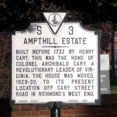
Near Richmond in Chesterfield County, Virginia — The American South (Mid-Atlantic)
Ampthill Estate
Erected 1962 by Virginia State Library. (Marker Number S-3.)
Topics and series. This historical marker is listed in these topic lists: Colonial Era • War, US Revolutionary. In addition, it is included in the Virginia Department of Historic Resources (DHR) series list. A significant historical year for this entry is 1732.
Location. 37° 27.031′ N, 77° 26.454′ W. Marker is near Richmond, Virginia, in Chesterfield County. Marker is at the intersection of Jefferson Davis Highway (U.S. 1) and Cogbill Road, on the right when traveling north on Jefferson Davis Highway. This marker is located at the entrance to the DuPont Spruance Plant. Touch for map. Marker is at or near this postal address: 5401 Jefferson Davis Highway, Richmond VA 23234, United States of America. Touch for directions.
Other nearby markers. At least 8 other markers are within walking distance of this marker. Falling Creek Stone Bridge (approx. 0.8 miles away); Site of First Iron Foundry in America (approx. 0.8 miles away); Jefferson Davis Highway (approx. 0.8 miles away); Warwick (approx. 0.9 miles away); Falling Creek Ironworks (approx. 0.9 miles away); Iron Furnace Overlook (approx. 0.9 miles away); Cary’s Mill Overlook (approx. 0.9 miles away); Natural History (approx. 0.9 miles away). Touch for a list and map of all markers in Richmond.
Also see . . . Archibald Cary. Wikipedia (Submitted on November 30, 2009, by Bernard Fisher of Richmond, Virginia.)
Credits. This page was last revised on August 6, 2020. It was originally submitted on November 29, 2009, by Bernard Fisher of Richmond, Virginia. This page has been viewed 1,633 times since then and 175 times this year. Photos: 1, 2. submitted on November 29, 2009, by Bernard Fisher of Richmond, Virginia.

