Near Munfordville in Hart County, Kentucky — The American South (East South Central)
Kentucky and the Western War
Western Theater, 1861-1862
Photographed by Lee Hattabaugh, January 25, 2011
1. Kentucky and the Western War Marker
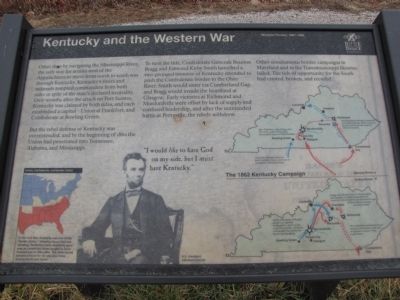
Other than by navigating the Mississippi River, the only way for armies west of the Appalachians to move from north to south was through Kentucky. Kentucky's rivers and railroads tempted commanders from both sides in spite of the state's declared neutrality. Only months after the attack on Fort Sumter, Kentucky was claimed by both sides, and each established a capitol - Union at Frankfort, and Confederate at Bowling Green.
But the rebel defense of Kentucky was overextended, and by the beginning of 1862 the Union had penetrated into Tennessee, Alabama, and Mississippi.
To turn the tide, Confederate Generals Braxton Bragg and Edmund Kirby Smith launched a two-pronged invasion of Kentucky intended to push the Confederate border to the Ohio River. Smith would enter via Cumberland Gap, and Bragg would invade the heartland at Glasgow. Early victories at Richmond and Munfordville were offset by lack of supply and confused leadership, and after the unintended battle at Perryville, the rebels withdrew.
Other simultaneous border campaigns in Maryland and in the Transmississippi likewise failed. The tide of opportunity
this page online
"I would like to have God on my side, but I must have Kentucky."
U.S. President Abraham Lincoln
(caption) In the Civil War, Kentucky was one of the "border states," allowing slavery but not seceding. Kentucky's early neutrality gave way as competing forces sought to force Kentuckians to take sides. The state would become pivotal for its rails and rivers linking North and South.
Erected by Battle for the Bridge Historic Preserve.
Topics. This historical marker is listed in these topic lists: Railroads & Streetcars • War, US Civil • Waterways & Vessels. A significant historical year for this entry is 1862.
Location. 37° 15.436′ N, 85° 53.278′ W. Marker is near Munfordville, Kentucky, in Hart County. It is on Charlie Dowling Road north of Bragg Avenue, on the left when traveling north. This marker is no longer accessible.. Touch for map. Marker is at or near this postal address: 300 Charlie Dowling Rd, Munfordville KY 42765, United States of America. Touch for directions.

Regionally, this marker is in Mammoth Cave Country and in the Pennyroyal Region. It is also
Photographed by Lee Hattabaugh, January 25, 2011
2. Kentucky and the Western War Marker
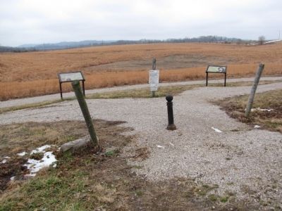
On the left.
Other nearby markers. At least 8 other markers are within walking distance of this marker: The Raider (here, next to this marker); Anthony Woodson Farm (within shouting distance of this marker); The Woodson Farm/The Preserve (about 300 feet away, measured in a direct line); Battle of Munfordville: Day 1 (about 500 feet away); Fort Craig (about 700 feet away); Battle of Munfordville: Siege (approx. 0.2 miles away); L&N Railroad Bridge (approx. 0.2 miles away); Battle of Munfordville (approx. ¼ mile away). Touch for a list and map of all markers in Munfordville.
More about this marker. This marker is no longer accessible. It is on private property. Please do not attempt to access it without permission of the property owner. According to a Google Review by Patrica Chapman, "We drove out to the site and all that was there were signs saying 'trails closed'. The stands where you would normally find information and maps were empty and behind a fence with a 'no trespassing' sign."
Credits. This page was last revised on July 4, 2024. It was originally submitted on February 2, 2011. This page has been viewed 1,242 times since then and 27 times this year. Last updated on July 3, 2024. Photos: 1, 2. submitted on February 2, 2011, by Lee Hattabaugh of Capshaw, Alabama. • Bernard Fisher was the editor who published this page.
