Clarkdale in Yavapai County, Arizona — The American Mountains (Southwest)
Moving On
Photographed by James Hulse, June 20, 2024
1. Moving On Marker
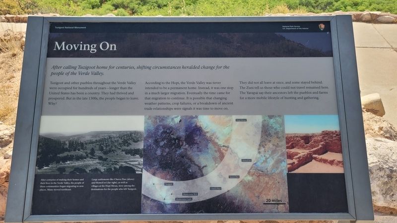
Tuzigoot and other pueblos throughout the Verde Valley were occupied for hundreds of years-longer than the United States has been a country. They had thrived and prospered. But in the late 1300s, the people began to leave. Why?
According to the Hopi, the Verde Valley was never intended to be a permanent home. Instead, it was one stop in a much larger migration. Eventually the time came for that migration to continue. It is possible that changing weather patterns, crop failures, or a breakdown of ancient trade relationships were signals it was time to move on.
They did not all leave at once, and some stayed behind. The Zuni tell us those who could not travel remained here. The Yavapai say their ancestors left the pueblos and farms for a more mobile lifestyle of hunting and gathering.
Captions
After centuries of making their homes and their lives in the Verde Valley, the people of these communities began migrating to new places. Many moved northeast.
Large settlements like Chavez Pass (above) and Homol'ovi (far right), as well as villages at the Hopi Mesas, were among the destinations for the people who left Tuzigoot.
Arizona State Archives
Erected by Tuzigoot
this page online
Topics. This historical marker is listed in these topic lists: Anthropology & Archaeology • Indigenous Peoples and Communities.
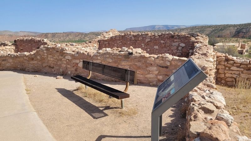
Location. 34° 46.152′ N, 112° 1.602′ W. Marker is in Clarkdale, Arizona, in Yavapai County. It is on Tuzigoot Road east of Sycamore Canyon Road. The marker is located in the Tuzigoot National Monument along the hiking loop trail. Touch for map. Marker is at or near this postal address: 25 Tuzigoot Rd, Clarkdale AZ 86324, United States of America. Touch for directions.

Regionally, this marker is in Arizona’s Verde Valley and in the Yavapai-Apache Nation. It is also in the American Southwest and in the Mountain West. Globally, it is in North America, the Western Hemisphere, the Western World, and the Anglosphere. Historically, it finds itself in what was once New Spain and also Mexico’s Alta California.
Other nearby markers. At least 8 other markers are within walking distance of this marker: An Evolving Village (here, next to this marker); The Pueblo's Plaza (a few steps from this marker); Clues in Architecture (a
Photographed by James Hulse, June 20, 2024
2. Moving On Marker
More about this marker. The marker is located in the Tuzigoot National Monument along the hiking loop trail. There is a small entrance fee to visit the archeological ruins.
Also see . . . Tuzigoot Human History. Tuzigoot National Monument
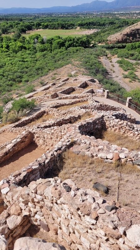
The first people - The human history of the Verde Valley begins around ten thousand years ago, when the southwest was cooler and wetter than it is today. Paleolithic hunter-gatherers traveled through a greener, woodier Verde Valley, filled with pinyon pine, shrub live oak, and juniper. Today we know of their presence from a handful of Clovis points - distinctive stone points that were probably used with spears - that have been found in and near the valley. Clovis(Submitted on July 4, 2024, by James Hulse of Medina, Texas.)points are found all across North America and parts of South America, indicating that these ancient people traveled widely across the continents, probably following game animals, the growth of edible plants, and other resources.Photographed by James Hulse, June 20, 20243. The view of the reconstructed ruins from the top pueblo
Credits. This page was last revised on July 5, 2024. It was originally submitted on July 3, 2024, by James Hulse of Medina, Texas. This page has been viewed 133 times since then and 13 times this year. Photos: 1, 2, 3. submitted on July 5, 2024, by James Hulse of Medina, Texas.
