Cape Neddick in York in York County, Maine — The American Northeast (New England)
St. Aspinquid
Photographed by Larry Gertner, May 11, 2023
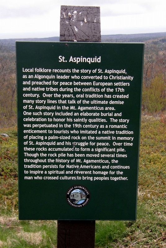
1. St. Aspinquid Marker
Marker 1:
Local folklore recounts the story of St. Aspinquid, as an Algonquin leader who converted to Christianity and preached for peace between European settlers and native tribes during the conflicts of the 17th century. Over the years, oral tradition has created many story lines that talk of the ultimate demise of St. Aspinquid in the Mt. Agamenticus area.
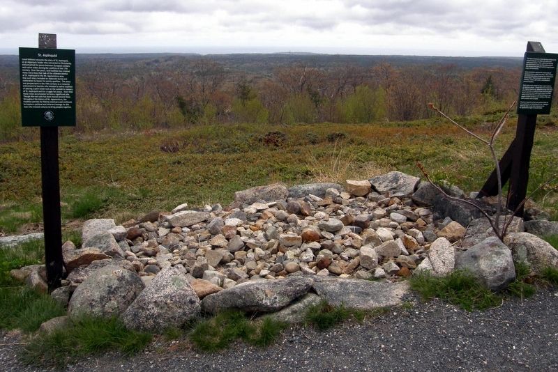
One such story included an elaborate burial and celebration to honor his saintly qualities. The story was perpetuated in the 19th century as a romantic enticement to tourists who imitated a native tradition of placing a palm-sized rock on the summit in memory of St. Aspinquid and his struggle for peace. Over time these rocks accumulated to form a significant pile.
Though the rock pile has been moved several times throughout the history of Mt. Agamenticus, the tradition persists for Native Americans and continues to inspire a spiritual and reverent homage for the man who crossed cultures to bring peoples together.
Marker 2:
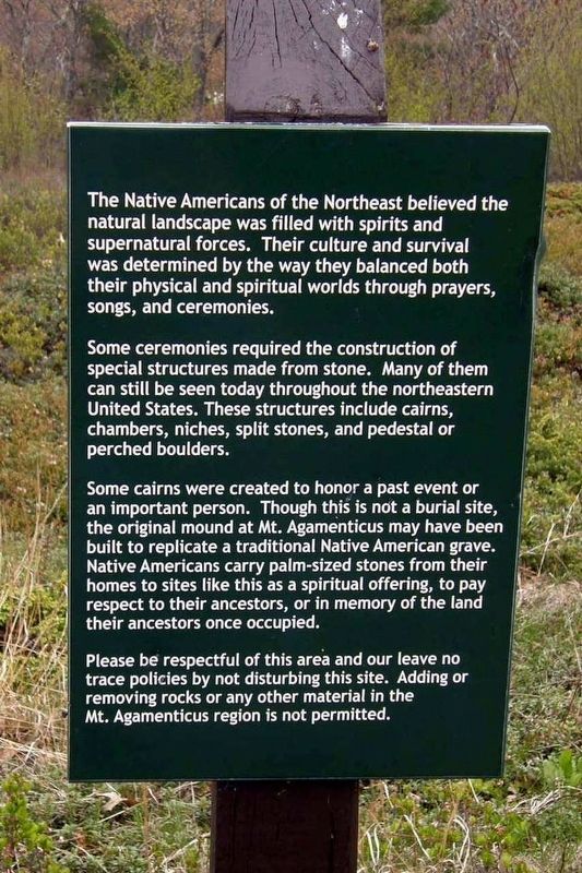
The Native Americans of the Northeast believed the natural landscape was filled with spirits and supernatural forces. Their culture and survival was determined by the way they balanced both their physical and spiritual worlds through prayers, songs, and ceremonies.
Some ceremonies required the construction of special structures made from stone. Many of them can still be seen today throughout the northeastern United States. These structures include cairns, chambers, niches, split stones, or pedestal or perched boulders.
Some cairns were created to honor a past event or an important person. Though this is not a burial site, the original mound at Mt. Agamenticus may have been built to replicate a traditional Native American grave. Native American carry palm-sized stones from their homes to sites like this as a spiritual offering,
this page online
Please be respectful of this area and our leave no trace policies by not disturbing this site. Adding or removing rocks or any other material in the Mt. Agamenticus region is not permitted.
Erected by Mount Agamenticus Conservation Region.
Topics. This historical marker is listed in these topic lists: Indigenous Peoples and Communities • Parks & Recreational Areas.
Location. 43° 13.426′ N, 70° 41.48′ W. Marker is in York, Maine, in York County. It is in Cape Neddick. It can be reached from Mount Agamenticus Road. Touch for map. Marker is at or near this postal address: Mount Agamenticus Conservation Region, Cape Neddick ME 03902, United States of America. Touch for directions.

Regionally, this marker is on Southern Maine Coast. It is also in the American Northeast, in New England, and on the Eastern Seaboard. Globally, it is in the North Atlantic Region, North America, the Western Hemisphere, the Western World, and the Anglosphere.
Other nearby markers. At least 8 other
Photographed by Larry Gertner, May 11, 2023
2. Ceremonial Stone Structures Marker
Also see . . . Saint Aspinquid’s Cairn & Mount Agamenticus. Stone Structures website entry (Submitted on July 7, 2024, by Larry Gertner of New York, New York.)
Photographed by Larry Gertner, May 11, 2023
3. The cairn and markers
Credits. This page was last revised on July 7, 2024. It was originally submitted on July 7, 2024, by Larry Gertner of New York, New York. This page has been viewed 560 times since then and 108 times this year. Photos: 1, 2, 3. submitted on July 7, 2024, by Larry Gertner of New York, New York.
