Bury St Edmunds in Suffolk, England, United Kingdom — Northwestern Europe (the British Isles)
The Chapter House
| — | Bury St Edmunds Abbey | — |
Photographed by Ray Gurganus, March 27, 2024
1. The Chapter House Marker
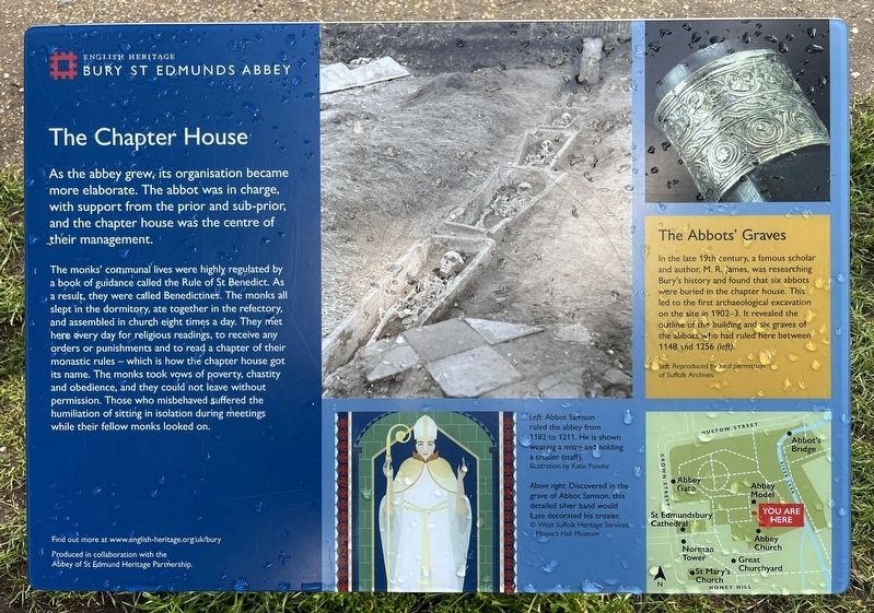
The monks' communal lives were highly regulated by a book of guidance called the Rule of St Benedict. As a result, they were called Benedictines. The monks all slept in the dormitory, ate together in the refectory, and assembled in church eight times a day. They met here every day for religious readings, to receive any orders or punishments and to read a chapter of their monastic rules which is how the chapter house got its name. The monks took vows of poverty, chastity and obedience, and they could not leave without permission. Those who misbehaved suffered the humiliation of sitting in isolation during meetings while their fellow monks looked on.
The Abbots' Graves
In the late 19th century, a famous scholar and author, M. R. James, was researching Bury's history and found that six abbots were buried in the chapter house. This led to the first archaeological excavation on the site in 1902-3. It revealed the outline of the building
this page online
Erected by English Heritage.
Topics. This historical marker is listed in these topic lists: Anthropology & Archaeology • Cemeteries & Burial Sites • Religion & Religious Structures.
Location. 52° 14.649′ N, 0° 43.138′ E. Marker is in Bury St Edmunds, England, in Suffolk. It can be reached from Angel Hill. Touch for map. Marker is at or near this postal address: 2 Abbeygate Street, Bury St Edmunds, England IP33 1RS, United Kingdom. Touch for directions.

Regionally, this marker is in East Anglia. Globally, it is on the Atlantic Ocean, in the North Atlantic Region, in Europe, in Atlantic Europe, on one of the British Isles, in the Western World, and in the Anglosphere. Historically, it finds itself in what was once the Roman Empire.
Other nearby markers. At least 8 other markers are within walking distance of this marker: The Heart of the Church (within shouting distance of this marker); The Cloister (within shouting distance of this marker); St Edmunds Abbey (within shouting
Photographed by Ray Gurganus, March 27, 2024
2. The Chapter House Marker
Credits. This page was last revised on July 13, 2024. It was originally submitted on July 12, 2024, by Ray Gurganus of Washington, District of Columbia. This page has been viewed 136 times since then and 32 times this year. Photos: 1, 2. submitted on July 12, 2024, by Ray Gurganus of Washington, District of Columbia. • Andrew Ruppenstein was the editor who published this page.
