Fort Loramie in Shelby County, Ohio — The American Midwest (Great Lakes)
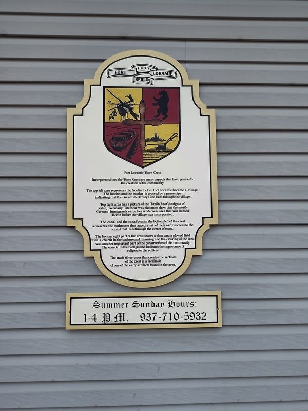
Fort Loramie Town Crest
Photographed by Craig Doda, June 29, 2024
1. Fort Loramie Town Crest Marker
Incorporated into the Town Crest are many aspects that have gone into the creation of the community.
The top left area represents the frontier before Fort Loramie became a village. The hatchet and the musket is crossed by a peace pipe indicating that the Greenville Treaty Line runs through the village.
Top right area has a picture of the "Berlin Bear", insignia of Berlin, Germany. The bear was chosen to show that the mostly German immigrants came to a wilderness area that was named Berlin before the village was incorporated.
The canal and the canal boat in the bottom left of the crest represents the businesses that traced part of their early success to the canal that ran through the center of town.
The bottom right part of the crest shows a plow and a plowed field with a church in the background. Farming and the clearing of the land was another important part of the construction of the community. The church in the background indicates the importance of religion to the settlers.
The trade silver cross that creates the sections of the crest is a facsimile of one of the early artifacts found in the area.
Topics.
this page online
Location. 40° 21.086′ N, 84° 22.455′ W. Marker is in Fort Loramie, Ohio, in Shelby County. It is at the intersection of North Main Street (Ohio Route 66) and Elm Street ( Route 364), on the right when traveling north on North Main Street. Touch for map. Marker is at or near this postal address: 37 N Main St, Fort Loramie OH 45845, United States of America. Touch for directions.

Regionally, this marker is in Ohio’s Till Plains. It is also in the American Midwest and in the Corn Belt. Globally, it is in North America, the Western Hemisphere, the Western World, and the Anglosphere. Historically, it finds itself in what was once the Haudenosaunee (Iroquois) Confederacy, the territory of the Mississippian Culture, and the Northwest Territory.
Other nearby markers. At least 8 other markers are within walking distance of this marker: You Are On The Buckeye Trail (within shouting distance of this marker); Fort Loramie School Bell (within shouting distance
Photographed by Craig Doda, June 29, 2024
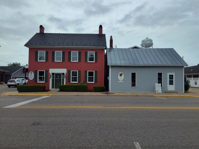
2. Fort Loramie Town Crest Marker
Another marker is no longer nearby. Pioneer Portage (was a few steps from this marker but has been confirmed missing).
Credits. This page was last revised on July 26, 2024. It was originally submitted on July 12, 2024, by Craig Doda of Napoleon, Ohio. This page has been viewed 167 times since then and 27 times this year. Photos: 1, 2. submitted on July 12, 2024, by Craig Doda of Napoleon, Ohio. • Devry Becker Jones was the editor who published this page.
