Three Rivers in Otero County, New Mexico — The American Mountains (Southwest)
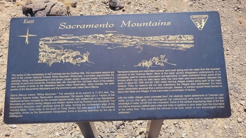
Sacramento Mountains
Photographed by James Hulse, June 25, 2024
1. Sacramento Mountains Marker
Sierra Blanca means "White Mountain." The elevation at its summit is 11,973 feet. The Mescalero Apache Indian Reservation encompasses 738 square miles--just a fraction of the traditional territory occupied by the nomadic Apache bands. Also nestled high in the Sacramento Mountains are historic mining villages and modern resorts such as Ruidoso and Cloudcroft. The Sacramento Mountain chain stretches some 60 miles, forming the northeastern edge of the Tularosa Basin. Thirty miles to the south of Three Rivers, the west face of the Sacramento Mountains, known as the Sacramento
this page online
Permanent streams and intermittent arroyos carry fresh spring and rain water from the mountain canyons to the Tularosa Basin. Most of the water quickly disappears underground, or is completely used for human consumption and agriculture. In wetter prehistoric times, some of the arroyos which now only run after heavy rains may have been year-round streams. Between the years of about AD 1000 and AD 1400, Indian farming villages existed along each of the major streams. Then, for reasons still not fully understood, the villages were abandoned. For many years, researchers assumed that a serious drought, disease, or warfare caused these farmers to leave their fields and villages. It may have been a combination of factors.
Like the Indian villages which preceded them, the relatively recent settlements of Tularosa (red reed), La Luz (the light); and Alamogordo (fat cottonwood) were built in locations to take advantage of water run-off from the mountains. Some of the earliest engineering feats of the first non-Native American settlers were miles and miles of pipeline to
Photographed by James Hulse, June 25, 2024
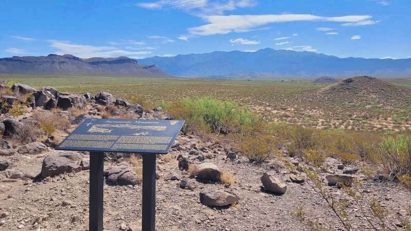
2. The Sacramento Mountains and Marker
Erected by Bureau of Land Management.
Topics. This historical marker is listed in these topic lists: Indigenous Peoples and Communities • Parks & Recreational Areas.
Location. 33° 20.811′ N, 106° 0.673′ W. Marker is in Three Rivers, New Mexico, in Otero County. It is on 3 Rivers Road 4.7 miles east of U.S. 54. The marker is located along the middle section of the petroglyphs hiking trail in the Three Rivers Petroglyph Site. Touch for map. Marker is at or near this postal address: 455 3 Rivers Road, Tularosa NM 88352, United States of America. Touch for directions.

Regionally, this marker is in the Pecos Valley. It is also in the American Borderlands and in the Southwest. Globally, it is in North America, the Western Hemisphere, the Western World, and the Anglosphere. Historically, it finds itself in what was once New Spain, the Comanchería, and the Republic of Texas.
Other nearby markers. At least 8 other markers are within walking
Photographed by James Hulse, June 25, 2024
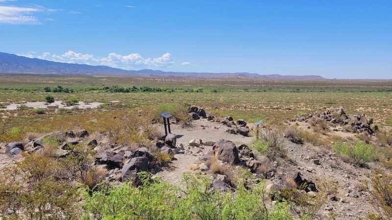
3. The view of the markers looking back at the visitors center
More about this marker. There is a small entrance fee to visit the Three Rivers Petroglyph Site.
Also see . . . Sacramento Mountains (New Mexico). Wikipedia
The Sacramento Mountains are a mountain range in the south-central part of the U.S. state of New Mexico, lying just east of Alamogordo in Otero County (small portions of the range lie in Lincoln County and Chaves County). From north to south, the Sacramento Mountains extend for 85 miles (137 km), and from east to west they encompass 42 miles (68 km).(Submitted on July 13, 2024, by James Hulse of Medina, Texas.)
Photographed by James Hulse, June 25, 2024
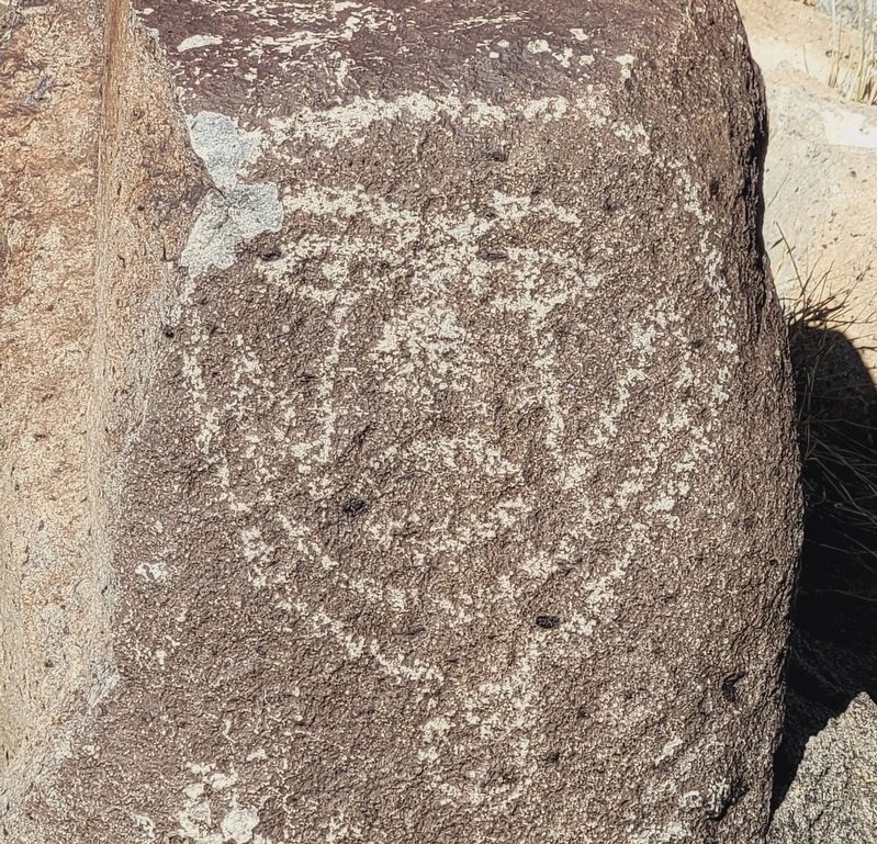
4. Petroglyph along the hiking trail
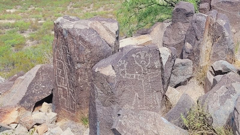
Photographed by James Hulse, June 25, 2024
5. Petroglyphs along the hiking trail
Credits. This page was last revised on July 13, 2024. It was originally submitted on July 12, 2024, by James Hulse of Medina, Texas. This page has been viewed 547 times since then and 108 times this year. Photos: 1, 2, 3, 4, 5. submitted on July 13, 2024, by James Hulse of Medina, Texas.
