Rocky Point State Park in Warwick in Kent County, Rhode Island — The American Northeast (New England)
Larry Mouradjian Fishing Pier
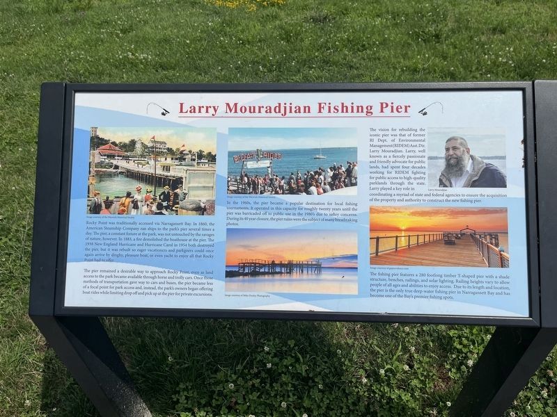
Rocky Point was traditionally accessed via Narragansett Bay. In 1860, the American Steamship Company ran ships to the park's pier several times a day. The pier, a constant fixture at the park, was not untouched by the ravages of nature, however. In 1883, a fire demolished the boathouse at the pier. The 1938 New England Hurricane and Hurricane Carol in 1954 both destroyed the pier, but it was rebuilt so eager vacationers and parkgoers could once again arrive by dinghy, pleasure boat, or even yacht to enjoy all that Rocky Point had to offer.
The pier remained a desirable way to approach Rocky Point, even as land access to the park became available through horse and trolly cars. Once those methods of transportation gave way to cars and buses, the pier became less of a focal point for park access and, instead, the park's owners began offering boat rides while limiting drop off and pick up at the pier for private excursions.
In the 1960s, the pier became a popular destination for local fishing tournaments. It operated in this capacity for roughly twenty years until the pier was barricaded off to public use in the 1980's
this page online
The vision for rebuilding the iconic pier was that of former RI Dept. of Environmental Management (RIDEM) Asst. Dir. Larry Mouradjian. Larry, well known as a fiercely passionate and friendly advocate for public lands, had spent four decades working for RIDEM fighting for public access to high-quality parklands through the state. Larry played a key role in coordinating a myriad of state and federal agencies to ensure the acquisition of the property and authority to construct the new fishing piers.
The fishing pier features a 280 footlong timber T-shaped pier with a shade structure, benches, railings, and solar lighting. Railing heights vary to allow people of all ages and abilities to enjoy access. Due to its length and location, the pier is the only true deep-water fishing pier in Narragansett Bay and has become one of the Bay's premier fishing spots.
Topics. This historical marker is listed in these topic lists: Animals • Parks & Recreational Areas • Sports • Waterways & Vessels. A significant historical year for this entry is 1860.
Location. 41° 41.313′ N,
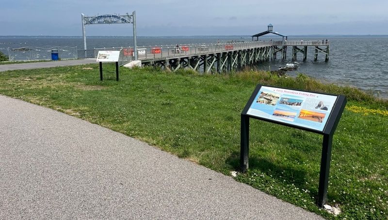

Regionally, this marker is in Greater Providence and on Narragansett Bay. It is also in the American Northeast, in New England, and on the Eastern Seaboard. Globally, it is in the North Atlantic Region, North America, the Western Hemisphere, the Western World, and the Anglosphere. Historically, it finds itself in what was once one of the original Thirteen Colonies.
Other nearby markers. At least 8 other markers are within walking distance of this marker: The Pier (a few steps from this marker); Presidential Phone Call (about 300 feet away, measured in a direct line); The Shore Dinner Hall (about 400 feet away); House of Horrors (about 500 feet away); The Circle Swing (about 600 feet away); The Skyliner (about 700 feet away); Rocky Point and Baseball (about 700 feet away); The Arch (about 800 feet away). Touch for a list and map of all markers in Warwick.
Credits. This page was last revised on July 13, 2024. It was originally submitted on July 13, 2024, by Devry Becker Jones of Washington, District of Columbia. This page has been viewed 427 times since then and 81 times this year. Photos: 1, 2. submitted on July 13, 2024, by Devry Becker Jones of Washington, District of Columbia.
