
Perth Amboy in Middlesex County, New Jersey — The American Northeast (Mid-Atlantic)
Ambo Point
Photographed by Bill Coughlin, May 24, 2008
1. Ambo Point Marker
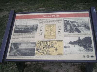
This is the section of the waterfront where the first houses were built by the Proprietors in 1683. Here it would have been easy to reach the water without climbing down a steep cliff.
During most of the 19th century, Perth Amboy was a fashionable resort. Water Street was lined by grand Victorian houses with large porches that caught the summer breezes. Remnants of the beaches lingered into the early 1960s when the water became too polluted for swimming. The well-tended gardens along Water Street disappeared as bulkheads edged the entire point and public park space expanded.
Erected by State of New Jersey Division of Parks & Forestry and National Park System.
Topics. This historical marker is
this page online
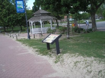
Location. 40° 29.965′ N, 74° 16.105′ W. Marker is in Perth Amboy, New Jersey, in Middlesex County. It is at the intersection of Water Street and High Street, on the left when traveling south on Water Street. Marker is in the Harborside park on the Perth Amboy waterfront. Touch for map. Marker is in this post office area: Perth Amboy NJ 08861, United States of America. Touch for directions.

Regionally, this marker is in New Jersey’s Central Jersey, in Greater Princeton, and in the New York City Metropolitan Area. It is also in the American Northeast, in the Mid-Atlantic, and on the Eastern Seaboard. Globally, it is in the North Atlantic Region, North America, the Western Hemisphere, the Western World, and the Anglosphere. Historically, it finds itself in what was once New Netherland and also one of the original Thirteen Colonies.
Other nearby markers. At least 8 other markers are within walking distance of this marker: Inca Garcilaso de la Vega (within shouting
Photographed by Bill Coughlin, May 24, 2008
2. Marker on the Perth Amboy Waterfront
This marker is part of the New Jersey Coastal Heritage Trail Route.
More about this marker. Several illustrations and photographs appear on the marker. One is a reproduction of handbill printed in England in 1682 that reads “Proposals by the Proprietors of East Jersey in America for the building of a Town on Ambo Point and for the disposition of lands in that Province, and also for encouragement of Artifices and Labourers that shall transport themselves thither out of England, Scotland and Ireland.” Below this is an “early 18th century map show[ing] the southeastern point of Perth Amboy, where the Raritan River meets the Arthur Kill, the water separating New Jersey from Staten Island. Raritan Bay opens
Photographed by Bill Coughlin, May 24, 2008
3. Raritan Bay
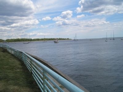
This view of the Raritan Bay was taken from near the marker. Staten Island, NY can be seen in the background.
Four old-time photos of the Perth Amboy waterfront are found at the four corners of the marker. Captions for these are:
“This shows the undeveloped bank along the river as it appeared about 1880. Until the 1960s there were small protected beaches where now you see seawall and lawn”, “Houses and gardens looking south along Water Street before 1935. In the left foreground is the Noe House, dating from the 1870s. The Noe family owned an oyster business and a dock”, and “The waters of the Raritan were used for many purposes, including spiritual cleansing. This 1950s baptism in the river continued a recorded tradition dating back to 1818.”
Also see . . . New Jersey Coastal Heritage Trail Route. National Park Service website. (Submitted on December 4, 2009, by Bill Coughlin of Woodland Park, New Jersey.)
Credits. This page was last revised on June 16, 2016. It was originally submitted on December 4, 2009, by Bill Coughlin of Woodland Park, New Jersey. This page has been viewed 1,831 times since then and 70 times this year. Photos: 1, 2, 3. submitted on December 4, 2009, by Bill Coughlin of Woodland Park, New Jersey.
