Near Holdrege in Phelps County, Nebraska — The American Midwest (Upper Plains)
First Site of Bethel Lutheran Church and Cemetery
June 1879

Photographed by Mark Hilton, July 10, 2024
1. First Site of Bethel Lutheran Church and Cemetery Marker
Marker has suffered from the elements.
Lay pastors serving the congregation were Olof Hedlund and C. J. Johnson. Pastor J. E. Swanborn was the first called pastor. The sod church was replaced in 1884 by a frame church built in Holdrege. In 1892, a frame building was erected at this site to be used during the summer months as a “Swede School” for the children of the congregation. The present congregation recognized with thankfulness the commitment and sacrifice these early pioneers made to affirm their Christian faith.
Erected by Nebraska State Historical Society, Bethel Evangelical Lutheran Church Congregation.
this page online
Topics and series. This historical marker is listed in these topic lists: Cemeteries & Burial Sites • Immigration • Religion & Religious Structures • Settlements & Settlers. In addition, it is included in the Nebraska State Historical Society series list. A significant historical date for this entry is November 12, 1877.
Location. 40° 26.843′ N, 99° 18.221′ W. Marker is near Holdrege, Nebraska, in Phelps County. It is on R Road 0.3 miles south of Grand Army of the Republic Highway (U.S. 34), on the left when traveling south. Touch for map. Marker is in this post office area: Holdrege NE 68949, United States of America. Touch for directions.

Regionally, this marker is in Eastern Nebraska. It is also in the American Midwest, in the Corn Belt, and on the prairies. Globally, it is in North America, the Western Hemisphere, the Western World, and the Anglosphere. Historically, it finds itself in what was once the Louisiana Purchase.
Other nearby markers. At least 8 other markers are within 15 miles of this marker, measured as the crow flies: Funk, Nebraska (approx. 3 miles away); Phelps County (approx. 3½

Photographed by Mark Hilton, July 10, 2024
2. First Site of Bethel Lutheran Church and Cemetery Marker
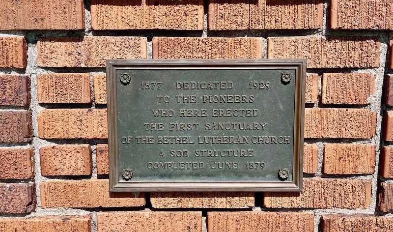
Photographed by Mark Hilton, July 10, 2024
3. Plaque about early sod sanctuary.
Plaque can be seen in wide view photo in left rear.
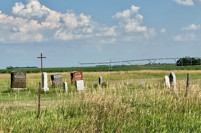
Photographed by Mark Hilton, July 10, 2024
4. A few graves of the Bethel Lutheran Cemetery.
Credits. This page was last revised on December 22, 2024. It was originally submitted on July 14, 2024, by Mark Hilton of Montgomery, Alabama. This page has been viewed 252 times since then and 34 times this year. Photos: 1, 2, 3, 4. submitted on July 14, 2024, by Mark Hilton of Montgomery, Alabama.
