Upper South Providence in Providence County, Rhode Island — The American Northeast (New England)
Collier Point Park
⎯⎯⎯
South Street Station
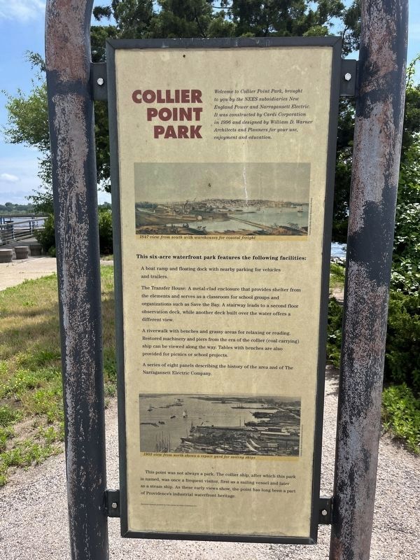
Collier Point Park
Welcome to Collier Point Park, brought to you by the NEES subsidiaries New England Power and Narragansett Electric. It was constructed by Cardi Corporation in 1996 and designed by William D. Warner Architects and Planners for your use, enjoyment and education.
This six-acre waterfront park features the following facilities:
A boat ramp and floating dock with nearby parking for vehicles and trailers.
The Transfer House: A metal-clad enclosure that provides shelter from the elements and serves as a classroom for school groups and organizations such as Save the Bay. A stairway leads to a second floor observation deck, while another deck built over the water offers a different view.
A riverwalk with benches and grassy areas for relaxing or reading. Restored machinery and piers from the era of the collier (coal carrying) ship can be viewed along the way. Tables with benches are also provided for picnics or school projects.
A series of eight panels describing the history of the area and of The Narragansett Electric Company.
This point was not always a park. The collier ship, after which this
this page online
South Street Station
A series of big changes on the Providence riverfront began with the introduction of the city's first electric power companies.
Providence's first electric power companies were the Rhode Island Electric Lighting Company and the Narragansett Electric Lighting Company. As early as 1882, ten electric street lamps were installed on Westminster Street and Market Square by the Rhode Island Electric Lighting Company. They were powered by a single Corliss steam engine. In 1884 Narragansett won its first commercial electric customer, a skating rink, followed by a street lighting contract.
Narragansett Electric Lighting Company built its first major plant on the waterfront at Elm Street in 1889. Its waterfront location facilitated coal shipments direct from ocean-going vessels, while its highly modern boiler plant made it a showplace. The steam engines were from the world-renowned Corliss Company, located in Providence.
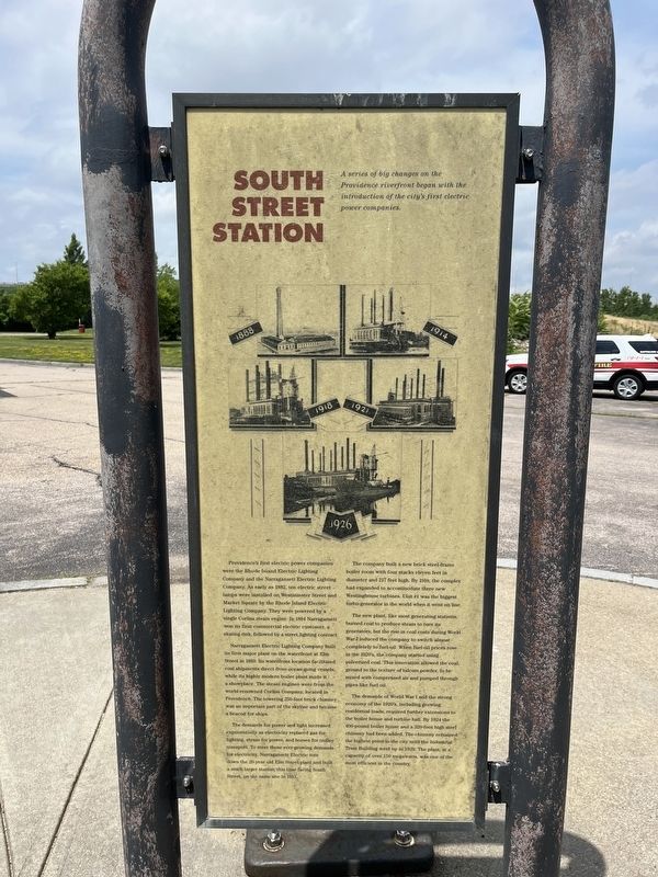
The demands for power and light increased exponentially as electricity replaced gas for lighting, steam for power, and horses for trolley transport. To meet these ever-growing demands for electricity, Narragansett Electric tore down the 20-year old Elm Street plant and built a much larger station, this time facing South Street, on the same site in 1913.
The company built a new brick steel-frame boiler room with four stacks eleven feet in diameter and 217 feet high. By 1918, the complex had expanded to accommodate three new Westinghouse turbines. Unit #1 was the biggest turbo-generator in the world when it went on line.
The new plant, like most generating stations, burned coal to produce steam to turn its generators, but the rise in coal costs during World War I induced the company to switch almost completely to fuel-oil. When fuel-oil prices rose in the 1920's, the company started using pulverized coal. This innovation allowed the coal, ground to the texture of talcum powder, to be mixed with compressed air and pumped through
Photographed by Devry Becker Jones (CC0), July 10, 2024
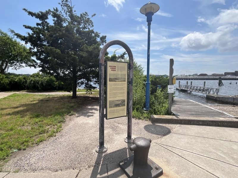
3. Collier Point Park / South Street Station Marker
The demands of World War I and the strong economy of the 1920's, including growing residential loads, required further extensions to the boiler house and a 320-foot high steel chimney had been added. The chimney remained the highest point in the city until the Industrial Trust Building went up in 1929. The plant, at a capacity of over 150 megawatts, was one of the most efficient in the country.
Topics. This historical marker is listed in these topic lists: Industry & Commerce • Parks & Recreational Areas • Waterways & Vessels. A significant historical year for this entry is 1882.
Location. 41° 48.736′ N, 71° 24.105′ W. Marker is in Providence, Rhode Island, in Providence County. It is in Upper South Providence. It is on Henderson Street 0.2 miles east of Allens Avenue (U.S. 1A), on the right when traveling east. Touch for map. Marker is at or near this postal address: 50 Allens Ave, Providence RI 02903, United States of America. Touch for directions.

Regionally, this marker is on Rhode Island’s Narragansett Bay. It is also in the American Northeast, in New England, and on the Eastern Seaboard. Globally, it is in the North Atlantic Region, North America, the Western Hemisphere, the Western World, and the Anglosphere. Historically, it finds itself in what was once one of the original Thirteen Colonies.
Other nearby markers. At least 8 other markers are within walking distance of this marker: Manchester Street Station (about 400 feet away, measured in a direct line); Manchester Street Station / The Providence River (about 700 feet away); The Fox Point Hurricane Barrier / From Oil to Gas (approx. 0.2 miles away); Providence River Bridge (approx. ¼ mile away); Providence River Park (approx. 0.3 miles away); Colonial Wharf at South Water Street: 1910-1942 / Fox Point and the Night Boat Era 1822-1932 (approx. 0.3 miles away); The Fox Point Hurricane Barrier / A Second Life for the Hurricane Barrier (approx. 0.3 miles away); 18 Bridge Street (approx. 0.4 miles away). Touch for a list and map of all markers in Providence.
Credits. This page was last revised on July 16, 2024. It was originally submitted on July 16, 2024, by Devry Becker Jones of Washington, District of Columbia. This page has been viewed 257 times since then and 42 times this year. Photos: 1, 2, 3. submitted on July 16, 2024, by Devry Becker Jones of Washington, District of Columbia.
