Bakersfield in Kern County, California — The American West (Pacific Coastal)
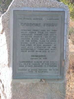
Gordons Ferry
California Historic Landmark
Erected 1937 by Bakersfield Parlor No.42, NSGW, El Tejon Parlor No.239, NDGW and Kern County Chamber of Commerce. (Marker Number 137.)
Topics and series. This historical marker is listed in these topic lists: Roads & Vehicles • Waterways & Vessels. In addition, it is included in the Butterfield Overland Mail, the California Historical Landmarks, and the Native Sons/Daughters of the Golden West series lists. A significant historical year for this entry is 1858.
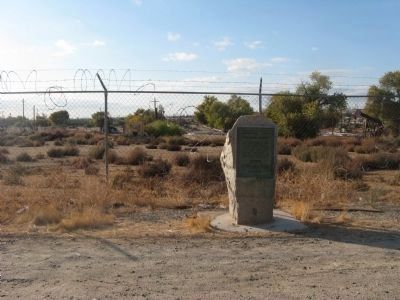
Location. 35° 25.488′ N, 118° 58.084′ W. Marker is in Bakersfield, California, in Kern County. Marker is on China Grade Loop, on the right when traveling south. Marker is approx. 1000 feet south of Round Mountain Road. Touch for map. Marker is in this post office area: Bakersfield CA 93308, United States of America. Touch for directions.
Other nearby markers. At least 8 other markers are within 4 miles of this marker, measured as the crow flies. Ethel's Old Corral (approx. ĺ mile away); Discovery Well (approx. 0.8 miles away); Home of Elisha Stevens (approx. 2.9 miles away); Oildale Waits Drilling Company (approx. 2.9 miles away); Oildale Mural (approx. 3.3 miles away); Jewett Family (approx. 3.6 miles away); Beale Memorial Clock Tower (approx. 3.6 miles away); Kern County Chamber of Commerce (approx. 3.6 miles away). Touch for a list and map of all markers in Bakersfield.
Credits. This page was last revised on October 21, 2020. It was originally submitted on December 5, 2009, by Syd Whittle of Mesa, Arizona. This page has been viewed 2,532 times since then and 92 times this year. Photos: 1, 2. submitted on December 5, 2009, by Syd Whittle of Mesa, Arizona.

