Valley Falls in Cumberland in Providence County, Rhode Island — The American Northeast (New England)
The Old Neighborhood
Valley Falls
| — | Cumberland, RI | — |
Photographed by Devry Becker Jones (CC0), July 10, 2024
1. The Old Neighborhood Marker
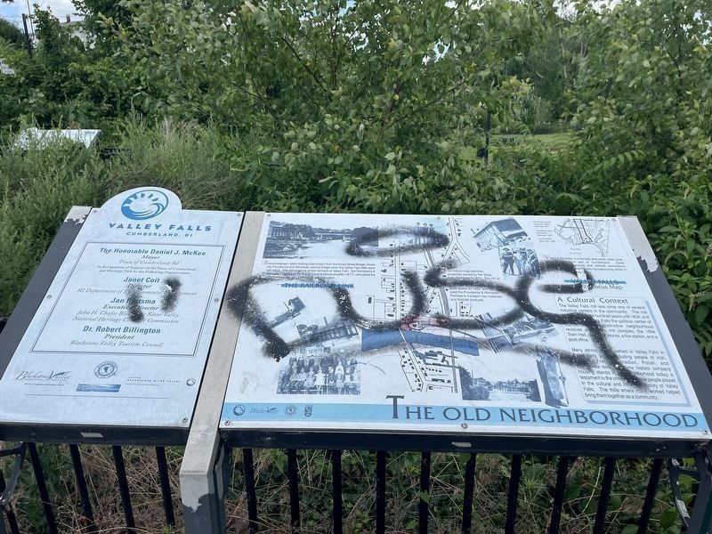
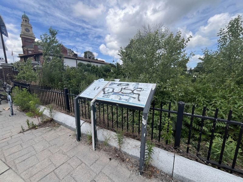
Unfortunately, the marker has been defaced.
A Cultural Context
The Valley Falls mill was once once of several industrial centers in the community. The mill here ran for over a hundred years until 1834, and [unreadable] Valley Falls the political center of Cumberland. The distinctive neighborhood revolved around the mill complex, the 1894 Town Hall, churches, stores, a fire station, and a post office.
Many ethnic groups settled in Valley Falls in these early years including people of Irish, English, French Canadian, Polish, and Portuguese descent. Some historic company housing stands in the neighborhood today, a testament to the critical role these people played in the cultural and industrial history of Valley Falls. The mills where many worked to helped bring them together as a community.
The Railroad Link
This photograph, taken looking downstream from the Broad Street Bridge, shows the Providence and Worcester railroad bridge when the Valley Falls Mills were still intact. The convergence of two railroads at Valley Falls — the Providence & Worcester (1847) and the Rhode Island & Massachusetts (1877) — stimulated the growth of local industry, commerce, and
this page online
This historic map identifies the properties owned by the Valley Falls Company in 1870. The mill at today's park site (red) took advantage of Blackstone River water power by 1820, and later used the Providence & Worcester Railroad to transport raw materials and finished products.
Valley Falls 1990's Locus Map
Valley Falls today is a densely-populated urban area in the southern part of Cumberland. Good waterpower resources and railroad connections made it an important textile manufacturing center in the 1800s and early 1900s.
Erected by Blackstone Valley Tourism Council; Town of Cumberland, Rhode Island; State of Rhode Island Department of Environmental Management; John H. Chafee Blackstone River Valley National Heritage Corridor Commission.
Topics. This historical marker is listed in these topic lists: Immigration • Industry & Commerce • Railroads & Streetcars • Waterways & Vessels. A significant historical year for this entry is 1834.
Location. 41° 53.987′ N, 71° 23.423′ W. Marker has been reported damaged. Marker is in Cumberland, Rhode Island, in Providence County. It is in Valley Falls. It is

Regionally, this marker is in the Blackstone Valley and in Greater Providence. It is also in the American Northeast, in New England, and on the Eastern Seaboard. Globally, it is in the North Atlantic Region, North America, the Western Hemisphere, the Western World, and the Anglosphere. Historically, it finds itself in what was once one of the original Thirteen Colonies.
Other nearby markers. At least 8 other markers are within walking distance of this location: Your Key to the Past / End of an Era (a few steps from this marker); Waterpower & Dams (within shouting distance of this marker); A Bit About Arches (within shouting distance of this marker); c 1820 - 1934 (within shouting distance of this marker); Sri Chinmoy Peace Bridge (within shouting distance of this marker); Veterans Memorial (within shouting distance of this marker); a different marker also named Veterans Memorial (within shouting distance of this marker); Turbine Power (within shouting distance of this marker). Touch for a list and map of all markers in Cumberland.
Credits. This page was last revised on July 16, 2024. It was originally submitted on July 16, 2024, by Devry Becker Jones of Washington, District of Columbia. This page has been viewed 218 times since then and 30 times this year. Photos: 1, 2. submitted on July 16, 2024, by Devry Becker Jones of Washington, District of Columbia.
