Valley Falls in Cumberland in Providence County, Rhode Island — The American Northeast (New England)
Your Key to the Past
⎯⎯⎯
End of an Era

Photographed by Devry Becker Jones (CC0), July 10, 2024
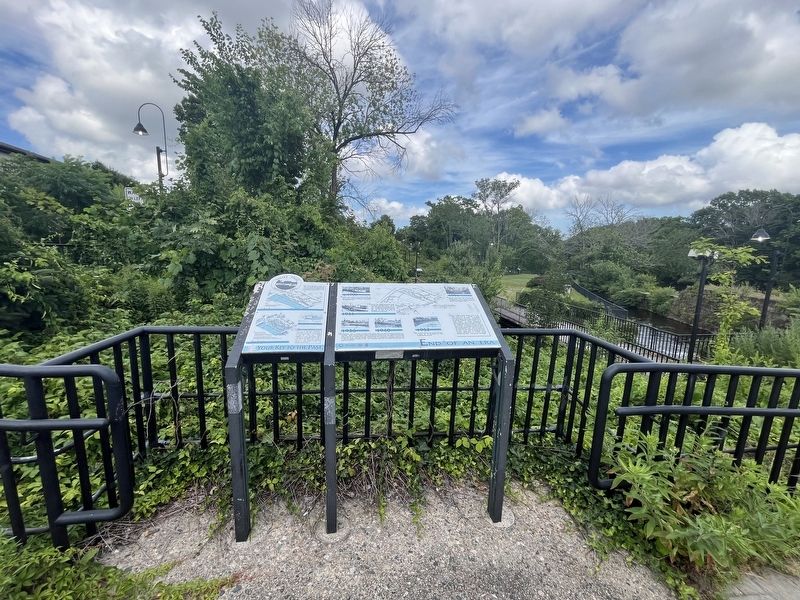
1. Your Key to the Past / End of an Era Marker
The site of the brick storehouse, mentioned on the sign at the Broad Street park entrance is immediately to your left. There was a small addition to the storehouse right behind you. The bridge in front of you was built for this park in 1992. As you can see in the bird's-eye drawing above, an older bridge crossed in exactly the same spot.
1915
The park site you are visiting today was once covered by the textile manufacturing plant depicted in this original 1915 drawing. Shown here are virtually all buildings except the earliest, built by the Harris family c1813-1820. Crawford Allen enlarged the complex in the 1830's, and the Chace family built nearly all remaining structures c1840-1900, including the stone dam. Sayles Finishing Plant added new buildings in the 20th century before demolishing the plant in 1934.
Use this drawing, and the footprint map below, to envision where you would be standing in the mill complex if it still filled the park today.
Today
In the Valley Falls Heritage Park today, you can see the raceways or canals which ran among the vanished buildings in the
this page online
Look closely at the drawing for hints of old walls and historic features visible on the site today. These same remnants appear in red on the Footprint Fragments map at right.
c 1900
Changing views across the river show the mill's last years. Here the complex appears in full glory, beyond the bowstring arch Broad Street Bridge. The old bridge was replaced in 1915.
1934
On April 5, 1934, Sayles Finishing Plants hired E.J. McCall to demolish the Plant.
Photographed by Devry Becker Jones (CC0), July 10, 2024
2. Your Key to the Past / End of an Era Marker
1936 / 1940
By September 1934, E.J. McCall had leveled all the building walls to the ground, leaving the fragments you see today. Sayles Finishing Plants managers thought they could ignore the river, sealing the intake gates west of the dam and letting McCall push building debris into some races, but floods in 1936 and 1938 proved them wrong. To let high water flow through the site, the company cut a rough trench across the site in 1939, and replaced the gates in 1940. The 1940 picture, taken from the Central Falls side, shows the gate work underway.
1952
Mill operations had long ago removed most signs of nature, but the demolished site soon reverted to trees and brush.
1991
Trees, brush, and poison ivy were thick when park planning started, hiding parts of the site and endangering some walls. Selective removal of vegetation left a canopy of shade trees and revealed the ruins for your enjoyment today.
Erected by Blackstone Valley Tourism Council; Town of Cumberland, Rhode Island; Rhode Island Department of Environmental Management.
Topics. This historical marker is listed in these topic lists: Bridges & Viaducts • Industry & Commerce • Parks & Recreational Areas • Waterways & Vessels. A significant historical date for this entry is April 5, 1934.
Location. 41° 53.991′ N, 71° 23.419′ W. Marker is in Cumberland, Rhode Island, in Providence County. It is in Valley Falls. It is at the intersection of Broad Street (Route 114) and Meeting Street, on the right when traveling north on Broad Street. Touch for map. Marker is at or near this postal address: 2 Broad St, Cumberland RI 02864, United States of America. Touch for directions.

Regionally, this marker is in the Blackstone Valley and in Greater Providence. It is also in the American Northeast, in New England, and on the Eastern Seaboard. Globally, it is in the North Atlantic Region, North America, the Western Hemisphere, the Western World, and the Anglosphere. Historically, it finds itself in what was once one of the original Thirteen Colonies.
Other nearby markers. At least 8 other markers are within walking distance of this marker: The Old Neighborhood (a few steps from this marker); A Bit About Arches (within shouting distance of this marker); Waterpower & Dams (within shouting distance of this marker); c 1820 - 1934 (within shouting distance of this marker); Veterans Memorial (within shouting distance of this marker); a different marker also named Veterans Memorial (within shouting distance of this marker); Sri Chinmoy Peace Bridge (within shouting distance of this marker); Turbine Power (within shouting distance of this marker). Touch for a list and map of all markers in Cumberland.
Credits. This page was last revised on July 17, 2024. It was originally submitted on July 17, 2024, by Devry Becker Jones of Washington, District of Columbia. This page has been viewed 190 times since then and 40 times this year. Photos: 1, 2. submitted on July 17, 2024, by Devry Becker Jones of Washington, District of Columbia.
