Point Judith in Narragansett in Washington County, Rhode Island — The American Northeast (New England)
Galilee: A Working Waterfront
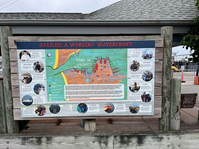
One of the largest fishing ports on the East Coast, Point Judith's Port of Galilee generates economic and recreational value for Rhode Island, celebrates the state's commercial fishing heritage, and offers opportunities for fishing businesses to innovate and prosper for years to come. Galilee is unique in its commitment to protecting and promoting its commercial fishing industry. While many fishing ports around the nation are losing waterfront access and shoreside facilities to tourism and development, Galilee is protected by the state, which owns and manages the land specifically as a fishing port.
Working waterfronts thrive on symbiotic relationships. Galilee's diverse collection of fishing vessels includes draggers, lobster boats, gill netters, fish trap boats, scallopers, and oyster farm vessels, each contributing to the wide variety of seafood landed here. Icehouses, fuel suppliers, welders, engine mechanics, net makers, safety trainers, and bait aggregators supply the boats with the inputs they need to catch and farm seafood. Numerous seafood dealers get fishermen's catch ready for market.
Meanwhile, restaurants,
this page online
[Captions:]
Restaurants
Family-run restaurants have fed fishermen, locals, and tourists for generations.
Seafood Markets
Seafood markets sell locally caught seafood to consumers.
Seafood Wholesalers
Dockside dealers buy fish from local fishermen and ship it to markets near and far.
Bait Suppliers
Bait suppliers buy skate and other baitfish from local draggers and supply it, salted and stringed, to local lobstermen.
Ferries
Interstate Navigation's Block Island Ferry services have made the 13-mile voyage between Block Island and Galilee since 1936.
Engine Mechanics
Engine mechanics provide the industry with the best and latest in marine engines, transmissions, generators, and hardware.
Gear Storage
Various spaces around the port are reserved for fishermen to work on their nets or traps. Gear maintenance is an important part of the fisherman's trade.
Net Engineers
Galilee's net engineers are regionally known for their innovative approach to gear design.
Safety Skills
Safety skills training is critical to making sure every fisherman gets home safe and sound.
Dockside Sales
Lobstermen sell freshly caught lobster and crabs direct to consumers through dockside sales.
Party & Charter Boats
Party and charter boats offer tourists a taste of sea life for a day. Serious recreational fishermen catch enough to fill their freezers.
Ice Houses
Ice houses manufacture large quantities of ice so that fishing boats can keep their catch cool at sea.
Processors and Freezers
Processors clean, fillet, package, and freeze squid and other local fish.
Oyster Farmers
Oyster farmers grow their oysters in the salt pond and use shoreside facilities in Galilee.
Fuel Companies
Fuel companies supply diesel to keep boat engines running.
Erected by the
Topics. This historical marker is listed in these topic lists: Animals • Industry & Commerce • Parks & Recreational Areas • Waterways & Vessels. A significant historical year for this entry is 1936.
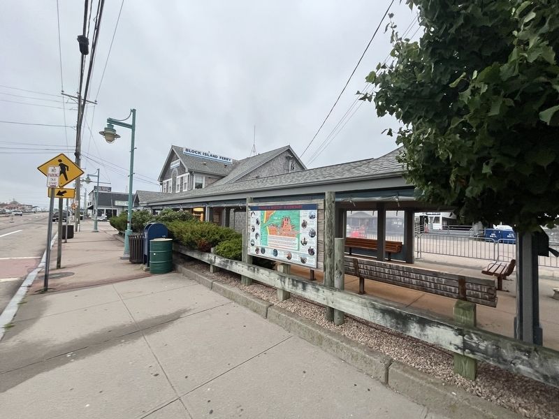
Location. 41° 22.754′ N, 71° 30.618′ W. Marker is in Narragansett, Rhode Island, in Washington County. It is in Point Judith. It is on Great Island Road just north of Ferry Terminal, on the right when traveling south. Touch for map. Marker is at or near this postal address: 304 Great Island Rd, Narragansett RI 02882, United States of America. Touch for directions.

Regionally, this marker is on Narragansett Bay and in South County. It is also in the American Northeast, in New England, and on the Eastern Seaboard. Globally, it is in the North Atlantic Region, North America, the Western Hemisphere, the Western World, and the Anglosphere. Historically, it finds itself in what was once one of the original Thirteen Colonies.
Other nearby markers. At least 8 other markers are within 2 miles of this marker, measured as the crow flies: From Trawl to Table (within shouting distance of this marker); Growth and Its Limits (about 600 feet away, measured in a direct line); In It for the Long Haul (about 600 feet away); From Fishing Village to Fishing Port (about 600 feet away); A Model of Innovation (about 600 feet away); From Trap to Table (approx. ¼ mile away); Point Judith Light House (approx. 1.9 miles away); The S.S. Black Point (approx. 2 miles away). Touch for a list and map of all markers in Narragansett.
Credits. This page was last revised on July 17, 2024. It was originally submitted on July 17, 2024, by Devry Becker Jones of Washington, District of Columbia. This page has been viewed 226 times since then and 19 times this year. Photos: 1, 2. submitted on July 17, 2024, by Devry Becker Jones of Washington, District of Columbia.
