The Loop District in Chicago in Cook County, Illinois — The American Midwest (Great Lakes)
Chicago Route 66
Start of the Trail
⎯⎯⎯
Ruta 66 de Chicago
Inicio de la Ruta
| — | History of Route 66 / Historia de la Ruta 66 | — |

Photographed by Sean Flynn, July 17, 2024
1. Chicago Route 66 side of marker
[English-language text on the west-facing side of the marker:]
More cars meant more demand for paved roads. In 1921, Congress passed the Federal Aid Highway Act, which called for a network of roads covering the entire country. A few years later, plans for interstate routes were approved for all 48 states. Route 66 stretched more than 2,400 miles from Chicago to Santa Monica, California. Cy Avery, the Oklahoma highway commissioner known as the "Father of Route 66," dubbed it "The Main Street of America." This route was considered the primary path between the Great Lakes and the Pacific Coast.
Route 66 was officially established in 1926. The Illinois stretch of Route 66 began as a two-lane road known as SB14, which followed the route of the old Pontiac Trail from Chicago to St. Louis. At first, SB14 began in Cicero, but its designation as Route 66 increased traffic. To accommodate this, the starting point was moved to Michigan Avenue and Jackson Boulevard in Chicago.
Ogden Avenue has traditionally been a major transportation route into and out of Chicago.
this page online
The development of the interstate highway system, the result of a bill signed by President Dwight D. Eisenhower, led to the decommissioning of Route 66 and the demise of many of Chicago's Ogden Avenue businesses. Drivers were offered a faster course to the southwest suburbs and central Illinois. In the 1960s, construction began on Interstate 55, and in 1977 the "End of Route 66" signs on Jackson Boulevard came down. A few remaining restaurants and repair shops along Ogden Avenue still display Route 66 memorabilia, ensuring its years as a piece of America's most mythologized highway are never forgotten.
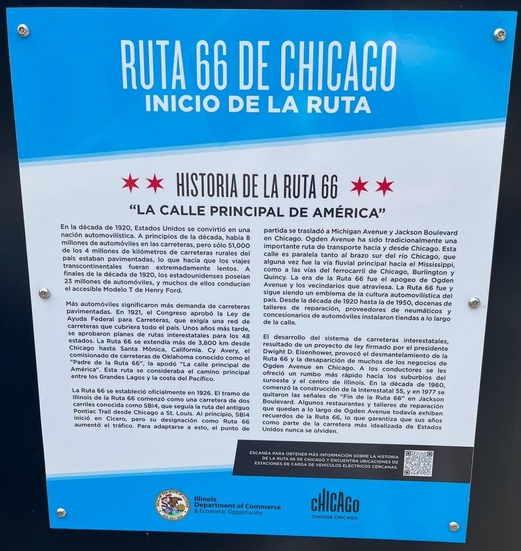
[Spanish-language text on the east-facing side of the marker:]
Photographed by Sean Flynn, July 17, 2024
2. Ruta 66 De Chicago side of marker
Más automóviles significaron más demanda de carreteras pavimentadas. En 1921, el Congreso aprobó la Ley de Ayuda Federal para Carreteras, que exigía una red de carreteras que cubriera todo el país. Unos años más tarde, se aprobaron planes de rutas interestatales para los 48 estados. La Ruta 66 se extendía más de 3,800 km desde Chicago hasta Santa Mónica, California. Cy Avery, el comisionado de carreteras de Oklahoma conocido como el "Padre de la Ruta 66", la apodó "La calle principal de América". Esta ruta se consideraba el camino principal entre los Grandes Lagos y la costa del Pacífico.
La Ruta 66 se estableció oficialmente en 1926. El tramo de Illinois de la Ruta 66 comenzó como una carretera de dos carriles conocida como SB14, que seguía la ruta del antiguo Pontiac Trail desde Chicago a St. Louis. Al principio, SB14 inició en Cicero, pero su designación como Ruta 66 aumentó el tráfico. Para adaptarse a esto, el punto de partida se trasladó a Michigan Avenue y Jackson Boulevard en Chicago. Ogden Avenue ha sido tradicionalmente una importante ruta de transporte hacia y desde Chicago. Esta calle es paralela tanto al brazo sur del río Chicago, que alguna vez fue la vía fluvial principal hacia el Mississippi, como a las vías del ferrocarril de Chicago, Burlington y Quincy. La era de
Photographed by Sean Flynn, July 17, 2024
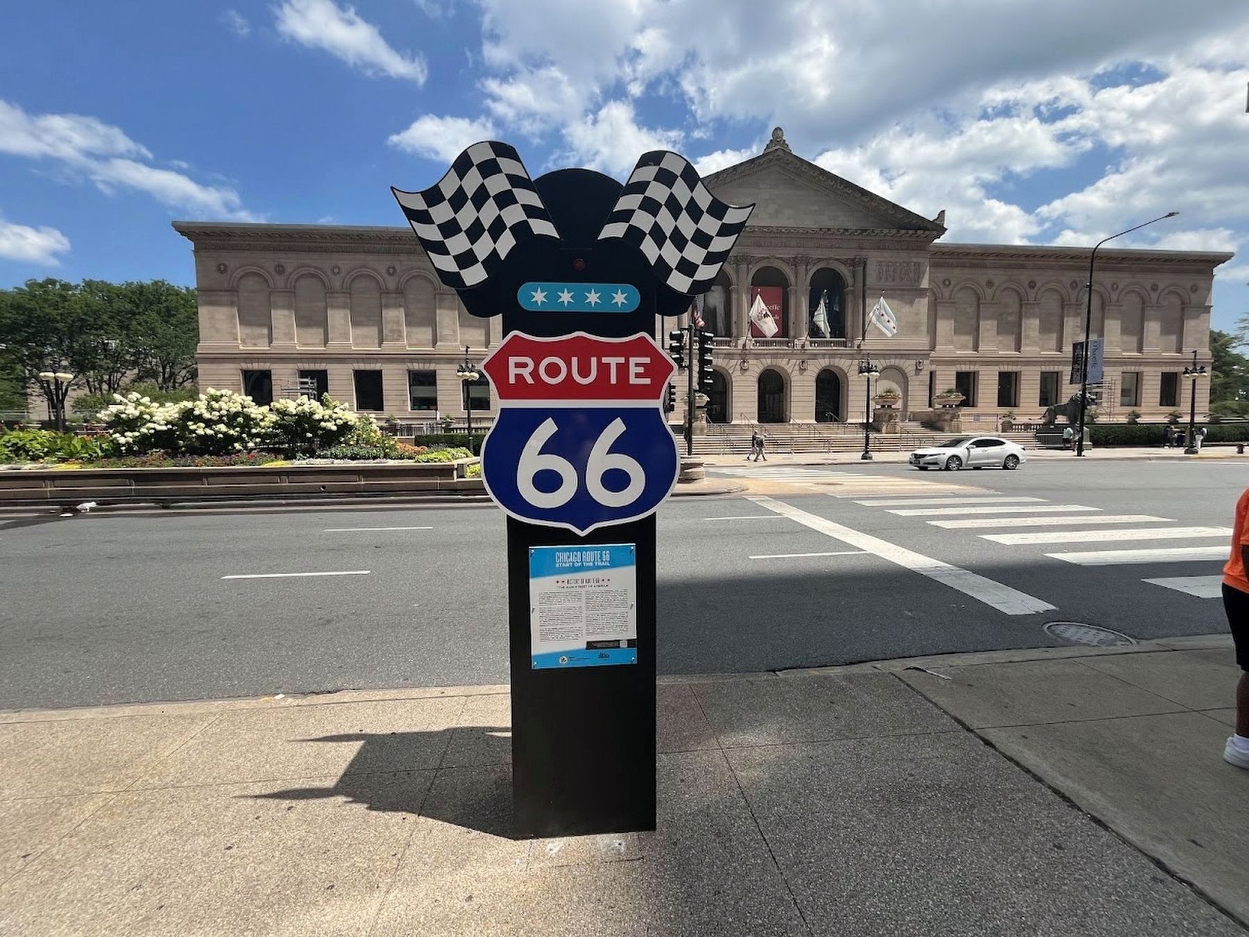
3. Chicago Route 66 Marker and the Art Institute of Chicago
El desarrollo del sistema de carreteras interestatales, resultado de un proyecto de ley firmado por el presidente Dwight D. Eisenhower, provocó el desmantelamiento de la Ruta 66 y la desaparición de muchos de los negocios de Ogden Avenue en Chicago. A los conductores se les ofreció un rumbo más rápido hacia los suburbios del suroeste y el centro de Illinois. En la década de 1960, comenzó la construcción de la Interestatal 55, y en 1977 se quitaron las señales de "Fin de la Ruta 66” en Jackson Boulevard. Algunos restaurantes y talleres de reparación que quedan a lo largo de Ogden Avenue todavía exhiben recuerdos de la Ruta 66, lo que garantiza que sus años como parte de la carretera más idealizada de Estados Unidos nunca se olviden.
Erected 2024 by Illinois Department of Commerce & Economic Opportunity; Choose Chicago.
Topics and series. This historical marker is listed in these topic lists: Industry & Commerce • Railroads & Streetcars • Roads & Vehicles • Waterways & Vessels. In addition, it is included in the Former U.S. Presidents: #34 Dwight D. Eisenhower, and the U.S. Route 66 series lists. A significant historical year for this entry is 1926.
Location. 41° 52.783′ N,
Photographed by Sean Flynn, July 17, 2024
4. Historic Route 66 sign
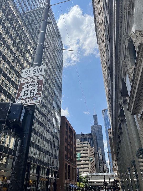
This brown sign marks the beginning of Route 66; it replaced another sign across the street that had been covered over with stickers. The Willis Tower is in the background.

Regionally, this marker is in Chicago’s Loop. It is also in the American Midwest. Globally, it is in North America, on the Great Lakes, in the Western Hemisphere, in the Western World, and in the Anglosphere. Historically, it finds itself in what was once the Viceroyalty of New France, the territory of the Mississippian Culture, and the Northwest Territory.
Other nearby markers. At least 8 other markers are within walking distance of this marker: Historic Michigan Boulevard (within shouting distance of this marker); a different marker also named Historic Michigan Boulevard (about 300 feet away, measured in a direct line); a different marker also named Historic Michigan Boulevard (about 300 feet away); Paul Hardwick (about 400 feet away); a different marker also named Historic Michigan Boulevard (about 600 feet away); Diane Simpson: “Good for Future” (about 700 feet away); Carson Pirie Scott & Company Building (about 700 feet away); Jewelers Row

Photographed by Sean Flynn, July 17, 2024
5. Chicago Route 66 / Ruta 66 De Chicago Marker
This photo shows the Spanish-language side of the sign, with Michigan Avenue going southward and the Art Institute of Chicago across the street.
More about this marker. The marker is one of four unveiled in 2024 in coordination with NASCAR's second Grant Park 165 race, a street circuit through Grant Park in downtown Chicago on July 7, 2024. The other three are found along Ogden Avenue southwest of downtown. Although Route 66 is a U.S. highway, the marker's styling at the top actually is based on that used by the Interstate Highway System.
A brown sign denoting the beginning of Historic Route 66 is on a nearby lamppost; it replaced a previous version of this sign that was on a different post and was famously covered in stickers.
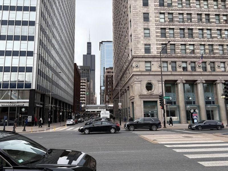
Regarding Chicago Route 66 / Ruta 66 de Chicago. The original eastern terminus of Route 66 was a block south of here, where Jackson Boulevard meets up with Michigan Avenue. However when that street was converted a one-way street, Route 66's easternmost point was moved up to Adams Street, which goes one-way towards the west.
Also see . . . Choose Chicago: The ultimate Route 66 Chicago itinerary. From Choose Chicago, a tourism bureau, a blog post about locations alongside Route 66 in and near downtown Chicago.
Excerpt: "Officially named Route 66 on April 30, 1926, Jackson Boulevard became part of the Mother Road and began whisking generations of migrants and road-tripping vacationers westward. In 1955, however, the boulevard was transformed into a one-way street, and Adams Street at(Submitted on July 17, 2024, by Sean P. Flynn of Oak Park, Illinois.)Michigan Avenue became the new launching point for Route 66."Photographed by Sean P. Flynn, December 12, 20246. Chicago Route 66 Marker from across Michigan Avenue
Credits. This page was last revised on March 24, 2025. It was originally submitted on July 17, 2024, by Sean P. Flynn of Oak Park, Illinois. This page has been viewed 507 times since then and 101 times this year. Photos: 1, 2, 3, 4, 5. submitted on July 17, 2024, by Sean P. Flynn of Oak Park, Illinois. 6. submitted on December 13, 2024, by Sean P. Flynn of Oak Park, Illinois.
