Block Island in New Shoreham in Washington County, Rhode Island — The American Northeast (New England)
Harbor Bay and Harbor Pond
1707
| — | Block Island Historical Society | — |

Three piers destroyed by
hurricanes
Nathaniel Dodge
First Harbor Master, 1715
Site of Bridge Gate to
Corne Neck 1676
500 feet south
Erected by Block Island Historical Society.
Topics. This historical marker is listed in these topic lists: Bridges & Viaducts • Colonial Era • Disasters • Waterways & Vessels. A significant historical year for this entry is 1715.
Location. 41° 10.583′ N, 71° 33.772′ W. Marker is in New Shoreham, Rhode Island, in Washington County. It is on Block Island. It is on Corn Neck Road 0.2 miles north of Ocean Avenue, on the left when traveling north. Touch for map. Marker is at or near this postal address: 600 Corn Neck Rd, Block Island RI 02807, United States of America. Touch for directions.

Regionally, this marker is on Narragansett Bay and in South County. It is also in the American Northeast, in New England, and on the Eastern Seaboard. Globally, it is in the North Atlantic Region, North America, the Western Hemisphere, the Western World, and the Anglosphere. Historically, it finds itself in what was once one of the original
this page online
Other nearby markers. At least 8 other markers are within walking distance of this marker: Trustrum Dodge (about 300 feet away, measured in a direct line); Block Island Historical Society (approx. 0.2 miles away); World War I Memorial (approx. 0.2 miles away); Life Saving Cart (approx. 0.2 miles away); Double Ender (approx. 0.2 miles away); New Shoreham (approx. ¼ mile away); Old Mill and Garrison Stone House (approx. 0.3 miles away); Transfer of Block Island (approx. 0.3 miles away). Touch for a list and map of all markers in New Shoreham.

Photographed by Devry Becker Jones (CC0), July 11, 2024
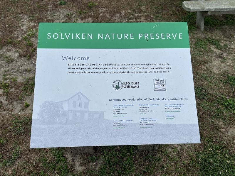
3. Nearby signage for Solviken Nature Preserve
Welcome
This site is one of many beautiful places on Block Island protected through the efforts and generosity of the people and friends of Block Island. Your local conservation groups thank you and invite you to spend some time enjoying the salt ponds, the land, and the ocean.
This site is one of many beautiful places on Block Island protected through the efforts and generosity of the people and friends of Block Island. Your local conservation groups thank you and invite you to spend some time enjoying the salt ponds, the land, and the ocean.
Credits. This page was last revised on July 17, 2024. It was originally submitted on July 17, 2024, by Devry Becker Jones of Washington, District of Columbia. This page has been viewed 185 times since then and 14 times this year. Photos: 1, 2, 3. submitted on July 17, 2024, by Devry Becker Jones of Washington, District of Columbia.
