Franklin Park in Cook County, Illinois — The American Midwest (Great Lakes)
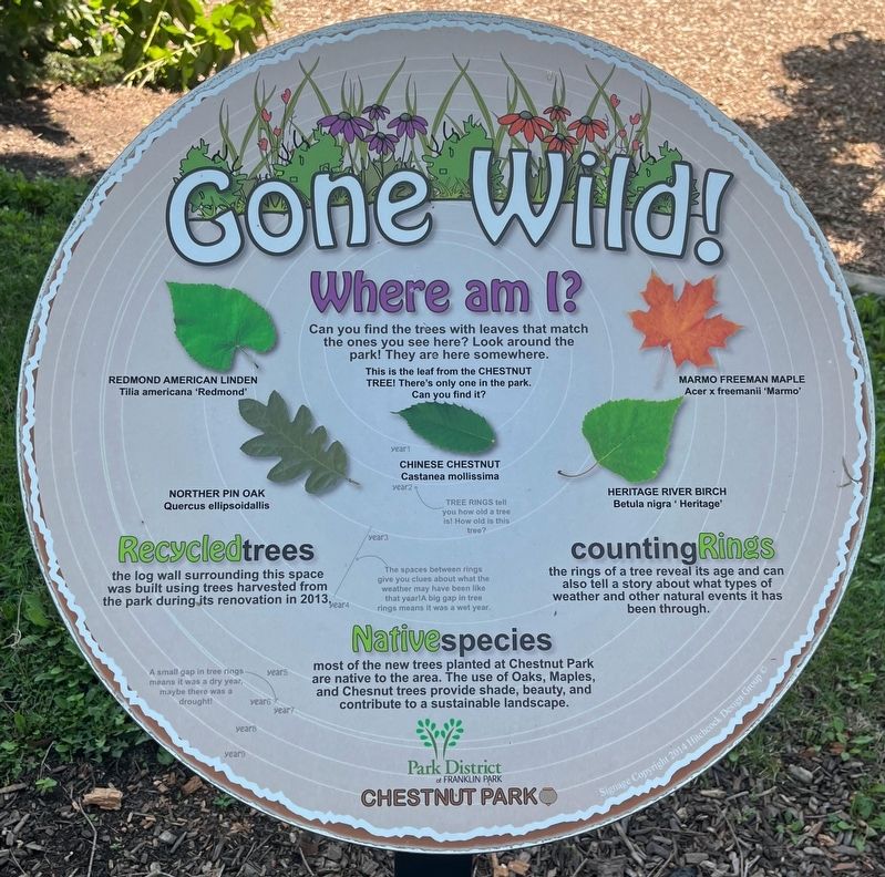
Gone Wild!
Where Am I?
Photographed by Sean Flynn, July 17, 2024
1. Gone Wild! Marker
Can you find the trees with leaves that match the ones you see here? Look around the park! They are here somewhere.
Recycled Trees
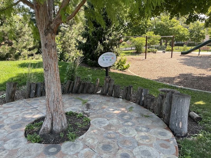
The log wall surrounding this space was built using trees harvested from the park during its renovation in 2013.
Native Species
Most of the new trees planted at Chestnut Park are native to the area. The use of Oaks, Maples, and Chesnut trees provide shade, beauty, and contribute to a sustainable landscape.
Counting Rings
The rings of a tree reveal its age and can also tell a story about what types of weather and other natural events it has been through.
Erected 2014 by Park District of Franklin Park.
Topics. This historical marker is listed in these topic lists: Environment • Horticulture & Forestry • Parks & Recreational Areas. A significant historical year for this entry is 2013.
Location. 41° 55.856′ N, 87° 52.678′ W. Marker is in Franklin Park, Illinois, in Cook County. It can be reached from Chestnut Avenue east of Sarah Street, on the right when traveling east. The marker is on the eastern side of Chestnut Park, near the playground. Touch for map. Marker is at
this page online

Regionally, this marker is in Greater Chicago. It is also in the American Midwest. Globally, it is in North America, on the Great Lakes, in the Western Hemisphere, in the Western World, and in the Anglosphere. Historically, it finds itself in what was once the Viceroyalty of New France, the territory of the Mississippian Culture, and the Northwest Territory.
Other nearby markers. At least 8 other markers are within walking distance of this marker: Connections! (a few steps from this marker); Music Evolution! (within shouting distance of this marker); Leyden Township Veterans Memorial (approx. half a mile away); Gouin Park (approx. 0.6 miles away); M42A1 Dusters (approx. 0.6 miles away); B-12 Tower (approx. 0.6 miles away); Veterans Memorial (approx. 0.8 miles away); Joe Thomas, Sr. Park (approx. one mile away). Touch for a list and map of all markers in Franklin Park.
Regarding Gone Wild!. The marker is one of five educational markers erected around Chestnut Park, a small park a block north of
Photographed by Sean Flynn, July 17, 2024
2. Gone Wild! Marker

Photographed by Sean Flynn, July 17, 2024
3. Chestnut Park
The marker about music is on the left, a marker about railroads is near the middle, and this marker about trees is on the far right. Two other markers about art and physical fitness are off camera to the rear.

Photographed by Sean Flynn
4. Chestnut Park Map
This "map" of Chestnut Park shows the five educational markers found on the pathway around the park.
Credits. This page was last revised on July 18, 2024. It was originally submitted on July 18, 2024, by Sean P. Flynn of Oak Park, Illinois. This page has been viewed 99 times since then and 17 times this year. Photos: 1, 2, 3, 4. submitted on July 18, 2024, by Sean P. Flynn of Oak Park, Illinois.
