Barrington in Bristol County, Rhode Island — The American Northeast (New England)
Barrington
| — | Rhode Island Slave History | — |
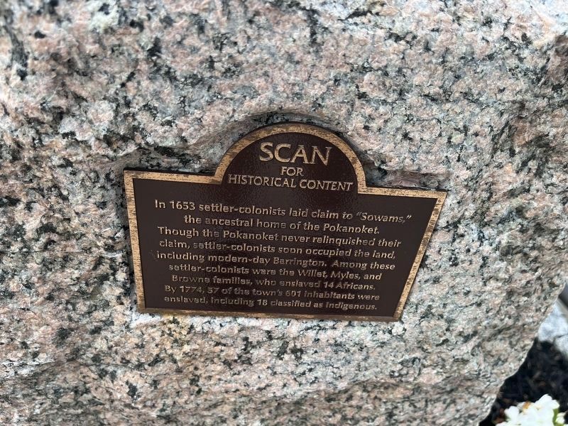
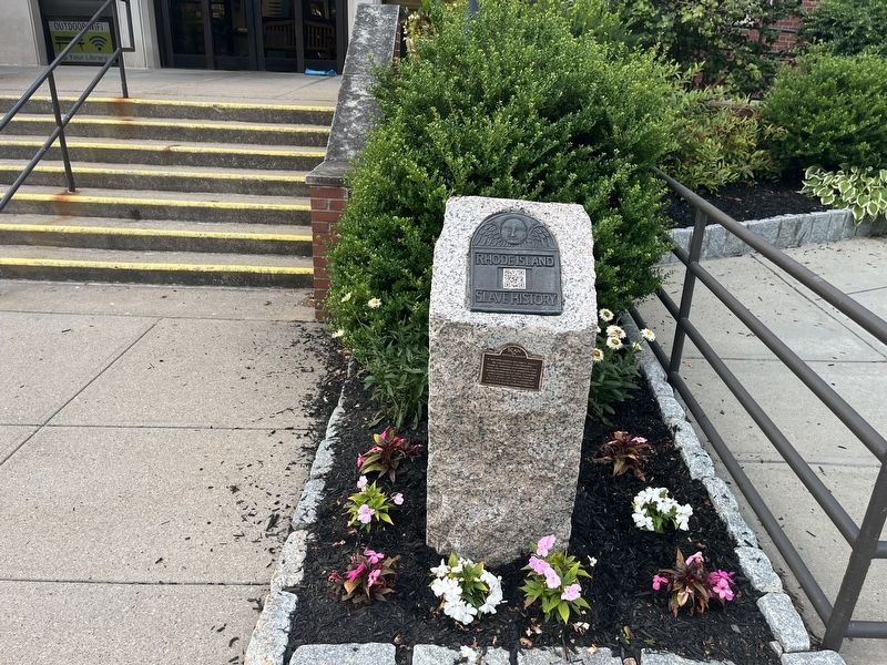
Erected by Rhode Island Slave History Medallions.
Topics. This historical marker is listed in these topic lists: Colonial Era • Indigenous Peoples and Communities • Settlements & Settlers. A significant historical year for this entry is 1653.
Location. 41° 44.435′ N, 71° 18.435′ W. Marker is in Barrington, Rhode Island, in Bristol County. It can be reached from Town Hall Drive north of County Road (Rhode Island Route 103), on the right when traveling north. Touch for map. Marker is at or near this postal address: 281 County Rd, Barrington RI 02806, United States of America. Touch for directions.

Regionally, this marker is in Greater Providence and on Narragansett Bay. It is also in the American Northeast,
this page online
Other nearby markers. At least 8 other markers are within walking distance of this marker: Civic Center Historic District (a few steps from this marker); Veterans Monument (within shouting distance of this marker); World War I Memorial (within shouting distance of this marker); Soldiers and Sailors Monument (about 700 feet away, measured in a direct line); Barrington Center (approx. 0.3 miles away); Police Cove (approx. 0.6 miles away); World War II Memorial (approx. 0.6 miles away); Brickyard Pond (approx. 0.7 miles away). Touch for a list and map of all markers in Barrington.
Related marker. Click here for another marker that is related to this marker. An identical marker can be found in Newport.
Credits. This page was last revised on July 18, 2024. It was originally submitted on July 18, 2024, by Devry Becker Jones of Washington, District of Columbia. This page has been viewed 334 times since then and 38 times this year. Photos: 1, 2. submitted on July 18, 2024, by Devry Becker Jones of Washington, District of Columbia.
