Barrington in Bristol County, Rhode Island — The American Northeast (New England)
Brickyard Pond
A Flooded Clay Pit
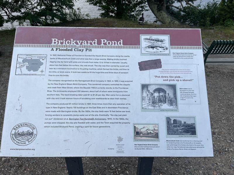
In 1847, Nathaniel Potter of Providence founded the Nayett Brick Company along the nearby banks of Mouscochuck Creek and what was then a large swamp. Making bricks involved digging clay by hand with picks and shovels from holes 12 to 14 feet in diameter. Usually, about two feet below the surface, clay was struck. The clay was then carried by oxcart and later by a miniature locomotive to the sizing machine, which formed the bricks, and then to the kilns, or brick ovens. It took two weeks to fill the huge kilns and three days of constant fires to cure the bricks.
The company reorganized as the Narragansett Brick Company in 1864. In 1893, it was acquired by the New England Steam Brick Company. This combined company controlled the claypits and creek from West Street, where the Bayside YMCA currently stands, to the Providence River. The brickworks employed 200 laborers, about half of whom were immigrants from southern Italy. The back-breaking labor paid $1 to $1.25 per day. Men came home plastered with clay and it took women hours of scrubbing over washboard to clean their clothes.
The company produced 67 million bricks
this page online
[Captions:]
New England Steam Brick Company drying shads and giant kilns lined the railroad tracks near Brickyard Pond. Bricks were transported by train as well as by boat.
— Mary Suriani recalls that brick workers like her father, Guiseppe DeAngelis, were allowed little rest during the grueling ten-hour workday. When they became tired, they were told,
"Put down the pick… and pick up a shovel!"
Brick makers pose at the entrance to a kiln circa 1925. Giuseppe DeAngelis (mentioned above), third from left, immigrated to Barrington at age 15 to work in the brickyard.
New England Steam Brick Company kilns and other buildings stood just west of the Bayside YMCA. 1938 photo.
Mouscochuck Creek was performed into a mile-long canal for transporting bricks to the Providence River. On towpaths, oxen pulled barges full of bricks to the mouth of the canal. Once at the river, large, flat-bottomed boats called scows delivered the bricks to Providence, Warren, Bristol, and Newport.
Erected by Barrington

Topics. This historical marker is listed in these topic lists: Immigration • Industry & Commerce • Railroads & Streetcars • Waterways & Vessels. A significant historical year for this entry is 1847.
Location. 41° 44.248′ N, 71° 19.196′ W. Marker is in Barrington, Rhode Island, in Bristol County. It is on East Bay Bike Path west of Kirby Street, on the right when traveling west. Touch for map. Marker is at or near this postal address: 35 Kirby St, Barrington RI 02806, United States of America. Touch for directions.

Regionally, this marker is in Greater Providence and on Narragansett Bay. It is also in the American Northeast, in New England, and on the Eastern Seaboard. Globally, it is in the North Atlantic Region, North America, the Western Hemisphere, the Western World, and the Anglosphere. Historically, it finds itself in what was once one of the original Thirteen Colonies.
Other nearby markers. At least 8 other markers are within walking distance of this marker: World War II Memorial (about 800 feet away, measured in a direct line); Soldiers and Sailors Monument (approx. 0.6 miles away); World War I Memorial (approx. 0.7 miles away); Veterans Monument (approx. 0.7 miles away); Civic Center Historic District (approx. 0.7 miles away); Barrington (approx. 0.7 miles away); Little Echo (approx. ¾ mile away); Barrington Center (approx. 0.8 miles away). Touch for a list and map of all markers in Barrington.
Credits. This page was last revised on July 18, 2024. It was originally submitted on July 18, 2024, by Devry Becker Jones of Washington, District of Columbia. This page has been viewed 1,160 times since then and 230 times this year. Photos: 1, 2. submitted on July 18, 2024, by Devry Becker Jones of Washington, District of Columbia.
