Near Camp Verde in Yavapai County, Arizona — The American Mountains (Southwest)
Creating a Home
Photographed by James Hulse, June 19, 2024
1. Creating a Home Marker
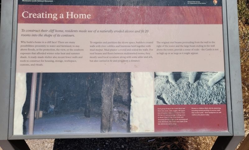
Why build a home in a cliff face? There are many possibilities: proximity to water and farmland, to stay above floods, or for protection, the view, or the southern exposure that afforded winter solar heat and summer shade. A ready-made shelter also meant fewer walls and roofs to construct for housing, storage, workspace, customs, and rituals.
To organize and partition the alcove space, builders created walls with river cobbles and limestone held together with mud mortar. Mud plaster covered and sealed the walls. For roof beams and floors between multistoried rooms, they mostly used local sycamore along with some alder and ash, but also carried in fir and pine from a distance.
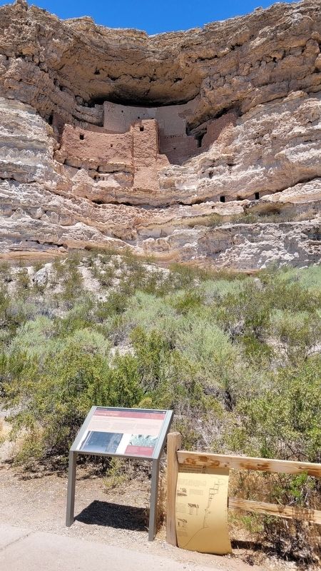
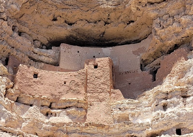
The original roof beams protruding from the wall to the right of the tower and the large beam ending in the wall above the tower, provide a sense of scale - the Castle is not as high up or as large as it might appear.
Captions
Each group living in the Castle likely had their own room, with roughly 140 square feet (13 sq m) or about 17.5 feet by 8 feet (5.3 m x 2.4 m) on average. Ceilings were at about 5 feet (1.5 m). Peep holes and doorways provided light in the morning and early afternoon, but rooms were dark in the late afternoon and evening.
Women or children likely did the plastering, including annual patching of exterior walls that eroded easily - their handprints are still visible in the plaster today.
Intermountain Museum Services
Erected by Montezuma
this page online
Topics. This historical marker is listed in these topic lists: Anthropology & Archaeology • Indigenous Peoples and Communities • Settlements & Settlers.
Location. 34° 36.723′ N, 111° 50.496′ W. Marker is near Camp Verde, Arizona, in Yavapai County. It is on Montezuma Castle Road one mile east of Beaver Creek Estates Road. The marker is located along the loop hiking trail at the Montezuma Castle National Monument. Touch for map. Marker is at or near this postal address: 2800 Montezuma Castle Rd, Camp Verde AZ 86322, United States of America. Touch for directions.

Regionally, this marker is in Verde Valley and in the Yavapai-Apache Nation. It is also in the American Southwest and in the Mountain West. Globally, it is in North America, the Western Hemisphere, the Western World, and the Anglosphere. Historically, it finds itself in what was once New Spain and also Mexico’s Alta California.
Other nearby markers. At least 8 other markers are within walking distance of this marker: Cycles of Care (here, next to this marker); Creekside Community
Photographed by James Hulse, June 19, 2024
2. The view of Montezuma Castle and the Creating a Home Marker
Other markers no longer nearby. The Community (was within shouting distance of this marker but has been permanently removed); The Way Up / Construction Sequence (was within shouting distance of this marker but has been permanently removed); Welcome to The Castle (was within shouting distance of this marker but has been permanently removed); The Neighborhood / Mysterious Departures (was about 300 feet away, measured in a direct line but has been permanently removed); The People Next Door (was about 300 feet away but has been permanently removed).
Also see . . . Montezuma Castle - History & Culture. National Park Service
On December 8, 1906, President Theodore Roosevelt celebrated the passage of the Antiquities Act by declaring four sites of historic and cultural significance as our nation's first National Monuments. Among these was Montezuma Castle, which the President identified as a place "of the greatest ethnological value and scientific interest." Although very few original artifacts remained in the structure due to intensive looting of the site, Roosevelt's decision assured the continued protection of one of the best preserved prehistoric cliff dwellings in North America.(Submitted on July 18, 2024, by James Hulse of Medina, Texas.)
Photographed by James Hulse, June 19, 2024
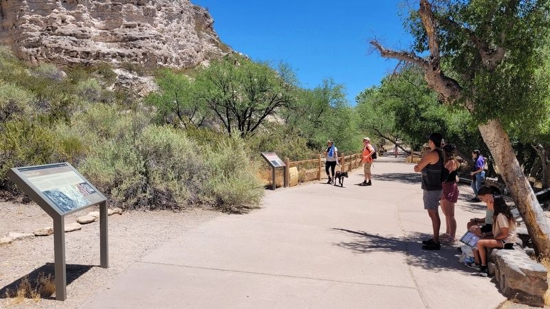
3. The view of the Creating a Home Marker along the trail (right side)
Photographed by James Hulse, June 19, 2024
4. Montezuma Castle
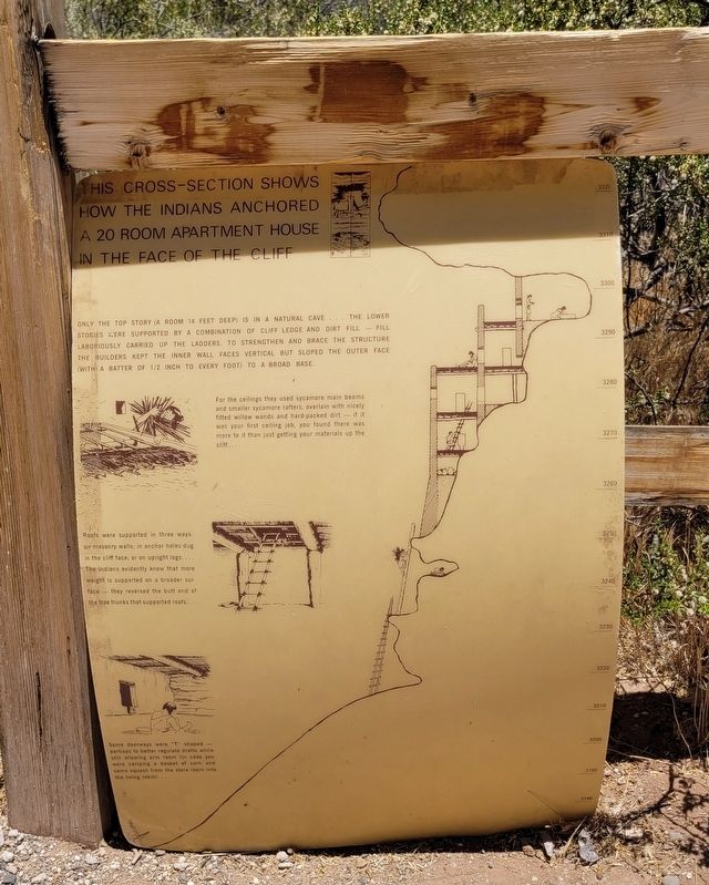
Photographed by James Hulse, June 19, 2024
5. Additional temporary marker of Cross Section of the Cliff Dwellings
Credits. This page was last revised on July 19, 2024. It was originally submitted on July 18, 2024, by James Hulse of Medina, Texas. This page has been viewed 178 times since then and 36 times this year. Photos: 1, 2, 3, 4, 5. submitted on July 19, 2024, by James Hulse of Medina, Texas.
