Marker Logo
THE HISTORICAL
MARKER DATABASE
“Bite-Size Bits of Local, National, and Global History”
Las Colinas in Irving in Dallas County, Texas — The American South (West South Central)
 

Bird's Fort Trail


Bird's Fort Trail Marker image. Click for full size.
Photographed by Morgan Petermann, July 18, 2024
1. Bird's Fort Trail Marker
Inscription. To protect lands of the Republic of Texas for settlement, General Edward H. Tarrant commissioned Maj. Jonathan Bird to build a fort near Caddo Village on the West Fork of the Trinity River. Maj. Bird and 36 volunteers left Fort Inglish, later Bonham, in October 1841, and built a fort some three miles north of modern Arlington. They cleared a wagon trail from the fort, which was the first Anglo settlement in Tarrant County, back to Fort Inglish. Both the trail and the fort were named for Maj. Bird, and shortly thereafter, some 20 families followed Bird's Fort Trail to the new settlement. The Beeman family from Illinois, which in 1842 resettled downriver at John Neely Bryan's village, later Dallas, was among this group. Sam Houston, President of the Republic, traversed Bird's Fort Trail via Grapevine Spring during August/September 1843 to negotiate with several Indian tribes. Subsequently, "a treaty of peace and friendship" was signed September 29, 1843, at Bird's Fort and became the best observed of all Indian treaties in Texas. Bird's Fort Trail followed this ridge, from which the Boy Scouts of America National
Paid Advertisement
Click or scan to see
this page online
Headquarters overlooks the Grapevine Prairie and modern Irving.
 
Erected 1990 by Irving Heritage Society and Boy Scouts of America.
 
Topics. This historical marker is listed in these topic lists: Indigenous Peoples and CommunitiesRoads & Vehicles. A significant historical year for this entry is 1841.
 
Location. 32° 53.127′ N, 96° 58.206′ W. Marker is in Irving, Texas, in Dallas County. It is in Las Colinas. It is at the intersection of West Walnut Hill Lane and High Point Drive on West Walnut Hill Lane. Touch for map. Marker is at or near this postal address: 1325 W Walnut Hill Ln, Irving TX 75038, United States of America. Touch for directions.

Regionally, this marker is in the Prairies & Lakes Region and in the Dallas-Fort Worth Metropolitan Area. Globally, it is in North America, a Gulf of Mexico state, the Western Hemisphere, the Western World, and the Anglosphere. Historically, it finds itself in what was once New Spain, the Republic of Texas, one of the Confederate States of America, and the Antebellum South.

Other nearby markers. At least 8 other markers are within 4 miles of this marker, measured as the
Bird's Fort Trail Marker image. Click for full size.
Photographed by Morgan Petermann, July 18, 2024
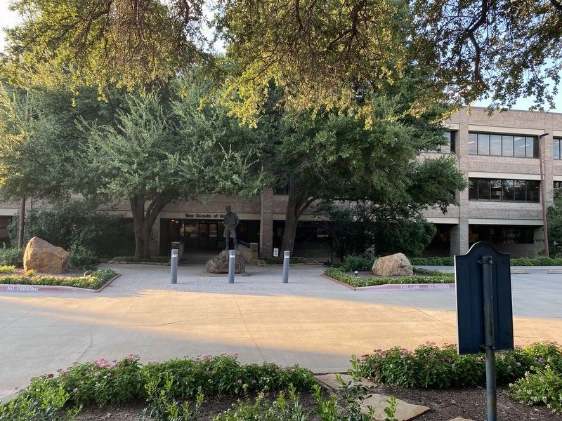
2. Bird's Fort Trail Marker
The marker looking across the parking lot at the Boy Scouts of America national headquarters.
crow flies: Hackberry Creek Ranch (approx. one mile away); Carpenter Tower (approx. 2.4 miles away); Elm Community (approx. 2½ miles away); California Crossing (approx. 2.8 miles away); Ben H. Carpenter: A Man and His Dream (approx. 2.9 miles away); Ben and Betty Carpenter: Partners in Life (approx. 2.9 miles away); Estelle Community (approx. 3 miles away); Ledbetter Farm Road (approx. 3½ miles away). Touch for a list and map of all markers in Irving.
 
 
Credits. This page was last revised on July 21, 2024. It was originally submitted on July 19, 2024, by Morgan Petermann of Hurst, Texas. This page has been viewed 494 times since then and 115 times this year. Photos:   1, 2. submitted on July 19, 2024, by Morgan Petermann of Hurst, Texas. • James Hulse was the editor who published this page.

m=251727

CeraNet Cloud Computing sponsors the Historical Marker Database.
This website earns income from purchases you make after using our links to Amazon.com. We appreciate your support.
Paid Advertisement
Jul. 25, 2026