Grayling Township in Crawford County, Michigan — The American Midwest (Great Lakes)
Glacial Landscape
| — | Forest Heritage Trail | — |
Photographed by Joel Seewald, July 1, 2024
1. Glacial Landscape Marker
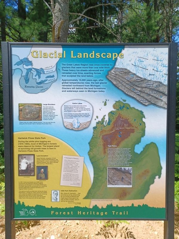
The Great Lakes Region was once covered by glaciers that were more than one mile thick. These heavy ice sheets advanced and retreated over time, exerting forces that sculpted the land below.
Approximately 10,000 years ago, after global temperatures rose, the last glacier retreated northward from Michigan. Glaciers left behind the land formations and waterways seen in Michigan today.
Large Boulders
You won't see any exposed bedrock in the area, as sediment deposited by the glaciers ranges from 250 to 800 feet thick. However, glaciers carried boulders to Michigan from as far away as northern Canada.
These rocks are called "glacial erratics." You can see this one along the Old Growth Trail in Hartwick Pines State Park.
Kettle Lakes
Blocks of ice occasionally broke off the receding glacier and were covered in glacial sediment — a mix of rocks and gravel. The depression left in the ground after the ice block melted is called a kettle.
Some of these low areas filled with water to form kettle lakes. Most Michigan inland lakes, such as nearby Higgins Lake, were created by this process.
High Plains
Grayling
this page online
Hartwick Pines State Park
During the white pine logging era (1870-1900), most of Michigan's forests were clearcut for timber. The largest stand of surviving old growth trees is here in Hartwick Pines State Park.
Land Donation
Karen Hartwick, daughter of local lumber magnate Nels Michelson, was searching for a way to memorialize her husband Edward, who died in Europe while serving in World War I.
In 1927, Karen purchased over 8,000 acres of land from the Salling & Hanson Logging Company and donated it to the State of Michigan. The deed required the construction of a memorial building dedicated to Edward Hartwick and a logging
Photographed by Joel Seewald, July 1, 2024
2. Glacial Landscape Marker
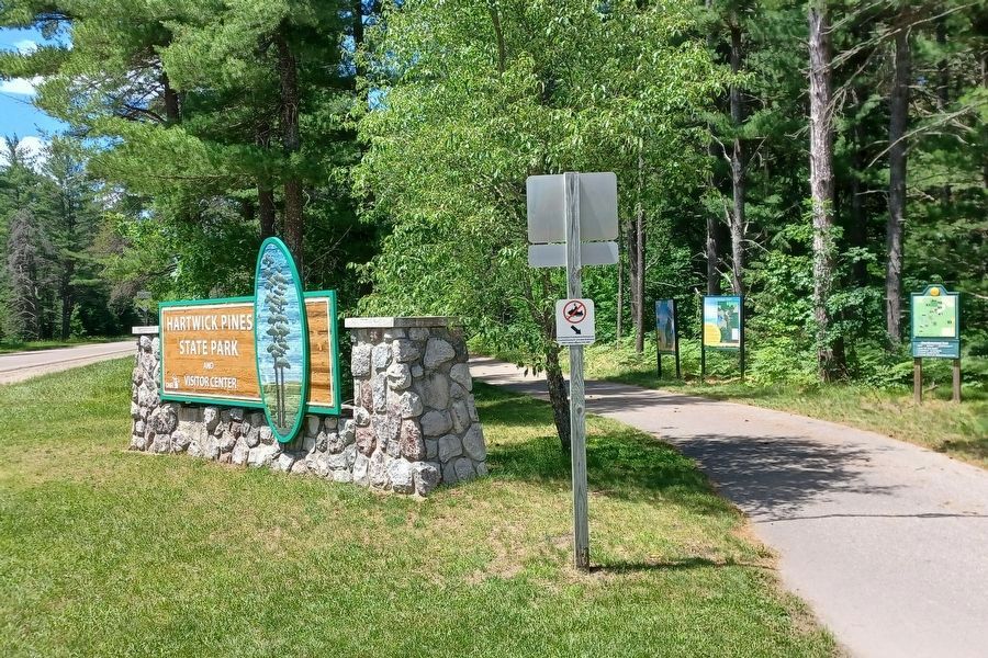
This marker is the leftmost of the three, in the shade.
This generous gift provided jobs during the Great Depression, a refuge for native plants and wildlife, and a place for people to experience the towering white pines that were cut down elsewhere. Eighty-five acres of this parcel were old growth trees. Forty-nine acres can still be seen today.
1935 Park Dedication
Mrs. Karen B. Hartwick . . . has enriched us all by preserving for us a thing of beauty that might easily have gone the way of other forests, were it not for her devotion.
Governor Frank D. Fitzgerald
July 19, 1935
A Surveyor's Memory
When I first came to Crawford County, I worked for the government on a survey. That was back in [18]69....I shall never forget ... those pines, tall, stately trees, eighty, ninety, a hundred, and a hundred and forty feet; as straight as a rifle barrel, and limbless to the top.
...As I think back now, it was a magnificent sight. The Hartwick Pines were too small to be cut when compared with what was standing. I like to see the efforts at reforestation, but it will take a long, long time.
John J. Higgins
government surveyor
Erected 2023 by Michigan History Center & Michigan Department of Natural Resources.
Topics. This historical marker is listed in these topic lists: Environment • Parks & Recreational Areas. A significant historical date for this entry is July 19, 1935.
Location. 44° 44.131′ N, 84° 40.209′ W. Marker is near Grayling, Michigan, in Crawford County. It is in Grayling Township. It is at the intersection of State Park Drive and Hartwick Pines Road (State Highway 93), on the left when traveling north on State Park Drive. Marker is at the entrance to Hartwick Pines State Park, alongside the Grayling Bicycle Turnpike, a hiking/biking path next to the highway. Touch for map. Marker is at or near this postal address: 3612 State Park Drive, Grayling MI 49738, United States of America. Touch for directions.

Regionally, this marker is in Northern Michigan Lower Peninsula. It is also in the American Midwest. Globally, it is in North America, the Great North Woods, the Western Hemisphere, the Western World, and the Anglosphere. Historically, it finds itself in what was once the Northwest Territory.
Other nearby markers. At least 8 other markers are within 5 miles of this marker, measured as the crow flies: Forest Heritage Trail (here, next to this marker); Hartwick Pines State Park (approx. half a mile away); Major Edward E. Hartwick (approx. half a mile away); Local Wildlife (approx. one mile away); Volunteers Matter (approx. 2.3 miles away); Forest Caretakers (approx. 2.3 miles away); Camp Grayling (approx. 4.7 miles away); Michigan Grayling (approx. 4.8 miles away). Touch for a list and map of all markers in Grayling.
Credits. This page was last revised on July 16, 2025. It was originally submitted on July 19, 2024, by Joel Seewald of Madison Heights, Michigan. This page has been viewed 231 times since then and 25 times this year. Photos: 1, 2. submitted on July 19, 2024, by Joel Seewald of Madison Heights, Michigan.
