
Near Highland in Doniphan County, Kansas — The American Midwest (Upper Plains)
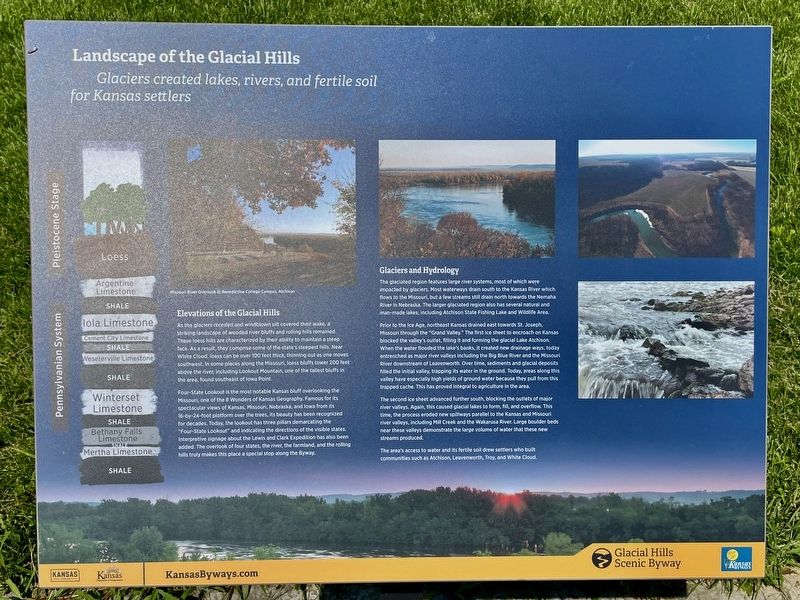
Landscape of the Glacial Hills
Glaciers created lakes, rivers, and fertile soil for Kansas settlers
| — | Glacial Hills Scenic Byway | — |
Photographed by Mark Hilton, July 11, 2024
1. Landscape of the Glacial Hills Marker
Elevations of the Glacial Hills
As the glaciers receded and windblown silt covered their wake, a striking landscape of wooded river bluffs and rolling hills remained. These loess hills are characterized by their ability to maintain a steep face As a result, they comprise some of the state's steepest hills. Near White Cloud, loess can be over 100 feet thick, thinning out as one moves southwest, In some places along the Missouri, loess bluffs tower 200 feet above the river, including Lookout Mountain, one of the tallest bluffs in the area, found southeast of Iowa Point.
Four-State Lookout is the most notable Kansas bluff overlooking the Missouri, one of the 8 Wonders of Kansas Geography. Famous for its spectacular views of Kansas, Missouri, Nebraska, and Iowa from its 16-by-24-foot platform over the trees, its beauty has been recognized for decades. Today, the lookout has three pillars demarcating the "Four-State Lookout" and indicating the directions of the visible states. Interpretive signage about the Lewis and Clark Expedition has also been added. The overlook of four states, the river, the farmland, and the rolling
this page online
Glaciers and Hydrology
The glaciated region features large river systems, most of which were impacted by glaciers. Most waterways drain south to the Kansas River which flows to the Missouri, but a few streams still drain north towards the Nemaha River in Nebraska The larger glaciated region also has several natural and man made lakes including Atchison State Fishing Lake and Wildlife Area.
Prior to the Ice Age, northeast Kansas drained east towards St. Joseph, Missouri through the "Grand Valley." The first ice sheet to encroach on Kansas blocked the valley's outlet, filling it and forming the glacial Lake Atchison. When the water flooded the lake's banks, it created new drainage ways, today entrenched as major river valleys including the Big Blue River and the Missouri River downstream of Leavenworth. Over time, sediments and glacial deposits filled the initial valley, trapping its water in the ground. Today, areas along this valley have especially high yields of ground water because they pull from this trapped cache. This has proved integral to agriculture in the
Photographed by Mark Hilton, July 11, 2024
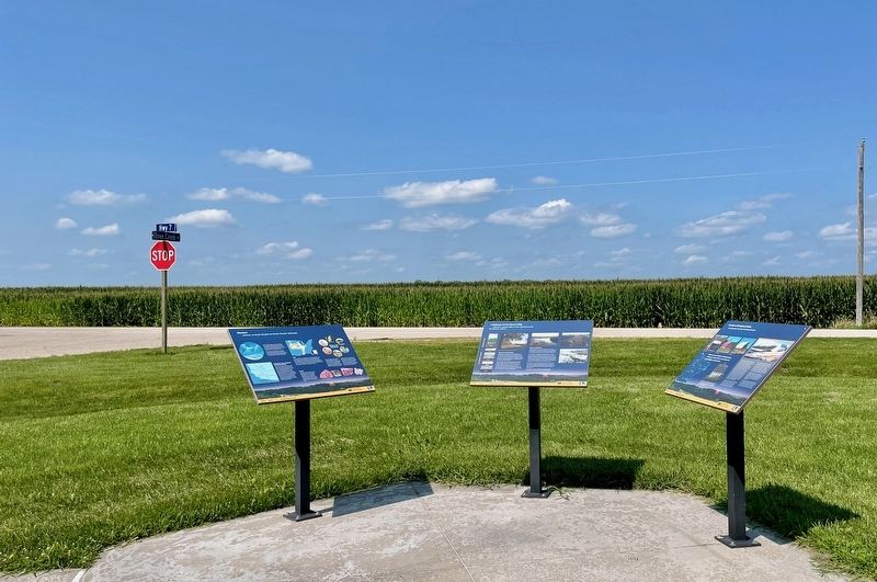
2. Landscape of the Glacial Hills Marker (middle of three).
Kansas Highway 7 in background.
The second ice sheet advanced further south, blocking the outlets of major river valleys. Again, this caused glacial lakes to form, fill, and overflow. This time, the process eroded new spillways parallel to the Kansas and Missouri river valleys, including Mill Creek and the Wakarusa River. Large boulder beds near these valleys demonstrate the large volume of water that these new streams produced.
The area's access to water and its fertile soil drew settlers who built communities such as Atchison, Leavenworth, Troy, and White Cloud.
Erected by Kansas Tourism, Kansas Department of Transportation.
Topics. This historical marker is listed in these topic lists: Environment • Waterways & Vessels.
Location. 39° 55.782′ N, 95° 14.286′ W. Marker is near Highland, Kansas, in Doniphan County. It is at the intersection of Dove Creek Road and State Route 7, on the right when traveling north on Dove Creek Road. Located at Iowa Point. Touch for map. Marker is in this post office area: Highland KS 66035, United States of America. Touch for directions.

Regionally, this marker is in Eastern Kansas. It is also in the American Midwest, in the Lewis & Clark Corridor, in the Corn Belt, on the prairies, and on the Southern Plains. Globally, it is in North America, the Western Hemisphere, the Western World, and the Anglosphere. Historically, it finds itself in what was once the Louisiana Purchase.
Other nearby markers. At least 8 other markers are within 5 miles of this marker, measured as the crow flies: The Barns of Doniphan County (here, next to this marker); Glaciers (here, next to this marker); Homeland of the Kanza Indians (approx. 4½ miles away); "the water…contains a half…Glass of ooze" (approx. 4½ miles away); The Lewis and Clark Expedition (approx. 4½ miles away); Glacial Hills Scenic Byway (approx. 4½ miles away); Wilbur Chapman (approx. 4½ miles away); July 10, 1804 (approx. 4½ miles away). Touch for a list and map of all markers in Highland.
Another marker is no longer nearby. "abounds with Beaver" (was approx. 3.2 miles away but has been confirmed missing).
Also see . . . Glacial Hills Scenic Byway – Kansas. (Submitted on July 23, 2024, by Mark Hilton of Montgomery, Alabama.)
Credits. This page was last revised on July 23, 2024. It was originally submitted on July 23, 2024, by Mark Hilton of Montgomery, Alabama. This page has been viewed 281 times since then and 28 times this year. Photos: 1, 2. submitted on July 23, 2024, by Mark Hilton of Montgomery, Alabama.
