Alta in Greenbrier County, West Virginia — The American South (Appalachia)
Fort Donnally
⎯⎯⎯
Border Heroes
Photographed by Forest McDermott, May 25, 2012
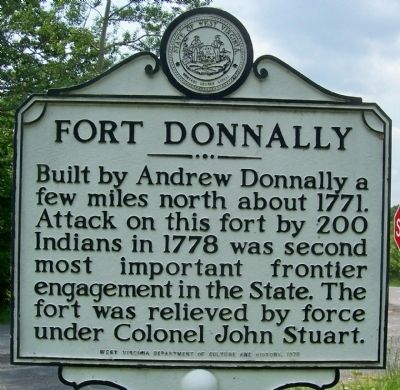
1. Fort Donnally Marker side
Fort Donnally. Built by Andrew Donnally a few miles north about 1771. Attack on this fort by 200 Indians in 1778 was second most important frontier engagement in the State. The fort was relieved by force under Colonel John Stuart.
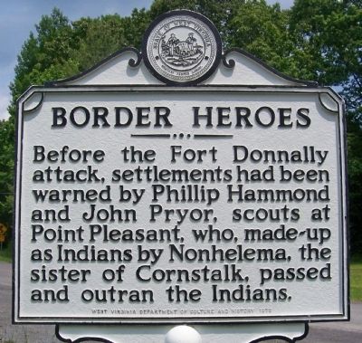
Border Heroes. Before the Fort Donnally attack, settlement had been warned by Phillip Hammond and John Pryor, scouts at Point Pleasant, who, made-up as Indians by Nonhelema, the sister of Cornstalk, passed and outran the Indians.
Erected 1978 by West Virginia Department of Culture and History.
Topics and series. This historical marker is listed in these topic lists: Forts and Castles • Indigenous Peoples and Communities • War, French and Indian • War, US Revolutionary. In addition, it is included in the West Virginia Archives and History series list. A significant historical year for this entry is 1771.
Location. Marker is missing. It was located near 37° 52.16′ N, 80° 32.587′ W. Marker was in Alta, West Virginia, in Greenbrier County. It was at the intersection of Midland Trail W (U.S. 60) and Old State 12/Alta Mountain Road (County Route 60/38) on Midland Trail W. Touch for map.
this page online

Regionally, this marker was in the Southern Coalfields. It was also in the American South, specifically in the Upper South, in Appalachia, and specifically in Southern Appalachia. Globally, it was in North America, the Western Hemisphere, the Western World, and the Anglosphere. Historically, it found itself in what was once the territory of the Mississippian Culture.
Other nearby markers. At least 8 other markers are within 6 miles of this location, measured as the crow flies: Andrew & Charles Lewis March (here, next to this marker); Maxon Sand (approx. 1.6 miles away); a different marker also named Fort Donnally / Border Heroes (approx. 2.2 miles away); Unknown Soldiers / Gen. Lewis' Trace (approx. 3.9 miles away); Battle of Tuckwiller's Hill (approx. 5 miles away); Confederate Disenfranchisement (approx. 5 miles away); Sam Black Church (approx. 5.2 miles away); Greenbrier Ghost (approx. 5.4 miles away). Touch for a list and map of all markers in Alta.
Additional commentary.
1. sign missing
this sign is not at
Photographed by Forest McDermott, May 25, 2012
2. Border Heroes Marker side
— Submitted April 17, 2018, by Roger Miller of Pulaski, Virginia.
Photographed by Roger Miller, April 15, 2018
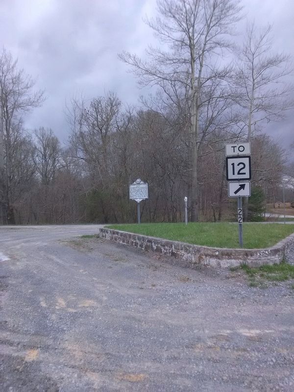
3. Missing Fort Donnally/Border Heroes Marker
It was on the empty post to the right of the Andres & Charles Lewis March marker that still stands.
Photographed by Forest McDermott, May 25, 2012
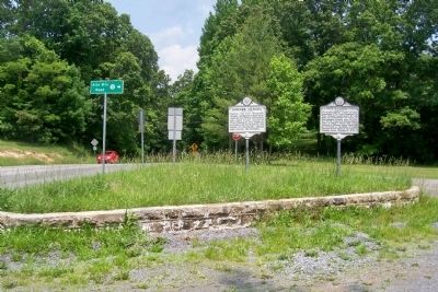
4. Fort Donnally/Border Heroes Marker
Looking east on U.S. Route 60
Credits. This page was last revised on July 24, 2024. It was originally submitted on May 30, 2012, by Forest McDermott of Masontown, Pennsylvania. This page has been viewed 2,725 times since then and 312 times this year. Last updated on July 23, 2024, by Dave W of Co, Colorado. Photos: 1, 2. submitted on May 30, 2012, by Forest McDermott of Masontown, Pennsylvania. 3. submitted on April 17, 2018, by Roger Miller of Pulaski, Virginia. 4. submitted on May 30, 2012, by Forest McDermott of Masontown, Pennsylvania. • Devry Becker Jones was the editor who published this page.
