Fort Plain in Montgomery County, New York — The American Northeast (Mid-Atlantic)
Canalway Trail: Fort Plain

Photographed by Steve Stoessel, July 27, 2024
1. Canalway Trail: Fort Plain Marker
Welcome to the Canalway Trail System, offering hundreds of miles of scenic trails and numerous parks for walking, cross-country skiing and other recreational activities. The Canalway Trail parallels the New York State Canal System, compromised of four historic waterways: the Erie, the Champlain, the Oswego, and the Cayuga-Seneca Canals. The Canal Systems spans 524 miles across New York State, linking the Hudson River with Lake Champlain, Lake Ontario, the Finger Lakes, the Niagara River and Lake Erie.
Cooperative initiatives between the New York State Canal Corporation, volunteers, local governments, and federal and state agencies have created this great network of trails for public use.
Enjoying the Canalway Trail: Safety Tips The Canalway Trail is intended to accommodate a variety of users. It is important to extend courtesy to all trail users and respect their rights. In order to avoid conflicts, trail protocol dictates that bicyclists should yield the right-of-way to all trail users. In addition, please observe the following tips for safe trail use: [Rules were not transcribed]
this page online
The area immediately around the locks has changed as well. The homes of the lockrenders and their families, sheds, barns, and the popular canal stores that existed near locks, have been replaced with power houses, lock operator control stands and the blue and yellow electric cabinets.
During construction of the Erie Barge Canal in the early 20th century, engineers designed moveable dams to control the flow of water in the river, which made navigation possible.
These dams hold back water in large ponds when the canal is open. In winter, the dam's panel are lifted out of the water so the river can resume its natural course.
View of Fort Plain from a hill, ca. 1900. (Notice the covered bridge on the

Photographed by Steve Stoessel, July 27, 2024
2. Canalway Trail: Fort Plain Marker
A bird's eye view of Fort Plain c.1879. Modernization came after 1908, when the canal was shifted into the Mohawk River. Although much of the canal route was abandoned and filled in at Ft. Plain, some portions near here are still visible.
Crossing Troubled Waters
When constructed and enlarged in the 19th century, the Erie Canal used a series of aqueducts, including one built in Fort Plain, to cross rivers, creeks, and ravines.
Impressive structures, often of stone, these aqueducts attracted the attention of numerous travelers and artists like Thomas Cole, who described them as the "castles of the United States" destined to "tell the tale of the enterprise and industry of the present generation."
Topics. This historical marker is listed in these topic lists: Parks & Recreational Areas • Waterways & Vessels. A significant historical year for this entry is 1900.
Location. 42° 55.975′ N, 74° 37.212′ W. Marker is in Fort Plain, New York, in Montgomery County. It is at the intersection of Empire State Trail and River Street (New York State Route 80), on the left when traveling west on Empire State Trail. Touch for map. Marker

Photographed by Steve Stoessel, July 27, 2024
3. Back Side of Marker

Regionally, this marker is in Upstate New York and in the Mohawk Valley. It is also in the American Northeast and in the Mid-Atlantic. Globally, it is in North America, the Western Hemisphere, the Western World, and the Anglosphere. Historically, it finds itself in what was once the Haudenosaunee (Iroquois) Confederacy, New Netherland, and one of the original Thirteen Colonies.
Other nearby markers. At least 8 other markers are within walking distance of this marker: Erie Canal in Fort Plain (here, next to this marker); Fort Plain Free Library (about 600 feet away, measured in a direct line); Canal Aqueduct (approx. 0.2 miles away); Diefendorf Hall (approx. ¼ mile away); Ta-Ra-Jo-Rees (approx. 0.4 miles away); Greene House (approx. 0.4 miles away); a different marker also named Canalway Trail: Fort Plain (approx. half a mile away); Fort Ehle (approx. 0.6 miles away). Touch for a list and map of all markers in Fort Plain.
Also see . . .
1. The Erie Canal (Wikipedia). (Submitted on July 27, 2024, by Steve Stoessel of Niskayuna, New York.)
2. Fort Plain (Wikipedia).

Photographed by Steve Stoessel, July 27, 2024
4. Canalway Trail: Fort Plain Marker
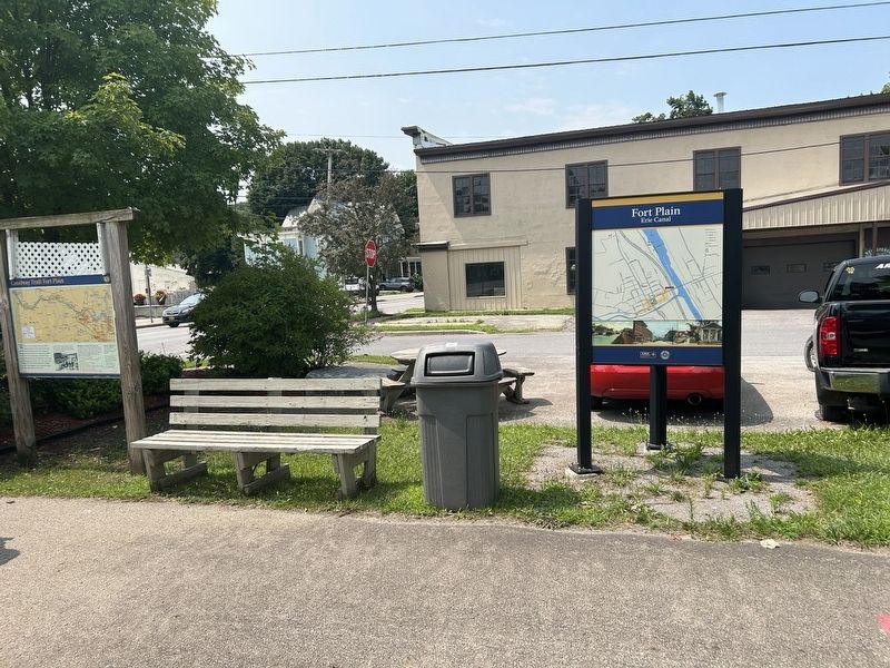
Photographed by Steve Stoessel, July 27, 2024
5. Canalway Trail: Fort Plain Marker

Photographed by Steve Stoessel, July 27, 2024
6. The Canalway Trail is now the Empire State Trail
Credits. This page was last revised on July 27, 2024. It was originally submitted on July 27, 2024, by Steve Stoessel of Niskayuna, New York. This page has been viewed 173 times since then and 20 times this year. Photos: 1, 2, 3, 4, 5, 6. submitted on July 27, 2024, by Steve Stoessel of Niskayuna, New York.
