
Canfield in Haldimand County, Ontario — Central Canada (North America)
The Underground Railroad
Black History of Canfield
Photographed by Bruce InCharlotte, July 4, 2024
1. The Underground Railroad - Black History of Canfield Marker
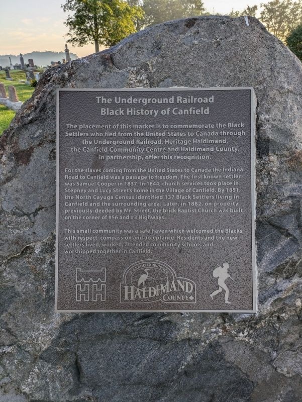
The placement of this marker is to commemorate the Black Settlers who fled from the United States to Canada through the Underground Railroad. Heritage Haldimand, the Canfield Community Centre and Haldimand County, in partnership, offer this recognition.
For the slaves coming from the United States to Canada, the Indiana Road to Canfield was a passage to freedom. The first known settler was Samuel Cooper in 1837. In 1844, church services took place in Stepney and Lucy Street's home in the Village of Canfield. By 1851, the North Cayuga Census identified 137 Black Settlers living in Canfield and the surrounding area. Later, in 1882, on property previously deeded by Mr. Street, the brick Baptist Church was built on the corner of #56 and #3 Highways.
This small community was a safe haven which welcomed the Blacks with respect, compassion and acceptance. Residents and the new settlers lived, worked, attended community schools and worshipped together in Canfield.
Erected by Haldimand County.
Topics. This historical marker is listed in these topic lists: Abolition & Underground RR • African Americans •
this page online
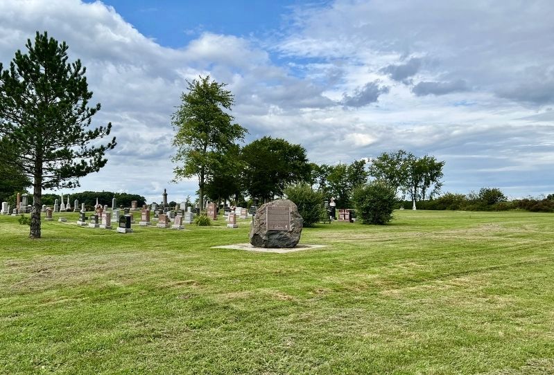
Location. 42° 58.635′ N, 79° 44.943′ W. Marker is in Canfield, Ontario, in Haldimand County. It is on Raglan Street, on the left when traveling south. The marker is in North Cayuga Canfield Park. Touch for map. Marker is in this post office area: Canfield ON N0A 1C0, Canada. Touch for directions.

Regionally, this marker is in the Southwest Ontario Area and in Southwestern Ontario. It is also in Central Canada. Globally, it is in North America, on the Great Lakes, in the Western Hemisphere, in the Western World, and in the Anglosphere. Historically, it finds itself in what was once a British colony, the Viceroyalty of New France, the Haudenosaunee (Iroquois) Confederacy, and Rupert’s Land.
Other nearby markers. At least 8 other markers are within 11 kilometers of this marker, measured as the crow flies: 9549 York Street (approx. 8.6 kilometers away); The Haldimand Grant (approx. 9.3 kilometers away); Judicial Complex, Haldimand County (approx. 9.3 kilometers away); Nicholas Log Cabin (approx. 9.3 kilometers away); Flour Mill Stones
Photographed by Tim Boyd, August 21, 2024
2. The Underground Railroad Marker
Credits. This page was last revised on August 22, 2024. It was originally submitted on July 28, 2024, by Bruce InCharlotte of Charlotte, North Carolina. This page has been viewed 413 times since then and 106 times this year. Photos: 1. submitted on July 28, 2024, by Bruce InCharlotte of Charlotte, North Carolina. 2. submitted on August 21, 2024, by Tim Boyd of Hamilton, Ontario. • Andrew Ruppenstein was the editor who published this page.
