Middletown in Frederick County, Maryland — The American Northeast (Mid-Atlantic)
Routzahn Farm

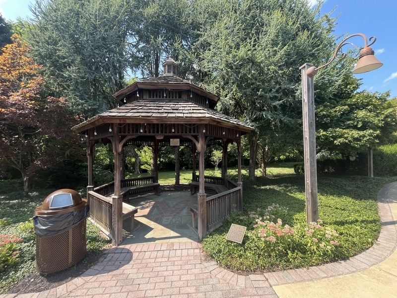
Once an open meadow this land was used as a Civil War encampment during the Battle of South Mountain. A source for water supply, and for the butchering of cattle, it is also where duel matches took place between enemies.
For four generations this land was part of the 133 acre Routzahn Farm, known as Woodmere. Two tracts called "the resurvey on Chevy Chase" and "the resurvey on Turkey Range" date back to 1866. Parces were sold off over time, including lots for 5 homes that the Routzahns built on East Main Street and the Middletown Middle School. This park is the last piece of the farm to be developed. The adjacent Cone Branch Estates was designed by John Thomas Routzahn prior to his death in 1999.
Topics. This historical marker is listed in these topic lists: Agriculture • Industry & Commerce • Settlements & Settlers • War, US Civil. A significant historical year for this entry is 1866.
Location. 39° 26.434′ N, 77° 32.035′ W. Marker is in Middletown, Maryland, in Frederick County. It is at the intersection of Cone Branch Drive and East Main Street (Alternate U.S. 40), on the left when traveling north on
this page online

Regionally, this marker is in the Washington Metropolitan Area and in Central Maryland. It is also in the American Mid-Atlantic. Globally, it is in North America, the Western Hemisphere, the Western World, and the Anglosphere. Historically, it finds itself in what was once one of the original Thirteen Colonies and also the Antebellum South.
Other nearby markers. At least 8 other markers are within walking distance of this marker: Woodmere (about 300 feet away, measured in a direct line); Charlie Keller (approx. 0.6 miles away); Tribute to All Veterans (approx. 0.6 miles away); World War II Memorial (approx. 0.6 miles away); World War I Memorial (approx. 0.6 miles away); Memorial Hall (approx. 0.6 miles away); a different marker also named Christ Reformed Church (approx. 0.6 miles away); a different marker also named World War I Memorial (approx. 0.6 miles away). Touch for a list and map of all markers in Middletown.
Another marker is no longer nearby. Christ Reformed Church (was
Credits. This page was last revised on July 29, 2024. It was originally submitted on July 29, 2024, by Devry Becker Jones of Washington, District of Columbia. This page has been viewed 419 times since then and 64 times this year. Photos: 1, 2. submitted on July 29, 2024, by Devry Becker Jones of Washington, District of Columbia.
