Mokane in Callaway County, Missouri — The American Midwest (Upper Plains)
Mokane to Tebbetts

Photographed by Duane and Tracy Marsteller, July 1, 2024
1. Mokane to Tebbetts Marker
Toward Mokane and beyond, Katy Trail State Park runs in the Missouri River floodplain under the bluffs, as far from the river as possible to avoid floods. The bluffs above the trail are composed of Jefferson City dolomite, a magnesium-rich limestone formed several hundred million years ago, when Missouri lay under shallow inland seas. In the fertile floodplain to the left of the trail are fields of corn and soybeans.
The Katy Trail crosses two large streams in the Mokane- Tebbetts segment: Middle River (milepost 128.7) via a 1926 steel through-truss bridge, and Hiller's Creek (milepost 130) via an 1897 pony-truss bridge. A through-truss bridge has added support at the top.
Tebbetts, founded in 1892 as a stop on the new line to St. Louis, reveals its railroad past in the
this page online
[Map captions]
• Milepost 125.3/Milepost 126.9/Milepost 126.8 The Katy Trail's railroad history is especially visible without plant cover. From left to right: The concrete base and battery box of an automatic block signal, a telegraph pole and a block indicator box remain from the Katy railroad era.
• Milepost 128.7 Longer through-truss bridges like the 180-foot span over the Middle River were strong designs; note the steel supports across the top.
• Milepost 130 This small pony-truss bridge over Hillers Creek was built of riveted steel, considered state of the art in 1897. The bridge's concrete abutments are original.
• Eastern cottontail rabbits like the “edge” habitat of the trail right-of-way, which provides cover next to more open areas where they feed. Missouri Department of Conservation photo by Jim Rathert.
• The 1919 county atlas shows the Katy Railroad occupied much of the central area of Tebbetts. Used by permission, State Historical Society of Missouri, Columbia
• Both common and beautiful, cardinals add color to any trip on the Katy
Photographed by Duane and Tracy Marsteller, July 1, 2024
2. Mokane to Tebbetts Marker
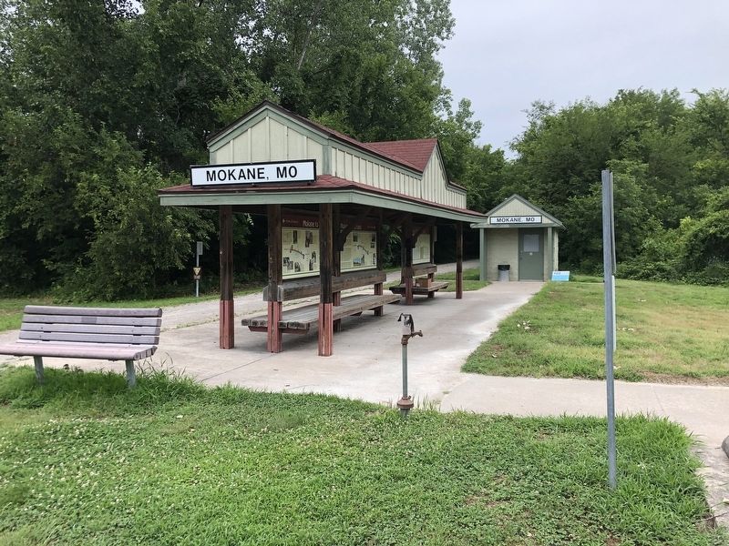
This marker is on the left of the trail shelter.
Topics and series. This historical marker is listed in these topic lists: Bridges & Viaducts • Environment • Parks & Recreational Areas • Railroads & Streetcars. In addition, it is included in the Katy Trail State Park series list. A significant historical year for this entry is 1892.
Location. 38° 40.484′ N, 91° 52.235′ W. Marker is in Mokane, Missouri, in Callaway County. It can be reached from Fulton Avenue (County Route C) 0.1 miles west of Missouri Route 94, on the right when traveling west. Touch for map. Marker is at or near this postal address: 101 Fulton Ave, Mokane MO 65059, United States of America. Touch for directions.

Regionally, this marker is in Little Dixie and in the Missouri River Corridor. It is also in the American Midwest, in the Lewis & Clark Corridor, and in the Corn Belt. Globally, it is in North America, the Western Hemisphere, the Western World, and the Anglosphere. Historically, it finds itself in what was once the territory of the Mississippian Culture, the Louisiana Purchase, and the Antebellum South.
Other nearby markers. At least 8 other markers are within 8 miles of this marker, measured as the crow flies: Mokane to Portland (here, next to this marker); Katy Railroad (here, next to this marker); History of Mokane (here, next to this marker); Mysteries of Standing Rock (a few steps from this marker); The Lewis and Clark Expedition Across Missouri (approx. 4½ miles away); Old Jail - 1930 (approx. 5.4 miles away); Fur Trading in Missouri (approx. 6.2 miles away); History of Tebbetts (approx. 7½ miles away). Touch for a list and map of all markers in Mokane.
Credits. This page was last revised on July 30, 2024. It was originally submitted on July 29, 2024, by Duane and Tracy Marsteller of Murfreesboro, Tennessee. This page has been viewed 154 times since then and 14 times this year. Photos: 1, 2. submitted on July 29, 2024, by Duane and Tracy Marsteller of Murfreesboro, Tennessee.
