Stroudsburg in Monroe County, Pennsylvania — The American Northeast (Mid-Atlantic)
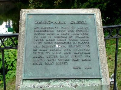
McMichaels Creek
September 20, 2005
1. McMichaels Creek Marker
Erected 1982.
Topics. This historical marker is listed in these topic lists: Colonial Era • Industry & Commerce • Natural Features. A significant historical year for this entry is 1753.
Location. 40° 59.144′ N, 75° 11.448′ W. Marker is in Stroudsburg, Pennsylvania, in Monroe County. It is on Ann Street near Broad Street (Pennsylvania Route 191), on the left when traveling west. Touch for map. Marker is at or near this postal address: 513 Ann St, Stroudsburg PA 18360, United States of America. Touch for directions.

Regionally, this marker is in the Pocono Mountains and in Greater Scranton and Wilkes-Barre. It is also in the American Northeast, in the Mid-Atlantic, in Appalachia, and specifically in Northern Appalachia. Globally, it is in North America, the Western
this page online
Other nearby markers. At least 8 other markers are within walking distance of this marker: Stroudsburg United Methodist Church World War II Memorial (within shouting distance of this marker); Fort Penn (about 700 feet away, measured in a direct line); J. J. Newberry Company Stores (about 700 feet away); Monroe County Vietnam Veterans Memorial (approx. 0.2 miles away); Monroe County "Boys in Blue" Honored Dead (approx. 0.2 miles away); Monroe County World War Memorial (approx. 0.2 miles away); 9/11 Memorial (approx. 0.2 miles away); Veterans Memorial (approx. 0.2 miles away). Touch for a list and map of all markers in Stroudsburg.
September 20, 2005
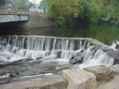
2. McMichaels Creek Dam
The Broad Street bridge is on the upper left.
Credits. This page was last revised on August 6, 2024. It was originally submitted on November 13, 2005, by J. J. Prats of Powell, Ohio. This page has been viewed 4,182 times since then and 92 times this year. Last updated on August 2, 2024, by Lori A Kuehn of East Stroudsburg, Pennsylvania. Photos: 1, 2. submitted on November 13, 2005. • Devry Becker Jones was the editor who published this page.
