Near Princeton in Bureau County, Illinois — The American Midwest (Great Lakes)
Illinois River Road
National Scenic Byway
Photographed by Duane and Tracy Marsteller, July 7, 2024
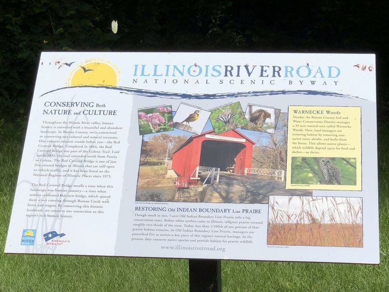
1. Illinois River Road Marker
Conserving Both Nature and Culture
Throughout the Illinois River valley, human history is entwined with a beautiful and abundant landscape. In Bureau County, we're committed to conserving our cultural and natural treasures. One cultural treasure stands before you – the Red Covered Bridge. Completed in 1864, the Red Covered Bridge was part of the Galena Trail. Laid out in 1833, the trail extended north from Peoria to Galena. The Red Covered Bridge is one of just five covered bridges in Illinois that are still open to vehicle traffic, and it has been listed on the National Register of Historic Places since 1975.
The Red Covered Bridge recalls a time when this landscape was frontier country – a time when settlers celebrated this new bridge, which spared them a wet crossing through Bureau Creek with horse and wagon. By conserving this historic landmark, we conserve our connection to this region's rich human history.
Restoring Old Indian Boundary Line Prairie
Though small in size, 7-acre Old Indian Boundary Line Prairie tells a big conservation story. Before white settlers came to Illinois, tallgrass
this page online
Warnecke Woods
Nearby, the Bureau County Soil and Water Conservation District manages a 33-acre natural area called Warnecke Woods. Here, land managers are restoring habitat by removing non-native trees, shrubs, and herbs from the forest. This allows native plants – which wildlife depend upon for food and shelter – to thrive.
Topics and series. This historical marker is listed in these topic lists: Bridges & Viaducts • Environment • Roads & Vehicles. In addition, it is included in the National Register of Historic Places (NRHP) series list. A significant historical year for this entry is 1864.
Location. 41° 24.961′ N, 89° 28.679′ W. Marker is near Princeton, Illinois, in Bureau County. It is on County Road 1950 East half a mile north of North Main Street (Illinois Route 26), on the right
Photographed by Duane and Tracy Marsteller, July 7, 2024
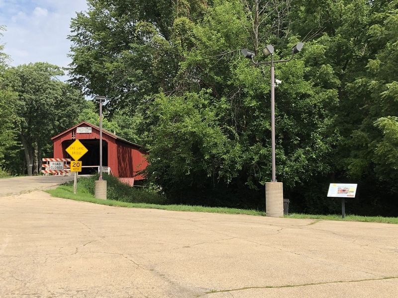
2. Illinois River Road Marker
The Red Covered Bridge is in the background.

Regionally, this marker is in Northern Illinois and specifically in the Illinois River Valley. It is also in the American Midwest and in the Corn Belt. Globally, it is in North America, the Western Hemisphere, the Western World, and the Anglosphere. Historically, it finds itself in what was once the territory of the Mississippian Culture and also the Northwest Territory.
Other nearby markers. At least 8 other markers are within 4 miles of this marker, measured as the crow flies: Enos and Elizabeth Mercer Matson / Peter and Jane Dawson Matson (approx. ¼ mile away); 1005 N. Main St. (approx. 2.3 miles away); 923 N. Main St. (approx. 2.3 miles away); 917 N. Main St. (approx. 2.3 miles away); 910 N. Main St. (approx. 2.3 miles away); In Commemoration of Virgil Fox (approx. 2.9 miles away); Flags of Freedom (approx. 2.9 miles away); 518 S. Main St. (approx. 3.3 miles away). Touch for a list and map of all markers in Princeton.
Also see . . . Red Covered Bridge (PDF). National
Photographed by Duane and Tracy Marsteller, July 7, 2024
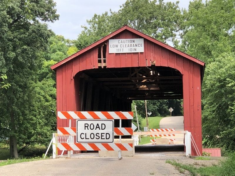
3. The Red Covered Bridge
The bridge has been closed to traffic since it was struck by a truck in November 2023.
Additional commentary.
1. Red Covered Bridge Closure
The bridge has been closed to traffic since November 16, 2023, when it was severely damaged by a semi truck that exceeded the bridge's height clearance. The driver was not cited but was subsequently fired by their employer. The Illinois Department of Transportation did temporary repairs to stabilize the bridge, but said it likely will be 2026 or beyond before the bridge is permanently repaired and reopened.
— Submitted August 4, 2024, by Duane and Tracy Marsteller of Murfreesboro, Tennessee.
Credits. This page was last revised on August 4, 2024. It was originally submitted on August 4, 2024, by Duane and Tracy Marsteller of Murfreesboro, Tennessee. This page has been viewed 198 times since then and 28 times this year. Photos: 1, 2, 3. submitted on August 4, 2024, by Duane and Tracy Marsteller of Murfreesboro, Tennessee.
