
Near San Antonio in Socorro County, New Mexico — The American Mountains (Southwest)
The Battle of Valverde

Photographed by James Hulse, July 23, 2024
1. The Battle of Valverde Marker
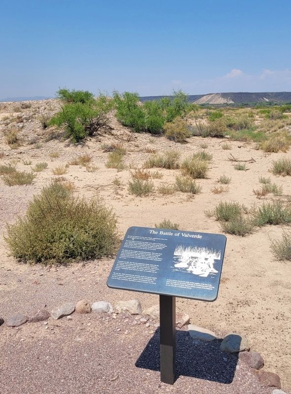
The main Battle of Valverde was fought in the winter on February 21, 1862. Colonel Edward Richard Sprigg Canby's Union troops and Colonel Henry Hopkins Sibley's Confederate forces fought in the arroyos and gullies of a dry riverbed below Valverde. Control of the battlefield constantly moved back and forth between the two forces.
The battle was also fraught with internal problems. Both sides found their regiments physically cut off from one another, and frequently unable to communicate with their leaders. For Union troops, the language barrier between the Anglo regulars and Hispanic New Mexico volunteers caused serious communication problems and a fundamental lack of trust.
Casualties ran high. The Valverde engagement finally ended with the Confederate forces holding the field, but at the end of a tumultuous day's fighting, the losses on both sides were comparable. Union forces reported around 68 soldiers killed, 160 wounded, and 25 missing or captured. Confederate forces reported 36 dead, 150
this page online
The next day, Sibley demanded the surrender of the fort and its supplies to the Confederates. Canby adamantly refused. The Confederates, who had lost so many of their wagons, supplies, and equipment that they could no longer contemplate launching an attack on the fort, were forced to press onward, leaving the badly needed supplies of the fort in the hands of Canby and his troops. Although the Confederates had "held the field," their objective failed. Modern military reviews of the battle do not call Valverde a Confederate victory.
Topics. This historical marker is listed in these topic lists: Forts and Castles • Hispanic Americans • War, US Civil. A significant historical date for this entry is February 21, 1862.
Location. 33° 38.168′ N, 107° 0.785′ W. Marker is near San Antonio, New Mexico, in Socorro County. It is on Fort Craig Road 4½ miles south of Old US Hwy 85 (New Mexico Highway 1). The marker is located at the Fort Craig Historic Site along the visitor trail. Touch for map. Marker is at or near this postal address: 457 Fort Craig Road, San Antonio NM 87832, United States of America. Touch for directions.

Regionally,
Photographed by James Hulse, July 23, 2024
2. The Battle of Valverde Marker
Other nearby markers. At least 8 other markers are within walking distance of this marker: Canby and Sibley at Fort Craig (here, next to this marker); Officers' Quarters (within shouting distance of this marker); Guard House and Sally Port (about 300 feet away, measured in a direct line); Parade Grounds and Enlisted Quarters About 1867 (about 300 feet away); The Buffalo Soldiers (about 400 feet away); Company Quarters (about 500 feet away); Commanding Officer's Quarters (about 500 feet away); The Establishment of Fort Craig (about 600 feet away). Touch for a list and map of all markers in San Antonio.
More about this marker. At Fort Craig Historic Site, an ADA accessible, self-guided interpretive trail is open seven days a week, from 8:00 a.m. to one-hour before sunset. The visitor’s center is open Thursday through Monday from

Photographed by James Hulse, July 23, 2024
3. The view of the Battle of Valverde Marker along the trail
Also see . . .
1. Fort Craig Historic Site. Bureau of Land Management website entry:
Fort Craig, established in 1854, was one of the largest and most important frontier forts in the West. Set in the rugged beauty of Socorro County, N.M., it was one of the eight forts situated along the primary north-south road in the Rio Grande Valley. Fort Craig played a crucial role in Indian campaigns and the Civil War.(Submitted on August 5, 2024, by James Hulse of Medina, Texas.)
2. Fort Craig, New Mexico and the Battle of Valverde. Bureau of Land management website entry:
During the Civil War, the fort was manned in large part by native New Mexicans. Its formidable earthen walls were armed with what was commonly referred to as “Quaker Cannons,” or logs that had been painted black to resemble artillery. Rather than attack the fort, under the cover of darkness, Confederate forces crossed to the opposite side of the Rio Grande, thereby circling around Fort Craig to the north. Now, instead of Fort Craig blocking the Confederacy’s way to Santa Fe, it was the Union contingent that found itself trapped behind enemy lines. Formerly content to wait safely behind his fortifications, Union Commander Colonel Edward Canby was now forced to fight.(Submitted on August 7, 2024, by James Hulse of Medina, Texas.)
Credits. This page was last revised on August 11, 2026. It was originally submitted on August 4, 2024, by James Hulse of Medina, Texas. This page has been viewed 285 times since then and 33 times this year. Photos: 1, 2, 3. submitted on August 7, 2024, by James Hulse of Medina, Texas.
