Near Manassas in Prince William County, Virginia — The American South (Mid-Atlantic)
Attack From Matthews Hill
Cannoneer's-Eye View
| — | First Battle of Manassas | — |

Photographed by Shane Oliver, September 26, 2015
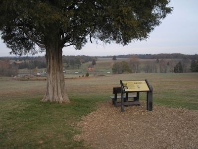
1. Attack From Matthews Hill Marker
Though the smoke and dust, Imboden's men could see outnumbered Confederate infantry starting to fall back from Matthews Hill. The cannoneers kept firing at top speed, knowing it would take massive reinforcements to stop the Yankees.
Retreating Confederates fled past Robinson House (the next tour stop) where Wade Hampton's South Carolinians made a desperate stand.
Topics. This historical marker is listed in this topic list: War, US Civil.
Location. This marker has been replaced by another marker nearby. It was located near 38° 48.975′ N, 77° 31.402′ W. Marker was near Manassas, Virginia, in Prince William County. It could be reached from Sudley Road (State Road 234) 0.3 miles south of Lee Highway (U.S. 29), on the right when traveling north. Touch for map. Marker was in this post office area:
this page online

Regionally, this marker was in the Washington Metropolitan Area, in Northern Virginia, and in the Piedmont. It was also in the American South, specifically in the Upper South, in the Mid-Atlantic, and on the Eastern Seaboard. Globally, it was in the North Atlantic Region, North America, the Western Hemisphere, the Western World, and the Anglosphere. Historically, it found itself in what was once the territory of the Mississippian Culture, one of the original Thirteen Colonies, one of the Confederate States of America, and the Antebellum South.
Other nearby markers. At least 8 other markers are within walking distance of this location: Flight from Matthews Hill (here, next to this marker); The Marines of '61 (about 400 feet away, measured in a direct line); Colonel Cameron (about 500 feet away); Judith Henry (about 500 feet away); a different marker also named Invaded Farmland (about 600 feet away); Wade Hampton (about 600 feet away); Honoring the Dead (about 600 feet away); 1st Battle of Bull Run Memorial (about 600 feet away). Touch for a list and map
Photographed by Bill Coughlin, November 8, 2007
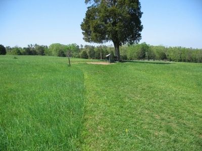
2. Marker on Manassas Battlefield
Other markers no longer nearby. Invaded Farmland (was about 500 feet away but has been replaced with another marker now near it); a different marker also named Honoring the Dead (was about 600 feet away but has been replaced with another marker now near it).
More about this marker. One the right side of the marker is a portrait of Capt. John Imboden. Above the portrait is a depiction of the view, with the Stone House indicated, along with a blue arrow showing the path of the Union attack.
This marker was replaced by a new one named Flight from Matthews Hill (see nearby markers).
Also see . . .
1. John Imboden. At First Manassas Captain Imboden commanded the Staunton Artillery armed with four Model 1841 6-pounder smoothbores. Later in the war, Imboden left the artillery to recruit a unit of partisans. Later promoted to Brigadier General, he fought in the Shenandoah Valley as a cavalry commander through much of the war, but was involved with the Gettysburg Campaign in 1863. (Submitted on June 8, 2008, by Craig Swain of Leesburg, Virginia.)
2. Supplemental Report of Captain John Imboden.
Photographed by Craig Swain, May 4, 2008
3. Cannoneer's Eye View Wayside
All my officers behaved throughout with heroic coolness and bravery, and the conduct of the men was that of veterans. (Submitted on December 31, 2008, by Craig Swain of Leesburg, Virginia.)
Photographed by Craig Swain, May 4, 2008
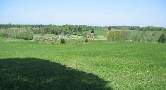
4. The Cannoneer's Eye View
From the bench next to the marker looking north. The Stone House stands at the intersection of Lee Highway (Old Warrenton Pike) and Sudley Road. Beyond the house is Matthews Ridge.
Credits. This page was last revised on August 6, 2024. It was originally submitted on June 8, 2008, by Craig Swain of Leesburg, Virginia. This page has been viewed 2,826 times since then and 41 times this year. Last updated on August 6, 2024, by Carl Gordon Moore Jr. of North East, Maryland. Photos: 1. submitted on October 2, 2015, by Shane Oliver of Richmond, Virginia. 2. submitted on November 25, 2010, by Bill Coughlin of Woodland Park, New Jersey. 3, 4. submitted on June 8, 2008, by Craig Swain of Leesburg, Virginia. • Bernard Fisher was the editor who published this page.
