Near Manassas in Prince William County, Virginia — The American South (Mid-Atlantic)
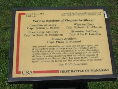
Various Sections of Virginia Artillery
| — | First Battle of Manassas | — |
Photographed by Craig Swain, May 4, 2008
1. Various Sections of Virginia Artillery Marker
Army of the Potomac (Beauregard) and Army of the Shenandoah (Johnston), CSA
Capt. Arthur L. Rogers
Wise Artillery
Capt. Ephraim G. Alburtis
Rockbridge Artillery
Capt. William N. Pendleton
Staunton Artillery
Capt. John D. Imboden
Thomas Artillery
Capt. Philip B. Stanard
"The ground occupied by our guns was an open space just at the eastern verge of the plateau. Here thirteen pieces, mostly 6-pounders, were maintained in action alternating to some extent with each other, and taking part as needed, all from the onset displaying that marvelous capacity of our people as artillerists which has made them, it would appear, at once the terror and the admiration of the enemy."
-Gen. P.G.T. Beauregard
Topics. This historical marker is listed in this topic list: War, US Civil. A significant historical date for this entry is July 21, 1861.
Location. 38° 48.9′ N, 77° 31.136′ W. Marker is near Manassas, Virginia, in Prince William County. It can be reached from Sudley Road (State Road 234) 0.7 miles south of Lee Highway (U.S. 29), on the right when traveling north. The marker on the Henry Hill trail, which starts at the
this page online

Regionally, this marker is in the Washington Metropolitan Area, in Northern Virginia, and in the Piedmont. It is also in the American South, specifically in the Upper South, in the Mid-Atlantic, and on the Eastern Seaboard. Globally, it is in the North Atlantic Region, North America, the Western Hemisphere, the Western World, and the Anglosphere. Historically, it finds itself in what was once the territory of the Mississippian Culture, one of the original Thirteen Colonies, one of the Confederate States of America, and the Antebellum South.
Other nearby markers. At least 8 other markers are within walking distance of this marker: Historic Farm Road Trace (here, next to this marker); Historic Road Trace (within shouting distance of this marker); Like a Stonewall (within shouting distance of this marker); "…Like a Stone Wall" (within shouting distance of this marker); Washington (Louisiana) Artillery Battalion (about 300 feet away,
Photographed by Bill Coughlin, April 20, 2023
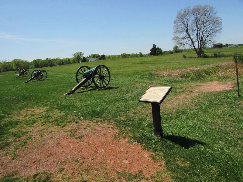
2. Various Sections of Virginia Artillery Marker
Photographed by Craig Swain
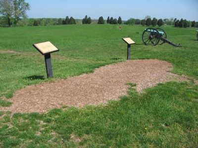
3. Markers Along Henry Hill Walking Trail
The marker for the historic farm road trace is on the left. On the right is a marker for sections of Virginia Artillery batteries.
Photographed by Craig Swain, May 6, 2007
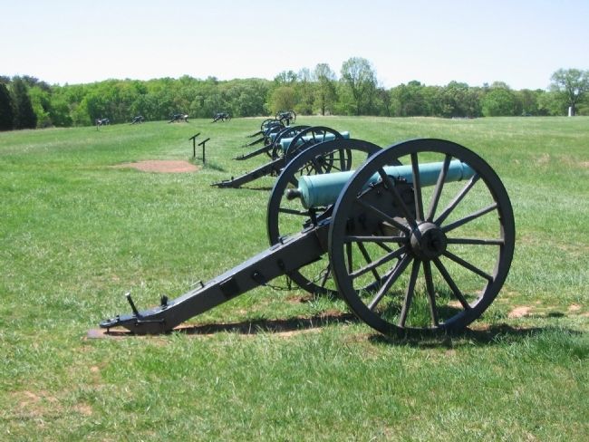
4. Six Pounder Field Guns
To represent the location of the batteries, an assortment of 6-pounder guns are arranged, facing the Federal lines. The Manassas Battlefield Park boasts examples of Models 1835 and 1841.

December 29, 2009
5. Cannon With Henry Hill House & Marker In Background
Credits. This page was last revised on August 7, 2024. It was originally submitted on June 11, 2008, by Craig Swain of Leesburg, Virginia. This page has been viewed 1,879 times since then and 37 times this year. Last updated on August 7, 2024, by Carl Gordon Moore Jr. of North East, Maryland. Photos: 1. submitted on June 11, 2008, by Craig Swain of Leesburg, Virginia. 2. submitted on April 29, 2023, by Bill Coughlin of Woodland Park, New Jersey. 3, 4. submitted on June 11, 2008, by Craig Swain of Leesburg, Virginia. 5. submitted on April 6, 2010. • Devry Becker Jones was the editor who published this page.
