Bedford-Stuyvesant in Brooklyn in Kings County, New York — The American Northeast (Mid-Atlantic)
Banneker Playground
1.67 acres
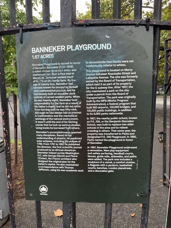
Banneker Playground is named in honor of Benjamin Banneker (1731-1806) a noted African-American writer and mathematician. Born a free man in Maryland, Banneker worked much of his life on the family farm. By the age of twenty-two, Banneker had become known for occupying himself with mathematical puzzles, and he had already built an accurate clock entirely of carved wooden parts. When he was twenty-eight, Banneker took responsibility for the farm as a result of his father's death, and he did not retire from farming until he was fifty-nine. Although he had always had an interest in mathematics and the mechanical workings of the natural environment, it wasn't until the end of his farming career that he took up serious studies, using books he borrowed from others.
Banneker's accomplishments spanned many disciplines. Based on his understanding of physics, he predicted solar eclipses, including the eclipse of 1789. From 1791 to 1802 he published the Almanac, the first scientific journal produced by an African-American. Banneker helped survey Washington D.C. with George Ellicott and Pierre L'Enfant, the French architect who
this page online
This playground is located on Marcy Avenue between Kosciusko Street and Lafayette Avenue. The site was formerly owned by the Board of Transportation, which held it as part of its property for the G subway line. After 1937, the city maintained a park on the site under a permit from the Board of Transportation. The park was originally built by the WPA (Works Progress Administration), a federal program that built 850 airports, 120,000 bridges, and 125,000 public buildings, in addition to its 8,000 parks nationwide.
In 1957, the nearby public school, known as P.S. 256, or the Benjamin Banneker School, was built to replace two older schools in the area and to relieve crowding in others. That same year, the property was transferred to Parks and designated P.S. 256 Playground. In 1985, Parks named the playground in honor of Banneker.
In 1997, Banneker Playground underwent a renovation. New play equipment and safety surfacing,
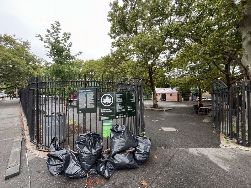
Erected by NYC Parks.
Topics and series. This historical marker is listed in these topic lists: African Americans • Education • Parks & Recreational Areas • Science & Medicine. In addition, it is included in the NYC Parks, and the Works Progress Administration (WPA) projects series lists. A significant historical year for this entry is 1789.
Location. 40° 41.449′ N, 73° 56.901′ W. Marker is in Brooklyn, New York, in Kings County. It is in Bedford-Stuyvesant. It is on Marcy Avenue just south of Kosciuszko Street, on the left when traveling north. Touch for map. Marker is at or near this postal address: 689 Marcy Ave, Brooklyn NY 11216, United States of America. Touch for directions.

Regionally, this marker is in New York City and on Long Island. It is also in the American Northeast, in the Mid-Atlantic, and on the Eastern Seaboard. Globally, it is in the North Atlantic Region, North America, the Western Hemisphere, the Western World, and the Anglosphere. Historically, it finds itself in what was once New Netherland and also one of the original Thirteen Colonies.
Other nearby markers. At least 8 other markers are within walking distance of this marker: Herbert Von King Park (about 700 feet away, measured in a direct line); Hattie Carthan Playground (approx. 0.4 miles away); Eleanor Roosevelt Playground (approx. 0.7 miles away); The Shoe Factory Building (approx. 0.7 miles away); Classon FulGate Block Association Garden (approx. ¾ mile away); John the Baptist Community Garden (approx. 0.8 miles away); Clinton Hill Historic District (approx. 0.8 miles away); The Vendome (approx. 0.8 miles away). Touch for a list and map of all markers in Brooklyn.
Credits. This page was last revised on August 11, 2024. It was originally submitted on August 11, 2024, by Devry Becker Jones of Washington, District of Columbia. This page has been viewed 219 times since then and 30 times this year. Photos: 1, 2. submitted on August 11, 2024, by Devry Becker Jones of Washington, District of Columbia.
